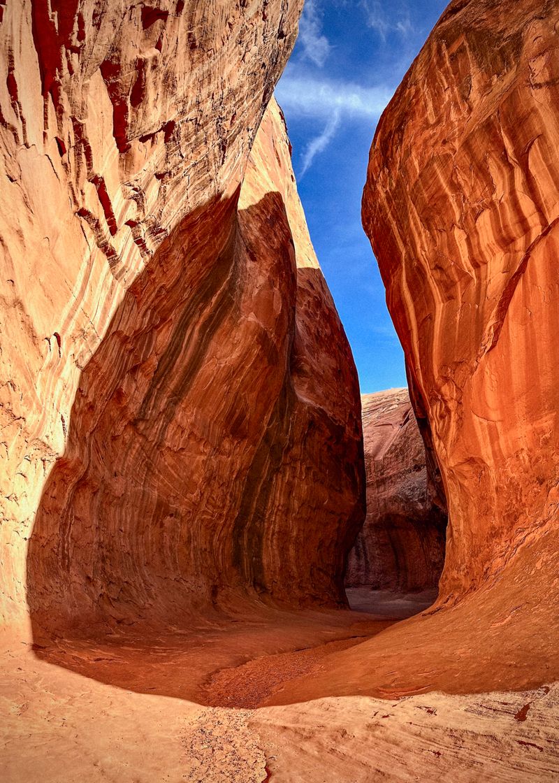
Leprechaun Canyon
A North Wash classic — three technical forks that drop through short rappels and long stretches of sustained stemming before merging into one of the prettiest lower narrows in the desert. Mostly dry, flash-flood-prone, and famously tight in the Middle Fork.
Leprechaun is one of North Wash's beginner-to-intermediate technical slots, and one of its most photogenic. Three forks — East (Right), West (Left), and the very tight Middle — each drop through a handful of short rappels and sustained stemming, then converge into a spectacular shared lower gorge. There is also a non-technical bottom-up hike (2A) that walks into the lower narrows without ropes. It's dry most of the year, with the longest rappel around 50 feet, but the slots are narrow and flash-flood-prone: never enter with rain in the forecast.
Quick stats
- ACA rating
- 3B II
- Distance
- 4 mi
- Time
- 3–6 hrs
- Difficulty
- Challenging
- Rappels
- to 50 ft
- Rope
- ~132 ft
- Best months
- March, April, May, October, November
The descent
Rappels. Longest rappel ~50 ft. East/Right Fork: first rappel ~50 ft off a natural anchor. West/Left Fork: an initial ~27 ft drop with no obvious anchor — the usual anchor is a wedged rock/chockstone in a pothole set back from the edge. Longest rappel across the system is ~50 ft in the East/Right Fork.
Water & swims. Generally little or no water unless right after rain — possibly wading, but likely no swimming.
Potholes. None flagged as mandatory/keeper in the sources.
Downclimbs. Multiple downclimbs and chockstone moves throughout.
Obstacles. Sustained stemming; silo squeeze (middle fork); chimneying (belfast boulevard side slot); chockstones.
Gear. Rope ~132 ft (Road Trip Ryan recommends a 40 m (~132 ft) rope to cover alternate rappels; a 30 m rope handles the standard drops.). Wetsuit: no. A wetsuit is generally not needed given little/no water; consider one only in cold conditions right after rain.
The Middle Fork's difficulty is sustained, very narrow stemming rather than rappelling — 'the tightest of all' near the end.
The forks
- East Fork (Right Fork) · 3B · longest rappel ~50 ft — First rappel ~50 ft off a natural anchor; final rappel ~33 ft. Tends to hold water after rain.
- West Fork (Left Fork) · 3B · longest rappel ~27 ft — Initial ~27 ft drop with no obvious anchor — usual anchor is a wedged rock/chockstone in a pothole set back from the edge.
- Middle Fork · 3B R- (RopeWiki: 3A II PG) · longest rappel ~25 ft — A ~20 ft low-angle rappel plus a ~14 ft drop; the real difficulty is sustained, very narrow stemming. RopeWiki: 'the final stretch is the tightest of all.'
Permits & access
No permit required. Bureau of Land Management — Henry Mountains / Hanksville Field Office. No permit is required to canyoneer Leprechaun Canyon (owner decision, 2026-08-10). This resolves a documented source conflict: RopeWiki and Road Trip Ryan reported a free self-issue permit via Garfield County / Bryce Canyon Country, while an older CanyoneeringUSA page and the BLM North Wash Recreation Area page state no permit requirement. The BLM page is the managing agency and names no permit. Conditions on BLM land change — confirm with the Hanksville Field Station before a trip.
Shuttle. Optional — a car spot is generally unnecessary; the forks loop back on foot.
Approach. Off Highway 95 in North Wash, near Hanksville. Approaches to each fork are short.
Trailhead. North Wash / Highway 95 pullout — Park along Hwy 95 in North Wash; approaches to the Irish Canyons are short.
North Wash is remote — nearest services in Hanksville, and no cell coverage. Carry water; there is none reliable in the canyon.
When to go
Spring, fall, or winter are best; summers can be hot. Monsoon season (roughly July–September) is the highest flash-flood risk — do not enter with rain in the forecast.
Avoid: July, August, September.
Safety & hazards
Flash flooding (high). Narrow North Wash slots, flash-flood-prone. Monsoon (roughly July–September) is the highest risk; do not enter with rain in the forecast. You can see the sky from much of the route — use it.
Tight stemming (Middle Fork) (moderate). The Middle Fork is very narrow with sustained stemming; a fall or getting stuck in the squeeze is the main non-flood hazard.
Remote — no services (moderate). Remote North Wash with no cell service; the nearest help is in Hanksville. Carry water and self-rescue capability.
Sources & beta
Canyon conditions, permit rules, and flows change — verify against the current source and forecast before you commit.
- Leprechaun (bottom-up hike) — CanyoneeringUSA (Tom Jones): 2A II bottom-up hike, fork names, 'permit not required' (older).
- Leprechaun — Road Trip Ryan: 3B / Middle 3B R−, per-fork rappels and anchors, 40 m rope, free self-issue permit, flash-flood rating.
- Leprechaun Canyon (Middle Fork) — RopeWiki: Middle Fork 3A II PG, rappel count/heights, 'tightest of all', free permit note.
- North Wash Recreation Area — BLM: Land management, access.