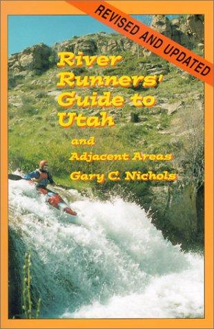
River Runners' Guide to Utah and Adjacent Areas
A comprehensive guidebook to whitewater rivers in Utah and neighboring regions, covering river access, rapids, flow considerations, trip logistics, and historical context for river runners.
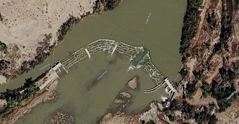
Just under eleven miles of flatwater connecting Gray Canyon to Labyrinth, with one critical feature — the Tusher Diversion Dam and its center-channel boat chute, open to boaters since 2017, roughly three miles below Swaseys.
Ten miles of flatwater through the broad valley of Green River, Utah — the connecting reach between Gray Canyon and Labyrinth, mostly shuttled past, occasionally floated as a town stretch.
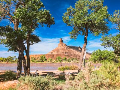
The town reach of the Green River — approximately 11 miles of slow flatwater from Swaseys Boat Ramp at the foot of Gray Canyon down through the town of Green River, Utah, to Green River State Park. The single most important feature of this reach is the Tusher Diversion Dam, sitting roughly three miles below Swaseys and just over six miles above town. First built in 1913, the old weir was a notorious keeper hydraulic that forced every party to portage or take their chances over rebar-studded concrete. Between 2015 and 2016, after years of advocacy by American Whitewater and the Utah Rivers Council, the dam was rebuilt as a stair-step grouted-riprap structure with a 25-foot boat chute set in the center of the channel and a state-secured 147 cfs in-stream water right to keep the chute running. The passage itself opened to boaters in March 2017. Boaters now run the chute straight down the middle. Scout from river right (private property — be respectful, do not trespass past the river bank). Even with the engineered chute, this is a manmade structure: approach with caution, expect splashy water in the chute, and stay clear of the rebar-studded rubble that flanks the right side and the boulder debris from Tusher Wash on the left. Outside the dam, the reach is character-free — canyon walls drop away above Swaseys; the river enters the broad open valley framed by the Book Cliffs to the north and the San Rafael Swell to the southwest. Passing under the US-191 (Main Street) bridge, the reach connects two very different river experiences — the technical pool-drop water of Gray Canyon above and the wilderness float of Labyrinth Canyon below. (The Union Pacific railroad and I-70 bridges cross just downstream of the State Park take-out.) No camps, no permits, no canyon — just the dam, the bridge, the current, and the agricultural valley on either bank. The take-out at Green River State Park sits at the head of a hundred-yard stretch of East Main Street that holds the entire post-trip routine in one walking radius: the John Wesley Powell River History Museum (River Runners Hall of Fame), the River Terrace Inn (lodging on the bank of the river), and the Tamarisk Restaurant (riverside diner with windows looking back at the water you just got off). Park your boat, walk the block.
USGS Green River at Green River gauge (09315000) reads this reach directly — the key gauge for all of the lower Green.
Long-running reference gauge on the lower Green River at the town of Green River, Utah — below the Desolation–Gray run and the Price River confluence.
USGS #09315000Below 1,500 cfs: slow current, exposed sand and gravel bars; bridges remain navigable.
1,500–8,000 cfs: typical season flows; gentle current, comfortable float.
Above 8,000 cfs: pushy current with tree-strainer hazards along banks; runoff peaks have hit 30,000+ cfs in big years.
Warms substantially through the upper basin — summer water temperatures in the 60s–70s°F.
Year-round runnable; flows controlled by Flaming Gorge releases and seasonal runoff.
↑ Rim
↓ River level
No permits, paved shuttle (~15 min), put in at Swaseys, take out at Green River State Park. The one item that's not a logistics afterthought: the Tusher Diversion Dam at mile ~3. Run the boat chute straight down the center of the channel. Scout from river right. The rebuild made this safe at normal flows; the structure was a portage-or-die hazard for a hundred years before that.
No permits required for this reach. The BLM Labyrinth Canyon permit zone begins downstream — see the Labyrinth Canyon section for permit details.
Public BLM river corridor passing through and adjacent to private land. No camping or trespass on private banks.
On a seven-day trip, you'll cook roughly 20 meals on a folding table in the sand. The constraint isn't ambition — it's ice management. Days one through three, you have real cooler capacity. Days four and five are the transition zone. Days six and seven are pantry cooking.
The best river cooks plan backward from the last night. If your final dinner is still good — not just edible, but genuinely good — the trip ends on a high.
Two coolers, segregated by access frequency. A well-managed deep cooler will hold usable ice through day 6 in 100°F air temps.
Folding table, two-burner propane stove, cast iron skillet, Dutch oven, and a large pot. The Dutch oven is the single most versatile piece.
Books that shape the science, history, and stories behind this place.
A comprehensive guidebook to whitewater rivers in Utah and neighboring regions, covering river access, rapids, flow considerations, trip logistics, and historical context for river runners.
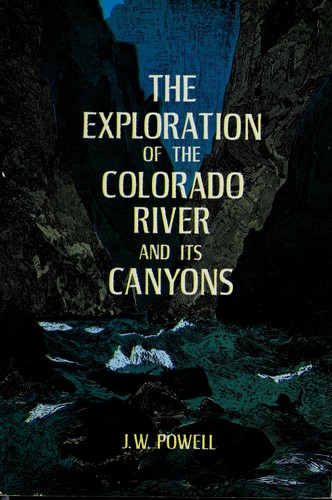
Powell's original account of the first scientific expedition through the Grand Canyon, documenting the geology, natural history, and challenges of navigating the unknown Colorado River.