Hell's Half Mile: Storm Oar Snap
criticalWhat goes wrong
- sudden weather deterioration
- unexpected oar failure before rapid entry
- spare oar difficult to access under pressure
Consequence
- bad entry into consequential rapid
- loss of control
Powell named it after a poem about a waterfall crashing in disaster. Then he capsized. The canyon hasn't changed its mind since.
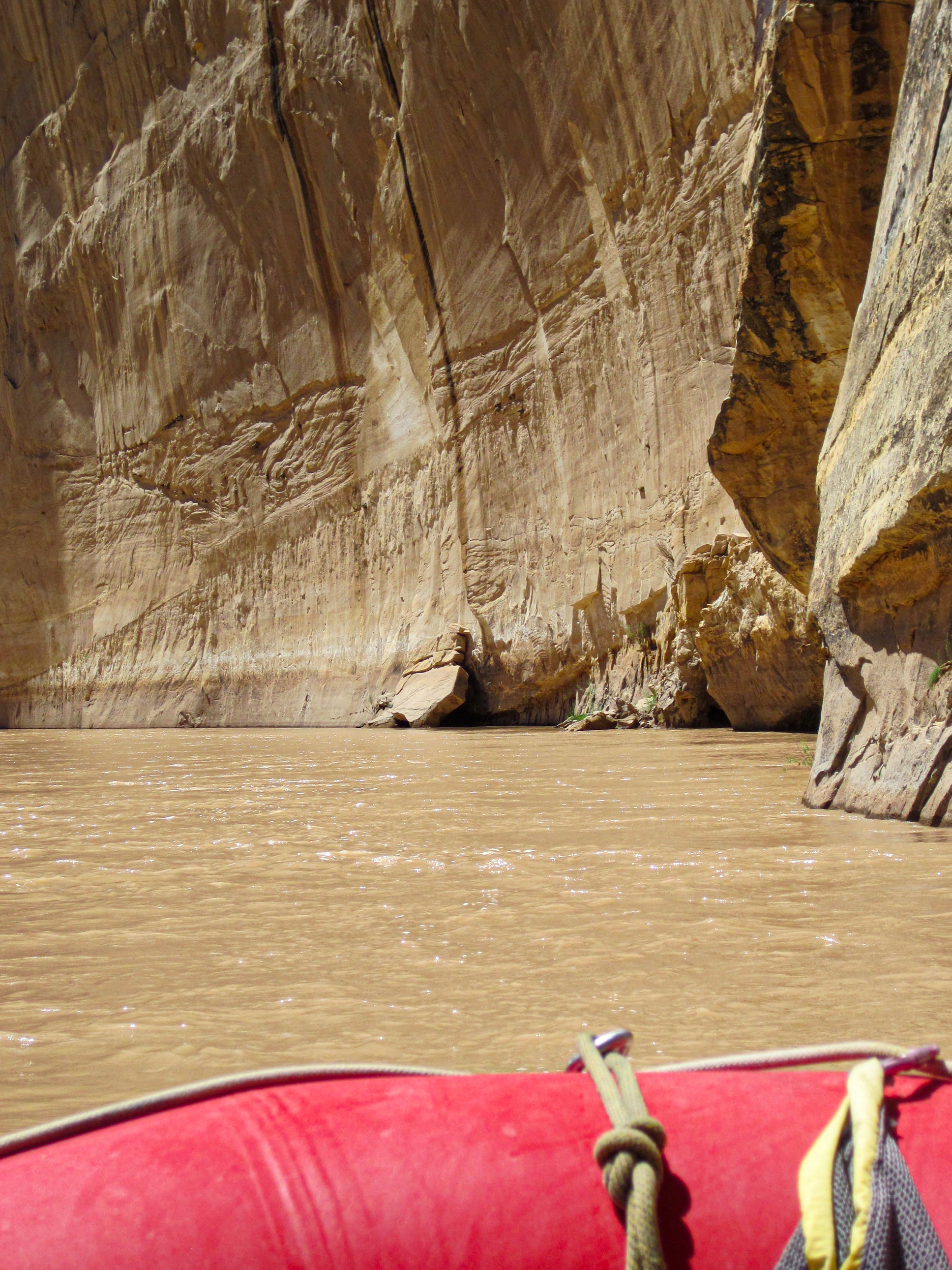
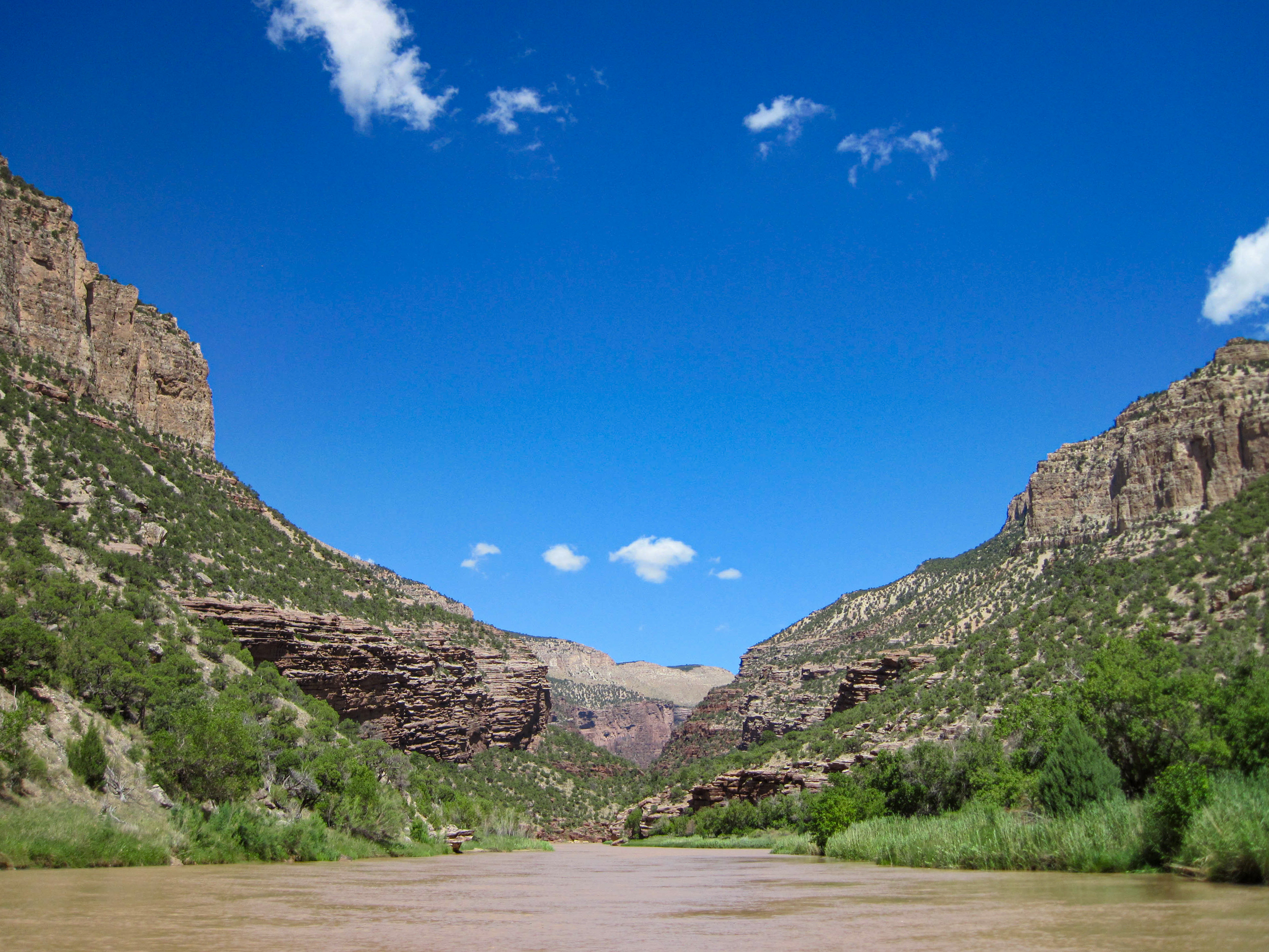
Lodore Canyon, Green River.
Lodore Canyon, Green River.
Lodore Canyon, Green River.
Lodore Canyon, Green River.
Lodore Canyon, Green River.
Lodore Canyon, Green River.
Lodore Canyon, Green River.
Lodore Canyon, Green River.
Lodore Canyon, Green River.
Lodore Canyon, Green River.
Lodore Canyon, Green River.
Lodore Canyon, Green River.
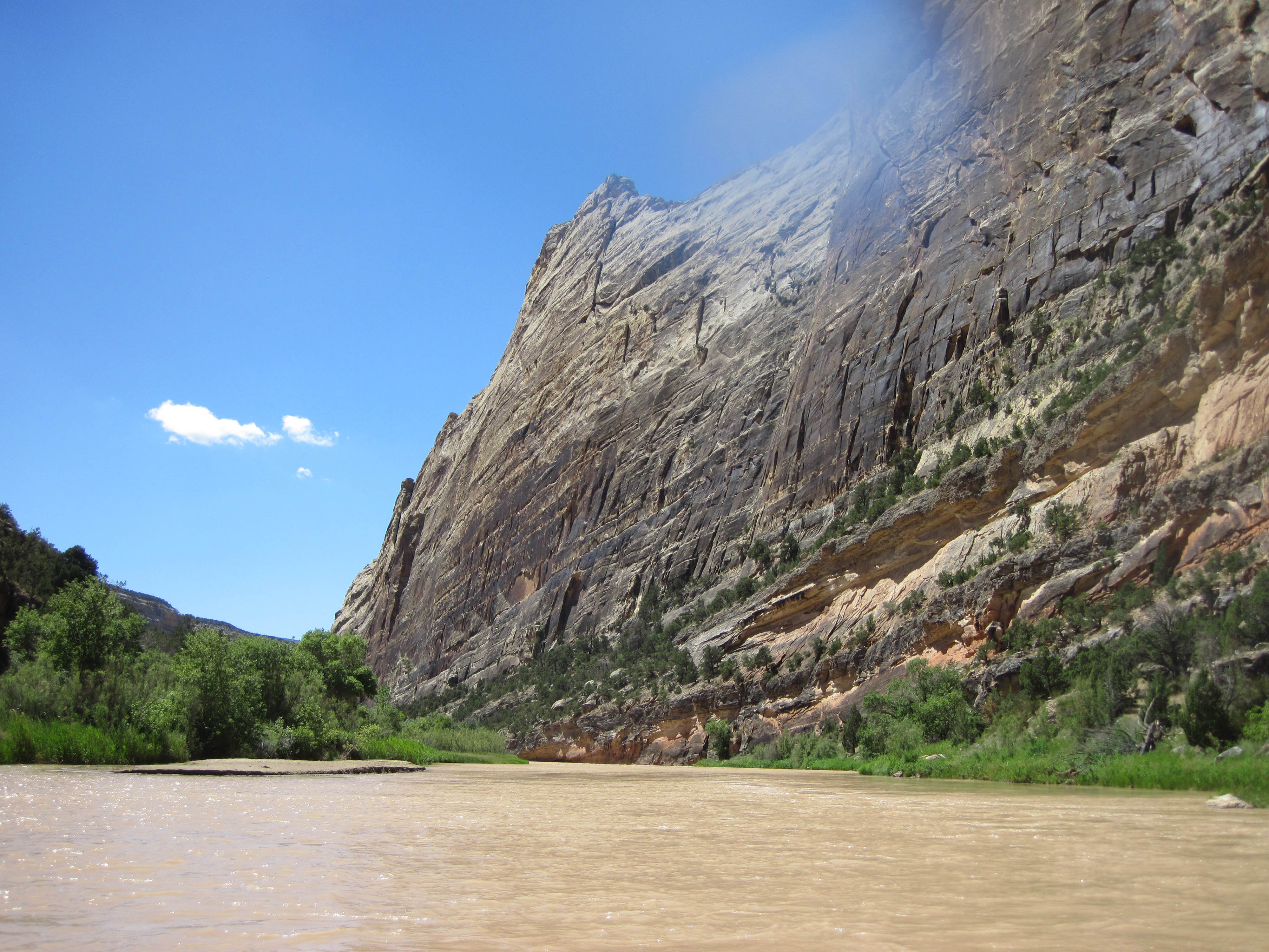
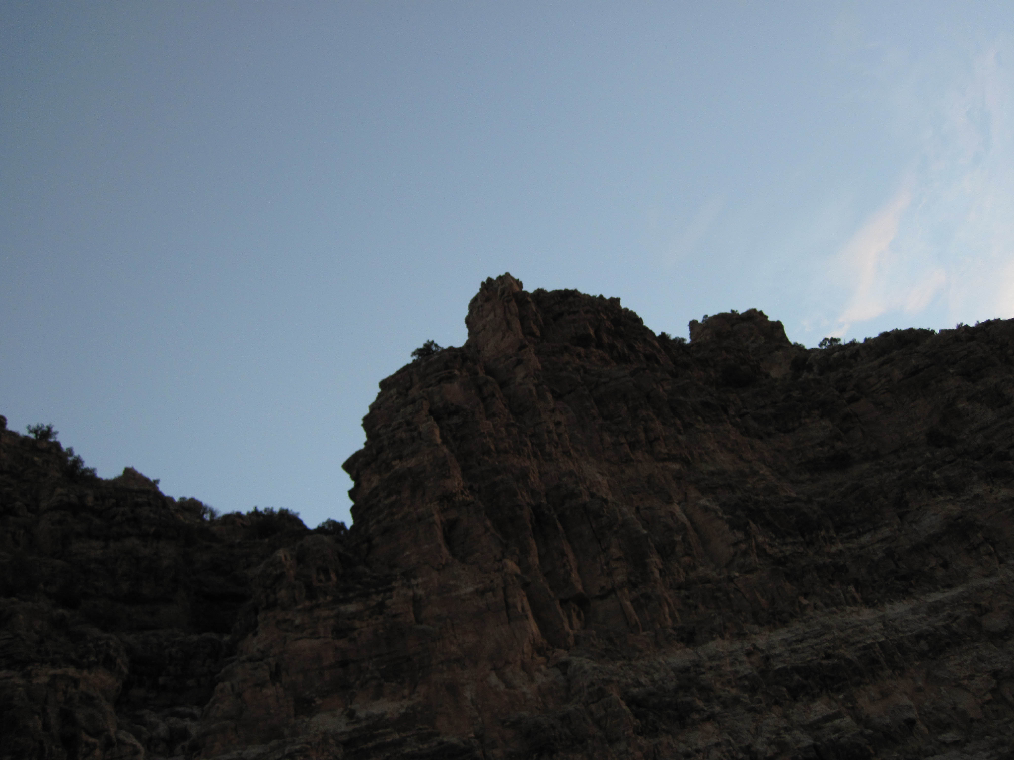
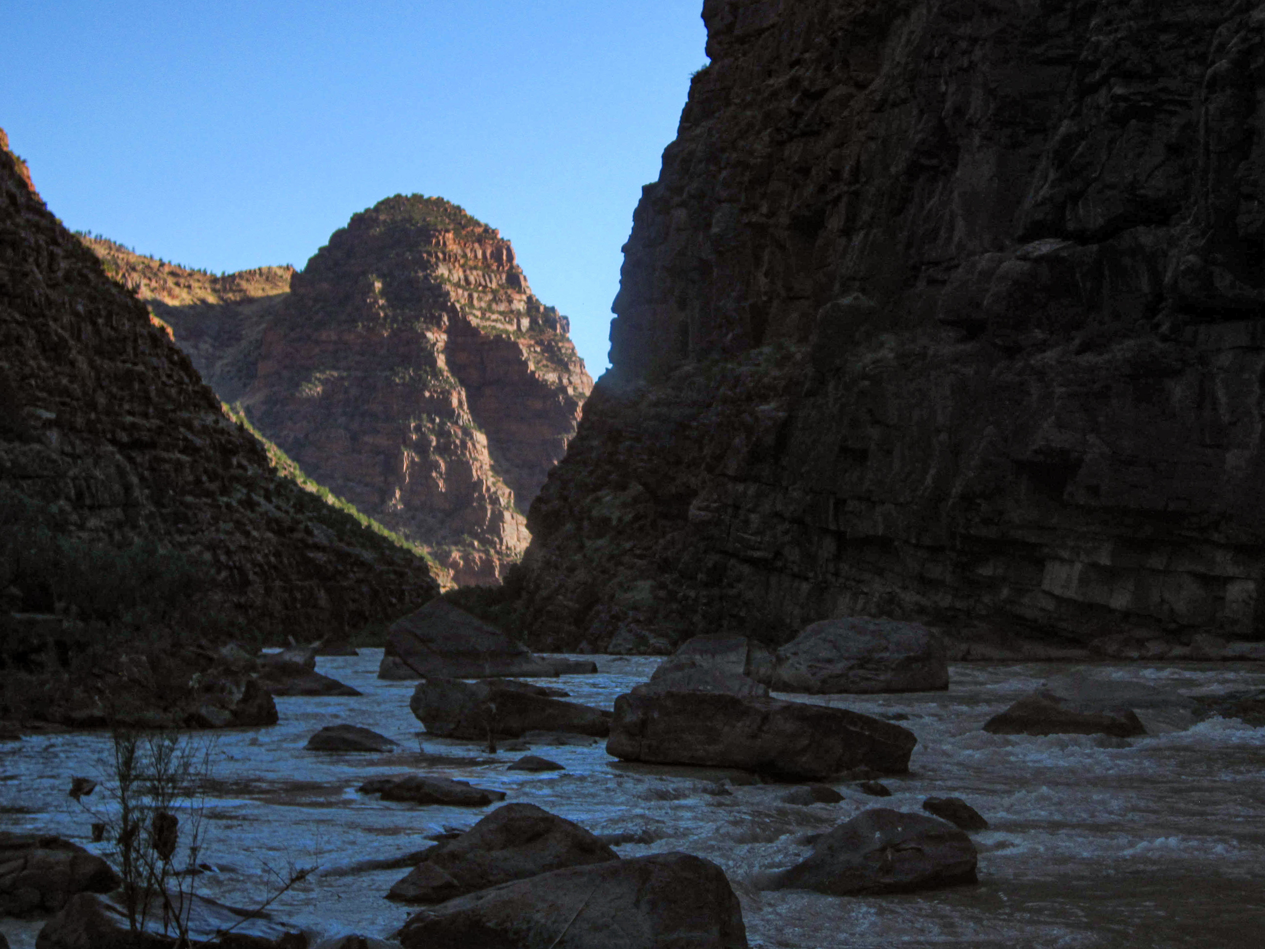
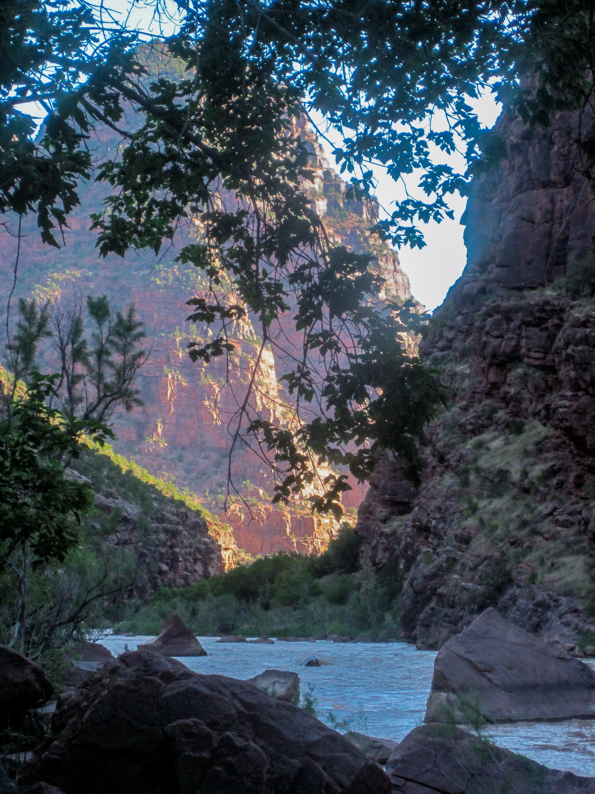
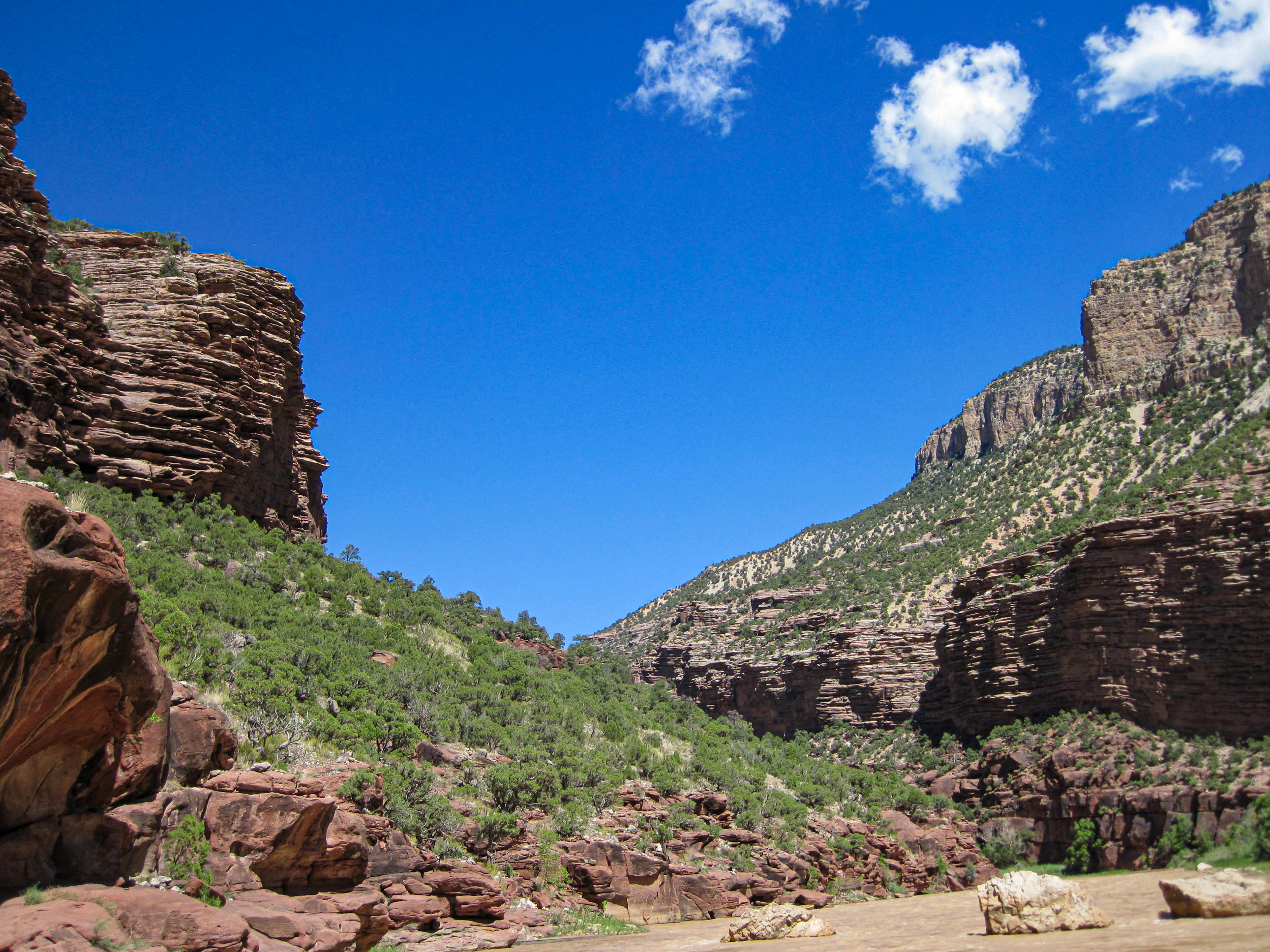
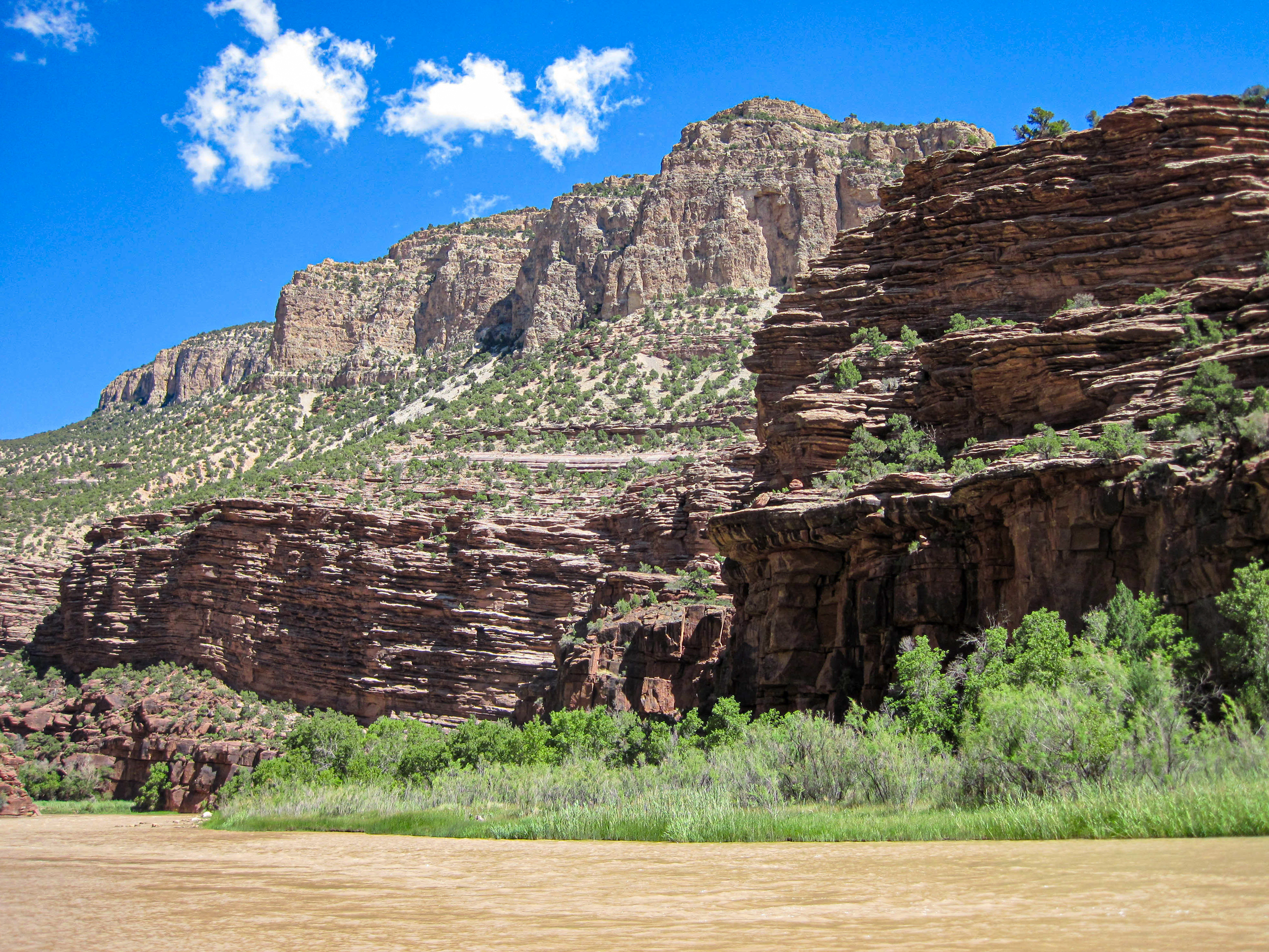
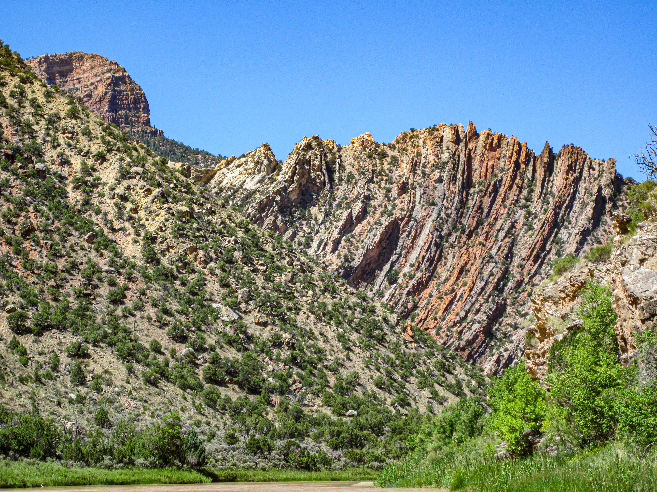
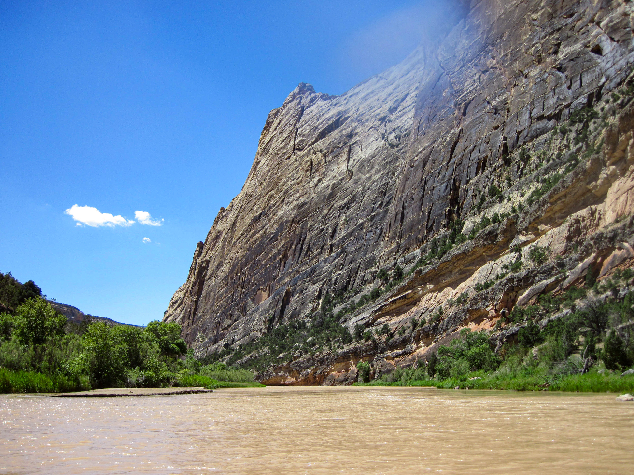
Lodore compresses everything that matters about western river running into seventeen miles. The Gates — two massive quartzite walls framing the Green River as it enters the Uinta Mountain uplift — are the threshold. Beyond them, the canyon narrows into billion-year-old rock and the rapids begin building toward the two that define the section: Disaster Falls, where Powell lost the No Name in 1869 and nearly lost the expedition, and Hell's Half Mile, a sustained Class IV drop that takes most of an actual half-mile to complete and will be the only thing anyone talks about at camp the night before they run it. Between and beyond the rapids, the canyon is austere and beautiful in a way that sandstone country isn't — dark quartzite polished by the river, cold water from Uinta snowmelt, side slots like Winnie's Grotto that open into shaded corridors sculpted by a million years of flash floods. The trip ends at Echo Park, where the Yampa enters from the east and Steamboat Rock rises eight hundred feet overhead, and the geology shifts abruptly from Precambrian to Mesozoic — a billion years of earth history crossed in a single confluence. This is also the canyon the Bureau of Reclamation proposed to drown in the 1950s. The dam was defeated. The river won. Every trip through Lodore is evidence of that victory.
Lodore is where American river exploration began to go wrong — and where the conservation movement proved it could win. Powell entered these quartzite walls in 1869, named the canyon after a poem about a waterfall crashing in disaster, and then immediately capsized at the rapid he'd call Disaster Falls, losing a boat and most of his remaining food supply six weeks into a journey no one had ever attempted. The canyon hasn't softened since. Seventeen miles of Class III–IV whitewater through billion-year-old Precambrian quartzite inside Dinosaur National Monument, with Hell's Half Mile producing one of the most consequential Class IV drops on the Green River system. In the 1950s, the Bureau of Reclamation proposed drowning all of it under the Echo Park Dam. The Sierra Club fought. The dam was stopped. The canyon is still here — the same river Powell ran, through the same rock he couldn't name because it predates the fossil record entirely.
Field-memory moments that define this run.
A Hell's Half Mile disaster sequence where nothing goes wrong because the crew was unprepared; the day simply curdles from bright sun into black weather, the reliable oar snaps on the setup move before Lucifer, and every backup plan begins detaching from reality in comic succession.
A high-consequence precision move through a tightening slot in big water, where the line appears late, the boat is already committed, and the margin between clean passage and full river possession is measured in one oar stroke.
A pinned boat or trapped load turns the riverbank into a wet, slippery rescue workshop: static rope, pulleys, prusiks, slings, anchors, commands, and nervous jokes all trying to become one clean system. It looks like chaos until the rigging starts to make sense, and then everyone understands that rescue is not a heroic moment so much as a careful orchestration performed with cold hands and elevated heart rates.
The threshold moment where the river stops being something you are reading and becomes something you are inside. The horizon line drops, speed builds, and every decision made upstream starts collecting interest.
The guide bunkhouse as river-life origin myth: a crowded, hilarious, emotionally radioactive room full of wet gear, bad sleep, instant coffee, borrowed socks, impossible friendships, and the strange knowledge that some of the best years of your life were lived in a place that should have been condemned with love.
Schwimmer Rapid is freedom fest on water: a rapid big enough that something could happen, casual enough that nothing usually does, and silly enough that everyone briefly considers entering the river like it is a public pool with better scenery and worse liability paperwork.
A quiet overlook above camp where the river corridor, camp, weather, route, and human scale suddenly arrange themselves into sense. It is part photography spot, part private altar, part tactical high ground for understanding your position inside the landscape.
The failure modes and consequences that recur on this run, drawn from the field archive. Judgment and preparation, not fear.
What goes wrong
Consequence
What goes wrong
Consequence
What goes wrong
Consequence
What goes wrong
Consequence
What goes wrong
Consequence
What goes wrong
Consequence
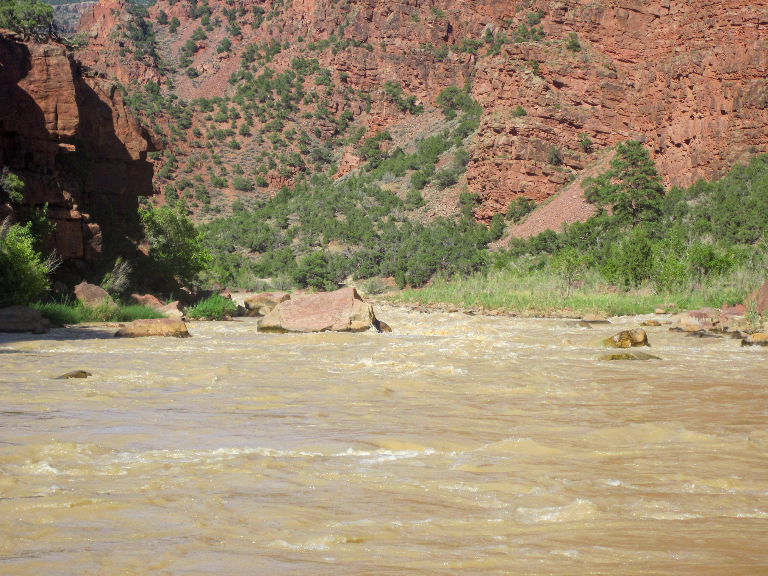
Lodore's hydrology is Rocky Mountain snowmelt — Uinta Range runoff feeding the Green through Flaming Gorge Reservoir and released at Greendale Dam just upstream of the put-in. The Greendale gauge is the only number that matters for trip planning. At 600 cfs the canyon is technical and scrapy — you're threading lines between quartzite boulders in water that gives you no margin for imprecision. At 1,500 the rapids are well-formed and readable, the pools deep enough to recover, Hell's Half Mile a serious but navigable Class IV. Above 2,500 the hydraulics get powerful — holes develop real holding force, laterals push hard, the recovery windows between drops compress. Above 4,000 the canyon is a committed Class IV run for expert teams who have scouted the high-water lines and have rescue systems that work in cold, fast water. The temperature matters more here than on the Colorado. This is snowmelt from nine thousand feet, released from the bottom of a reservoir — 45 to 52 degrees through spring, cold enough that a swim at Hell's Half Mile is not a whitewater inconvenience but a hypothermia event. Wetsuits and drysuits aren't optional. They're what keeps a swim from becoming an evacuation.
Historical Green River gauge above Flaming Gorge reservoir area. Primary reference for Lodore Canyon and Gates of Lodore trip planning when used in context with current downstream releases.
Primary operational gauge for planning Split Mountain Canyon floats. Located near Jensen, UT, below Dinosaur National Monument, this gauge integrates snowmelt from the Uinta Basin watershed and is the most direct reading for Split Mountain and lower Lodore trip planning.
The Greendale gauge (USGS 09234500) sits just upstream of the Gates of Lodore put-in and is the direct reference for Lodore Canyon conditions. The Jensen, Utah gauge downstream can be used to compare how the system is tracking week to week. Yampa River confluence (about 15 miles downstream at Echo Park) adds significant volume — check Yampa near Maybell gauge when combining trips.
Below 800 cfs — technical and rocky throughout. Disaster Falls requires precise low-water lines; Hell's Half Mile loses some power but demands careful reading. Shallow gravel bars between pools.
800–2,500 cfs — classic Lodore conditions. Most rapids run with clear, well-defined lines. Hell's Half Mile is Class IV with a defined route. Scouting recommended for first-timers at any flow.
Above 2,500 cfs — powerful hydraulics throughout. Hell's Half Mile becomes a serious Class IV commitment with larger holes. Disaster Falls is fast and complex. For teams experienced at high-volume whitewater. Camp options may be reduced at very high flows.
Water temperatures range from 40–52°F April through June (snowmelt). Hypothermia is a real risk; wetsuit or drysuit required for spring trips. Water warms in summer but remains colder than the Colorado River system.
Peak flows April–June driven by Rocky Mountain snowmelt; drops significantly by August. July can still offer good flows in high-snowpack years.
Runnable but scrapy. Precise low-water lines required at Disaster Falls. Hell's Half Mile loses power but demands careful reading.
The sweet spot. Hell's Half Mile is Class IV with a defined route. Scouting recommended for all groups.
Powerful hydraulics throughout. Hell's Half Mile becomes a serious commitment with larger holes. Camp options may be reduced.
For teams experienced at high-volume Class IV in cold water. Full rescue systems required.
The Gates of Lodore are the threshold into some of the oldest rock accessible by river anywhere in the American West. The Uinta Mountain Group — Precambrian quartzite, more than a billion years old — forms the dark, angular walls that give Lodore its character. This rock was deposited as sand on an ancient shoreline before multicellular life existed, metamorphosed under heat and pressure, and then uplifted as part of the Uinta Mountains — the only major east-west trending range in the Rocky Mountain system. The Green River is older than the uplift. It established its course before the mountains began rising sixty-five million years ago and carved downward as the Uintas rose around it, maintaining its path through sheer hydraulic persistence — what geologists call antecedent drainage. The same concept applies at Westwater and the Grand Canyon's Inner Gorge, but at Lodore the evidence is particularly clean: the river enters the uplift, cuts through it, and exits into younger rock at Echo Park, where the geology shifts abruptly to the Weber Sandstone and Morgan Formation of the Paleozoic. The rapids form where the quartzite is hardest and least erodible — the rock refuses to get out of the way, so the river narrows, steepens, and accelerates. Disaster Falls and Hell's Half Mile are geological events as much as hydraulic ones.
The Uinta Mountain Group quartzite that forms Lodore's walls was deposited as shoreline sand more than a billion years ago — before multicellular life existed — then metamorphosed under heat and pressure into the dense, dark, angular rock that gives the canyon its character. The Uintas are the only major east-west trending range in the Rockies, and the Green River predates them: it established its course before the uplift began and carved downward as the mountains rose, maintaining its path through antecedent incision. The rapids form where this billion-year-old quartzite refuses to erode — the river narrows, steepens, and accelerates around rock that is fundamentally harder than anything in the sandstone canyons downstream. At Echo Park, the geology shifts abruptly to Paleozoic Weber Sandstone and Morgan Formation — a transition that compresses a billion years of earth history into a single confluence.
The Uinta Mountain Group quartzite that forms Lodore's walls was deposited as shoreline sand more than a billion years ago — before multicellular life existed — then metamorphosed under heat and pressure into the dense, dark, angular rock that gives the canyon its character. The Uintas are the only major east-west trending range in the Rockies, and the Green River predates them: it established its course before the uplift began and carved downward as the mountains rose, maintaining its path through antecedent incision. The rapids form where this billion-year-old quartzite refuses to erode — the river narrows, steepens, and accelerates around rock that is fundamentally harder than anything in the sandstone canyons downstream. At Echo Park, the geology shifts abruptly to Paleozoic Weber Sandstone and Morgan Formation — a transition that compresses a billion years of earth history into a single confluence.
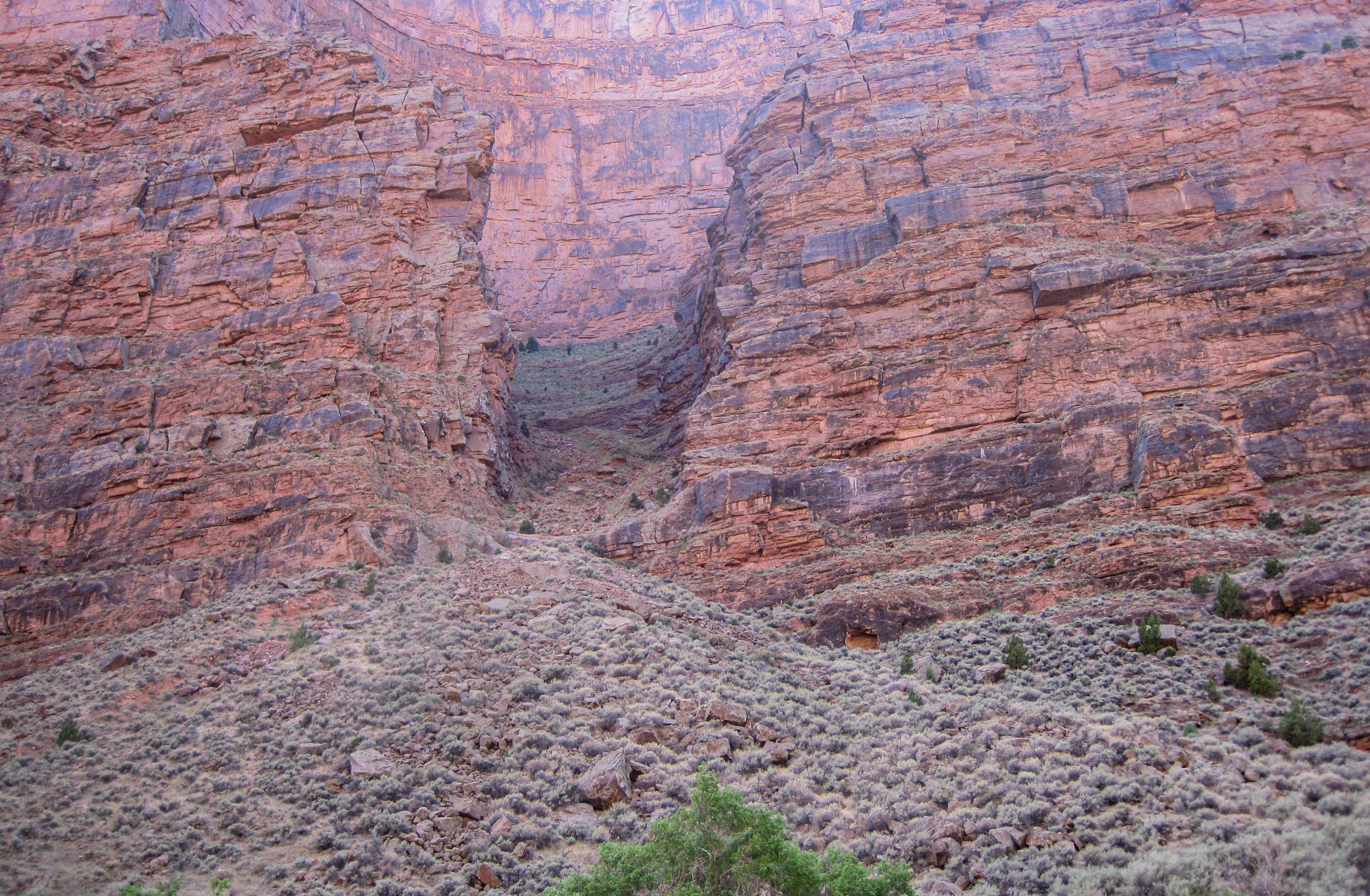
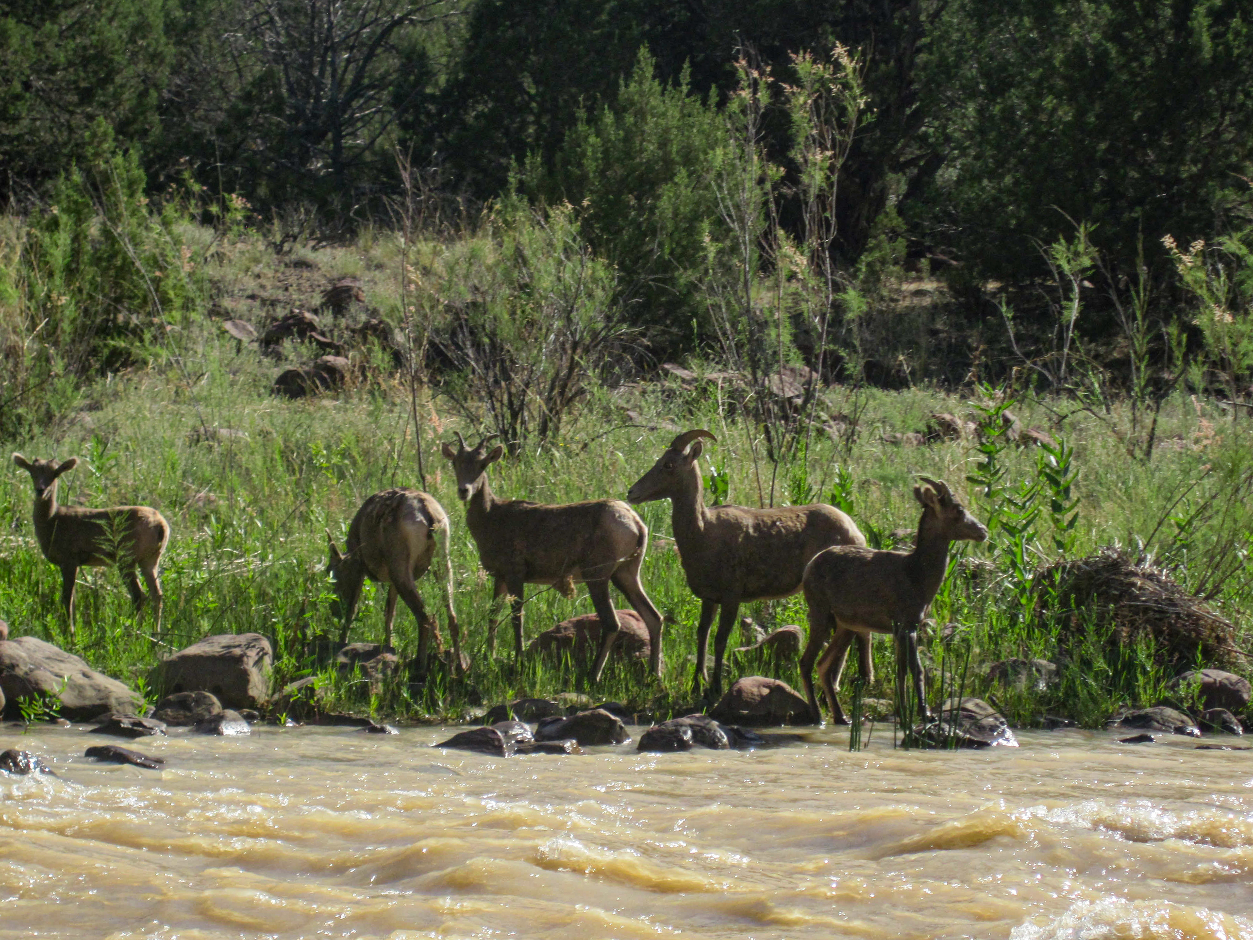
Dinosaur National Monument's protected status produces wildlife density you can see from the boat. Bighorn sheep work the quartzite rim and talus — you'll spot them above Disaster Falls if you look up while scouting. Peregrine falcons nest on the polished cliff faces because the walls are steep enough and smooth enough to be inaccessible to predators. Great blue herons stand in the pools below each rapid with the patience of creatures that have outlasted every management plan. River otters — reintroduced into the monument — are present if you're quiet and lucky. The plant communities have a montane character absent from the sandstone canyons to the south: Fremont cottonwood gallery forest at river level, coyote willow on the bars, big sagebrush on the higher terraces, serviceberry on the rocky slopes. This is the edge of the Rocky Mountain West, not the Colorado Plateau — the ecology reflects that transition. Below the canyon, the Green River provides critical habitat for Colorado pikeminnow and humpback chub — both federally endangered, both adapted to a river system that the dam infrastructure upstream has fundamentally altered. The cold, regulated releases from Flaming Gorge maintain the water temperature regime that Lodore's aquatic community now depends on.
Dinosaur National Monument's protected status produces wildlife density you can see from the boat. Bighorn sheep work the quartzite rim and talus — you'll spot them above Disaster Falls if you look up while scouting. Peregrine falcons nest on the polished cliff faces because the walls are steep enough and smooth enough to be inaccessible to predators. Great blue herons stand in the pools below each rapid with the patience of creatures that have outlasted every management plan. River otters — reintroduced into the monument — are present if you're quiet and lucky. The plant communities have a montane character absent from the sandstone canyons to the south: Fremont cottonwood gallery forest at river level, coyote willow on the bars, big sagebrush on the higher terraces, serviceberry on the rocky slopes. This is the edge of the Rocky Mountain West, not the Colorado Plateau — the ecology reflects that transition. Below the canyon, the Green River provides critical habitat for Colorado pikeminnow and humpback chub — both federally endangered, both adapted to a river system that the dam infrastructure upstream has fundamentally altered. The cold, regulated releases from Flaming Gorge maintain the water temperature regime that Lodore's aquatic community now depends on.
Powell entered Lodore Canyon on June 8, 1869, and named it after Robert Southey's 1820 poem 'The Cataract of Lodore' — a piece of children's verse about a waterfall that comes 'rushing and gushing and flushing and crushing.' Two days later, the No Name hit a rock at Disaster Falls and broke apart. The crew survived. The barometers and much of the remaining food did not. It was six weeks into a journey no one had completed, and Powell was now short one of four boats, navigating blind, with men who were beginning to doubt whether the expedition would survive. Dolnick's account of the expedition captures the psychological texture of that moment — the mix of genuine scientific ambition and genuine terror that defined Powell's leadership. The second expedition in 1871 was better equipped and more deliberately scientific, but it's the 1869 journey that gave Lodore its place in American exploration mythology. The canyon's second great historical moment came in the 1950s, when the Bureau of Reclamation proposed the Echo Park Dam — a structure that would have flooded Lodore and the lower Yampa corridor entirely. The fight to stop it became one of the defining battles of the American conservation movement. David Brower and the Sierra Club led the opposition. The dam was defeated in 1956, partly through a compromise that allowed Glen Canyon Dam to be built instead — a bargain that Marc Reisner and others have called the conservation movement's original sin. Lodore survived. Glen Canyon did not. Every trip through Lodore carries both victories and that cost. The broader corridor connects to the frontier history Burroughs documented in Browns Park — the outlaw geography of the upper Green, where Butch Cassidy's landscape and the ranching culture of the Colorado-Wyoming border persisted because the canyon country made people invisible.
Powell entered Lodore on June 8, 1869, named it after Southey's poem about a waterfall 'rushing and gushing and crushing,' and two days later proved the name prophetic at Disaster Falls. The No Name broke apart; the crew survived; the barometers and most of the remaining food did not. Six weeks into a journey no one had completed, Powell was now short one of four boats. The second expedition in 1871 was better equipped but less dramatic — it's the 1869 journey that gave Lodore its mythology. The canyon connects upstream to the outlaw geography Burroughs documented in Browns Park, where Butch Cassidy's landscape persisted because the canyon country made people invisible.
The permit is the first constraint — lottery through Recreation.gov for May and June, with some shoulder-season availability first-come, first-served. Apply early. Demand for peak dates is high and the NPS controls group size, boat type, and campsite assignment with no flexibility. The shuttle is the second constraint. Gates of Lodore to Echo Park is sixty-five miles via Maybell and Dinosaur, Colorado — about ninety minutes on paved road. That's the easy part. The Echo Park road is thirteen miles of dirt that becomes impassable when wet. A single thunderstorm can strand your shuttle vehicle for days. Call Dinosaur National Monument before running the shuttle. Confirm conditions in person if you can. The canyon itself has no cell service, no road access between put-in and take-out, and NPS-assigned campsites with no substitutions. This is a national monument with enforcement — fire pans, groovers, waste pack-out, and campsite compliance are inspected at Echo Park. The logistical overhead is higher than the mileage suggests. Plan accordingly.
Echo Park access via 13-mile dirt road from Dinosaur, CO through the monument. Road closes when wet. Confirm conditions with NPS before shuttling. Groups continuing to Split Mountain can float the Green through Whirlpool Canyon.
Shuttle requires backtracking from Gates of Lodore via Maybell, CO and Dinosaur, CO before taking the Echo Park road. Total drive is ~90 minutes in good conditions. Echo Park road is the vulnerability — a recent rain event can strand vehicles. Confirm conditions with Dinosaur NM (970) 374-3000 before running the shuttle.
Lottery-based permit system for peak season (May–July). Apply through recreation.gov well in advance — demand for May and June dates is high. Some first-come, first-served availability in shoulder months. The Dinosaur NM permit covers Lodore, Whirlpool Canyon, and Split Mountain as an integrated permit system. Group size and boat type restrictions apply — confirm with NPS at time of permit application.
Lodore is a cold-water Class IV trip that punishes the underprepared. Spring water is 45–52 degrees — Uinta snowmelt released from the bottom of Flaming Gorge Reservoir — and a swim at Hell's Half Mile puts you in that water for longer than you want. Wetsuit or drysuit is non-negotiable through June regardless of air temperature. Neoprene gloves help at high flows. Helmets are essential for all craft — the quartzite is harder than sandstone and the consequences of contact are different. Boats need to be appropriate for sustained Class IV: oar rigs, paddle rafts, or hardshell kayaks with solid self-bailing design. There is nowhere to empty a swamped boat between drops in the gorge section. Throw bags should be accessible and practiced with. The NPS requires fire pans and groovers for all river trips in the monument — they inspect at Echo Park takeout, and they're not casual about it. The short mileage (seventeen miles over three to four days) means you're carrying full expedition gear weight for a compact distance — which creates an opportunity for experienced teams to go light and fast, but also means there's no excuse for cutting corners on rescue, repair, or cold-water preparedness. Bring the gear you'd bring for a week. You'll use more of it than you expect.
On a seven-day trip, you'll cook roughly 20 meals on a folding table in the sand. The constraint isn't ambition — it's ice management. Days one through three, you have real cooler capacity. Days four and five are the transition zone. Days six and seven are pantry cooking.
The best river cooks plan backward from the last night. If your final dinner is still good — not just edible, but genuinely good — the trip ends on a high.
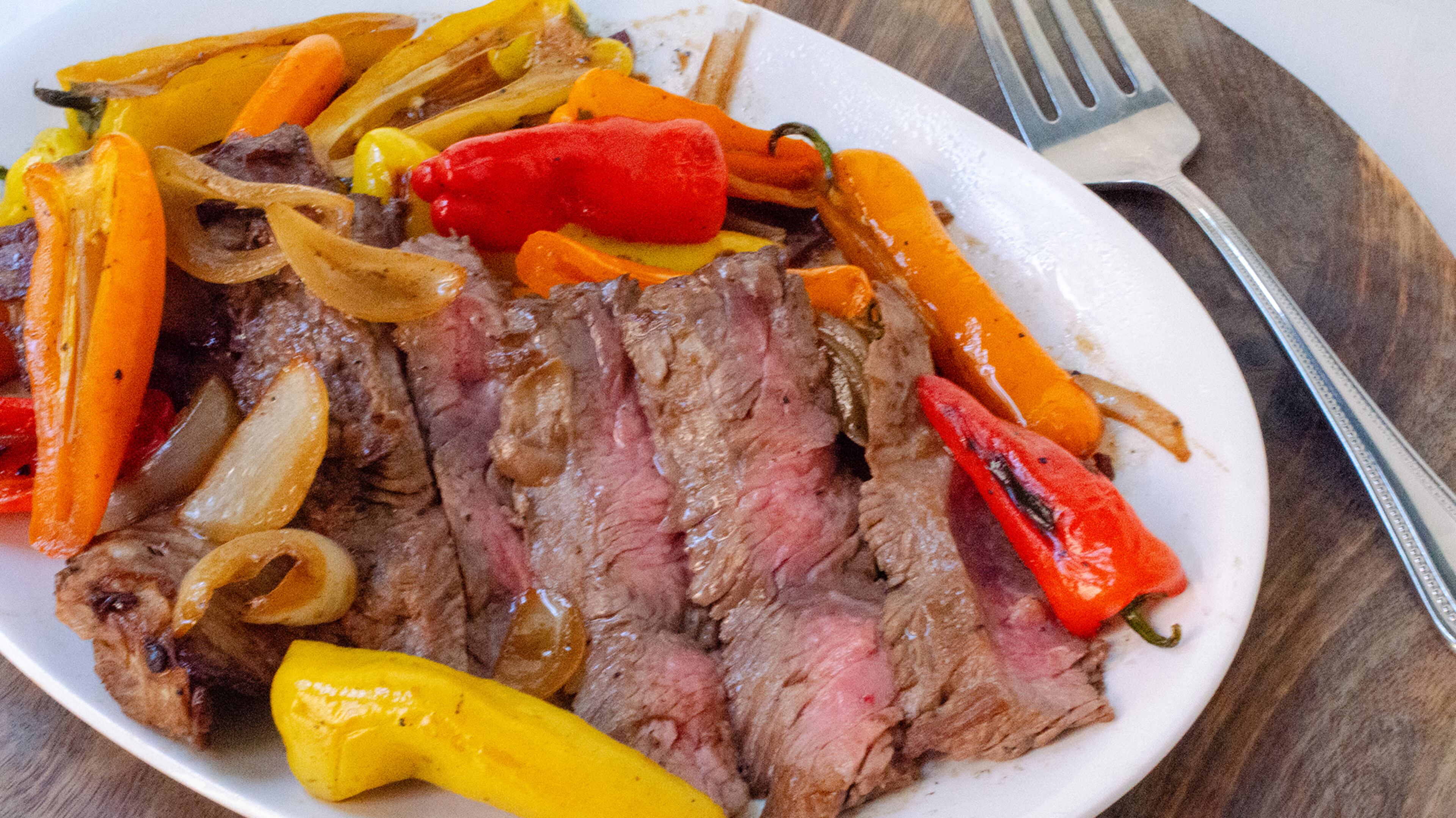
Night one. Fresh cooler. Cast iron over charcoal. The best steak you'll eat all week.

Marinated at home, grilled in camp. The best taco night on the river.
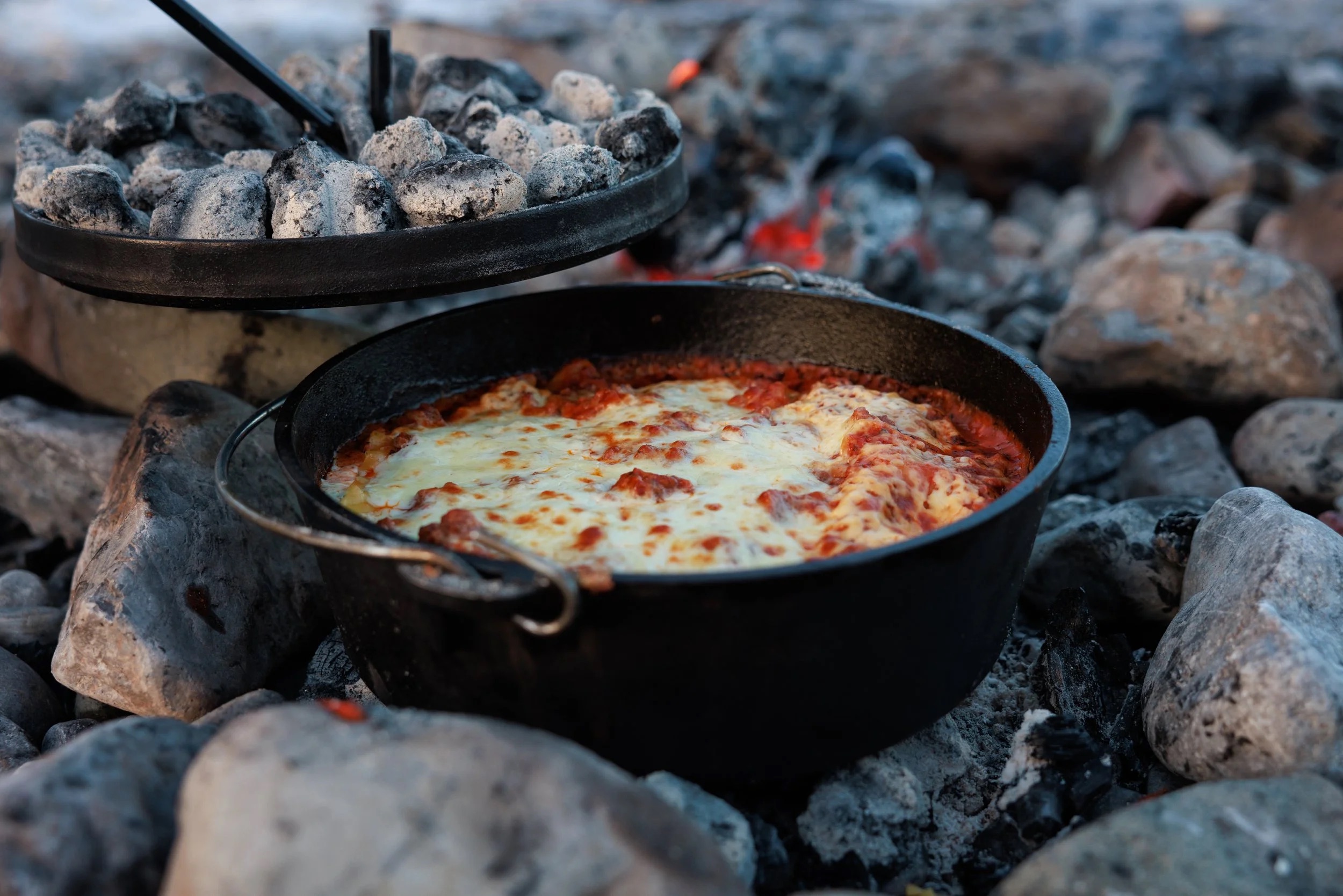
Real lasagna. Dutch oven. Day 3 of a river trip. It works.

One pot. Canned coconut milk. Twenty-five minutes. The transition meal.

Pizza dough holds for five days. Cast iron and charcoal do the rest.

Every ingredient is shelf-stable. Day 6 dinner that doesn't taste like day 6.

Canned beans. Rice. Cumin. Lime. Whatever's left. The last night done right.
The night-one showstopper. Thick-cut ribeyes seared in a screaming-hot cast iron over charcoal, with halved bell peppers and onions charring on the grate alongside. This is the meal you cook while the cooler is still cold and the group is still clean. Finish with flaky salt and a squeeze of lime. It takes ten minutes and sets the tone for the whole trip.
Salt the steaks before you set up camp — by the time you've rigged the kitchen, they've had their 30 minutes. The cast iron needs to be genuinely smoking before the first steak goes in. If it's windy, position the fire pan so you're shielded and the coals stay hot. In desert heat above 100F, pull steaks from the cooler only 10 minutes ahead — they'll come to temp fast. Keep a spray bottle of water nearby for flare-ups from the dripping fat.
Pre-marinated chicken thighs grilled over charcoal, sliced thin, and piled into warm flour tortillas with crunchy cabbage slaw and crumbled cotija. The marinade does all the work at home — lime, cumin, garlic, and green chile — so in camp you just grill and assemble. This is the meal that makes people stop what they're doing and walk over to the kitchen.
The key to this recipe is the frozen marinade bags. They keep the cooler cold on day 1 and produce perfectly thawed, deeply marinated chicken by day 2. If it's extremely hot (105F+), check the bags on the morning of day 2 — they may thaw faster than expected. Don't skip the towel for the tortillas; they go from warm and pliable to stiff and cracked in two minutes of desert air. If it's windy, the charcoal will burn hot and fast — watch for flare-ups from the marinade dripping.
Proper lasagna built in a 12-inch Dutch oven over charcoal. Layer no-boil noodles, pre-made meat sauce (frozen flat in gallon bags at home), ricotta, and mozzarella. Charcoal on top and bottom, 45 minutes, and you pull out something that shouldn't be possible at a sandbar camp. The meat sauce freezes flat and doubles as an ice pack for the first two days.
The coal ratio is everything. Too many coals on the bottom and you'll scorch it. Roughly 1/3 underneath, 2/3 on top. In windy conditions, position the fire pan in a sheltered spot — wind cools coals unevenly and you'll get hot spots. If you're cooking on sand, clear the area thoroughly first; sand gets everywhere when the wind picks up, and nothing ruins lasagna like grit. Bring a lid lifter or channel-lock pliers — the lid will be 400 degrees. Start the charcoal earlier than you think. Dutch oven cooking always takes longer than expected, and hungry river people get impatient.
A one-pot curry that comes together in 25 minutes on a propane stove. Canned coconut milk, Thai curry paste, and pre-cut vegetables over rice. By night 4, the cooler is thinning out and the pantry starts pulling weight — canned coconut milk and curry paste do all the heavy lifting here. The vegetables just need to be crisp-tender. This is the meal that proves one-pot cooking doesn't have to taste like compromise.
This recipe is almost wind-proof because it's all in a pot with a lid. The propane stove handles it better than charcoal. The key mistake people make is adding all the vegetables at once — carrots need a head start or they'll be raw while the snap peas turn to mush. If you only have one burner, cook the rice first, set it aside covered (it holds heat for 20 minutes), then make the curry. In cold weather (below 50F), the coconut milk may have solidified in the can — it melts fast once heated, but give it an extra minute.
Real pizza made in a cast iron skillet over charcoal. Press pre-made dough into an oiled skillet, top with canned San Marzano sauce, hard salami, olives, and parmesan, then cover and cook over charcoal for 12 minutes. The bottom gets crisp and almost fried in the oil while the lid traps heat to melt the cheese. Make 3-4 pizzas to feed 8. The dough is made at home and keeps 4-5 days in the cooler — this is a day-5 meal built on foresight.
The oil in the skillet is non-negotiable. It prevents sticking and creates the fried-bottom texture that makes this work. Don't skimp. The dough will fight you if it's cold — let it warm up for 10 minutes before pressing. If it springs back, let it rest 5 more minutes. People will crowd the kitchen for pizza night, which is great for morale but means you need a system: one person on dough, one on toppings, one managing coals. Batch cooking takes an hour — serve each pizza as it comes out instead of waiting for all four. In wind, the coals cool quickly between pizzas. Keep extra lit coals ready.
The ultimate pantry meal. Every single ingredient is shelf-stable: canned tomatoes, olives, capers, anchovies, garlic, red pepper flakes, dried pasta. No cooler required. Boil pasta in filtered river water, make the sauce in another pot, combine. Fifteen minutes of active cooking and you have a dinner that tastes like you planned it, not like you ran out of options. This is the recipe that proves the last nights of a trip don't have to be sad.
This is the most reliable recipe in the entire trip menu. Nothing can go wrong with the ingredients — they're all shelf-stable and nearly indestructible. The one thing to watch is the pasta water. At elevation (Desolation Canyon is around 4,500 feet at put-in), water boils at a lower temperature and pasta takes slightly longer to cook. Taste it. On a single-burner stove, boil the pasta first, drain it, then make the sauce in the same pot to save fuel. The olives and capers provide so much salt that you probably won't need to add any to the sauce — taste first.
The last-night staple. Canned black beans seasoned with cumin and lime over rice, topped with whatever survives the trip — cheese rinds, crisped tortilla strips, pickled jalapeños, hot sauce. This is the meal that asks nothing of the cooler and everything of the pantry. It's cheap, fast, filling, and the toppings make it feel like a real dinner instead of a concession. Every trip ends here, and nobody complains.
This meal is intentionally designed to absorb scraps. Take inventory of the cooler and dry boxes before you start — whatever is left becomes a topping. Cheese rinds that would be trash at home become crispy bits when grated and scattered over hot beans. Stale tortillas become croutons when fried. The cumin and lime do the real work; without them, it's just beans and rice. With them, it tastes intentional. On cold last nights, this warm bowl is exactly what people want before the takeout drive home. If you have a second burner, heat the beans and cook rice simultaneously. Single-burner: cook rice first, set aside, then do the beans.
Two coolers, segregated by access frequency. A well-managed deep cooler will hold usable ice through day 6 in 100°F air temps.
Learn about ice managementFolding table, two-burner propane stove, cast iron skillet, Dutch oven, and a large pot. The Dutch oven is the single most versatile piece.
Learn about kitchen setupBooks that shape the science, history, and stories behind this place.
Powell's original account of the first scientific expedition through the Grand Canyon, documenting the geology, natural history, and challenges of navigating the unknown Colorado River.
A historical portrait of the ranching and outlaw culture of Browns Park and the remote canyons of the Colorado Plateau, illuminating how geography shaped the final stronghold of the old frontier.

An accessible introduction to the rock layers, canyon formation, and landscapes of the Colorado Plateau and canyon country.
The dramatic story of John Wesley Powell's first expedition through the Grand Canyon and the birth of river exploration in the American West.

A foundational scientific text on river geomorphology, covering sediment transport, channel form, fluvial dynamics, and the physical processes that shape river systems.

A geological exploration of Utah’s major river systems explaining how tectonics, sedimentation, and erosion shaped the canyon landscapes of the Colorado Plateau and surrounding regions.
A guide to understanding the subtle clues in water movement—from puddles and rivers to oceans—teaching readers how currents, waves, surface textures, and patterns reveal information about wind, depth, obstacles, and landscape.
A rigorous, university-level introduction to physical hydrology covering the full water cycle — precipitation, evapotranspiration, infiltration, groundwater, runoff generation, and streamflow — with quantitative methods throughout. The scientific foundation for understanding how rivers work at the watershed scale, from snowpack in the Rockies to baseflow in canyon rivers.
A rigorous graduate-level treatment of river hydraulics and sediment transport, covering flow resistance, bedforms, channel stability, and the physical mechanics that govern river behavior.
A comprehensive guidebook to whitewater rivers in Utah and neighboring regions, covering river access, rapids, flow considerations, trip logistics, and historical context for river runners.

A key geological reference for understanding the uplift, stratigraphy, tectonics, and erosional history of the Colorado Plateau.
Three deeply reported narratives about humanity's attempts to stop rivers, lava, and debris flows — and what the land does in return. A masterwork of geological journalism that asks whether nature can ever truly be controlled.
Craig Childs explores the hidden water sources and desert hydrology of the American Southwest, revealing how water shapes and sustains life in the most arid landscapes on Earth.