River Runners' Guide to Utah and Adjacent Areas
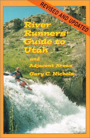
A comprehensive guidebook to whitewater rivers in Utah and neighboring regions, covering river access, rapids, flow considerations, trip logistics, and historical context for river runners.
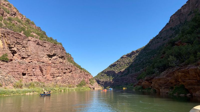
Swallow Canyon is a cold, clear, and accessible float below Flaming Gorge Dam — regulated flows, easy riffles, osprey nests, and cottonwood-lined canyon walls make it one of the most approachable river segments on the upper Green.
Swallow Canyon is a short, scenic float on the Green River just downstream of Flaming Gorge Dam, straddling the Colorado-Utah border in the Browns Park region where cold, clear dam-release water winds through a narrow canyon lined with cottonwoods and canyon walls. The flow is regulated by dam operations rather than seasonal snowmelt, making it one of the most consistent and accessible river segments on the upper Green — no significant whitewater, just mellow riffles, osprey nesting cliffs, and a canyon atmosphere that rewards casual paddlers and wildlife watchers alike.
Flow is controlled by Flaming Gorge Dam operations and tracked at the Greendale gauge — more predictable than snowmelt-driven sections but still cold year-round from the dam release.
Historical Green River gauge above Flaming Gorge reservoir area. Primary reference for Gates of Lodore trip planning when used in context with current downstream releases.
USGS #09234500Below 800 cfs — slow and easy; riffles are minimal. Good for families and beginning paddlers.
800–2,500 cfs — pleasant riffles and active current; the canyon feels lively.
Above 2,500 cfs — stronger current and more active riffles; flat sections move quickly. Still accessible for intermediate paddlers.
Dam-regulated flow from Flaming Gorge is relatively consistent year-round; natural seasonal peaks are reduced.
↑ Rim
↓ River level
Browns Park — the broad valley surrounding Swallow Canyon — has a rich history as a ranching and outlaw haven in the late 19th century. Butch Cassidy and the Wild Bunch used Browns Park as a refuge between jobs. The canyon itself is named for the cliff swallows that nest in colonies on the sandstone walls each spring.
No permit required and easy Little Hole access make Swallow Canyon one of the least logistically demanding floats on the Green River; the main variable is the dirt road condition at Indian Crossing take-out.
Indian Crossing to Swallow Canyon Boat Ramp
Indian Crossing down to the Swallow Canyon ramp — both reached by dirt through Browns Park, high clearance recommended when wet.
Google used a car, their times do not account for towing a trailer, driving on washboard, pitted pavement, and dirt that goes to grease in the rain — our adjusted times help align to the reality of running real river shuttles.
No launch permit required. A day-use fee may apply at Little Hole Recreation Area, managed by Ashley National Forest. Indian Crossing Campground is managed by BLM Colorado.
On a seven-day trip, you'll cook roughly 20 meals on a folding table in the sand. The constraint isn't ambition — it's ice management. Days one through three, you have real cooler capacity. Days four and five are the transition zone. Days six and seven are pantry cooking.
The best river cooks plan backward from the last night. If your final dinner is still good — not just edible, but genuinely good — the trip ends on a high.
Two coolers, segregated by access frequency. A well-managed deep cooler will hold usable ice through day 6 in 100°F air temps.
Folding table, two-burner propane stove, cast iron skillet, Dutch oven, and a large pot. The Dutch oven is the single most versatile piece.
Books that shape the science, history, and stories behind this place.
A comprehensive guidebook to whitewater rivers in Utah and neighboring regions, covering river access, rapids, flow considerations, trip logistics, and historical context for river runners.
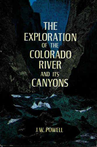
Powell's original account of the first scientific expedition through the Grand Canyon, documenting the geology, natural history, and challenges of navigating the unknown Colorado River.