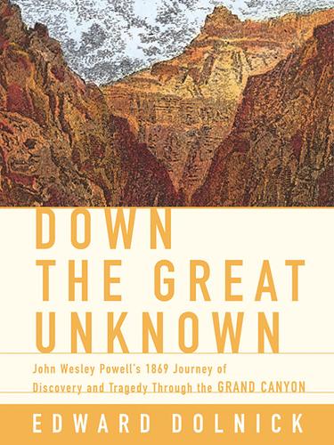
Down the Great Unknown
The dramatic story of John Wesley Powell's first expedition through the Grand Canyon and the birth of river exploration in the American West.
Two billion years of rock. One river. The trip you wait years for — and the canyon that explains why you waited.
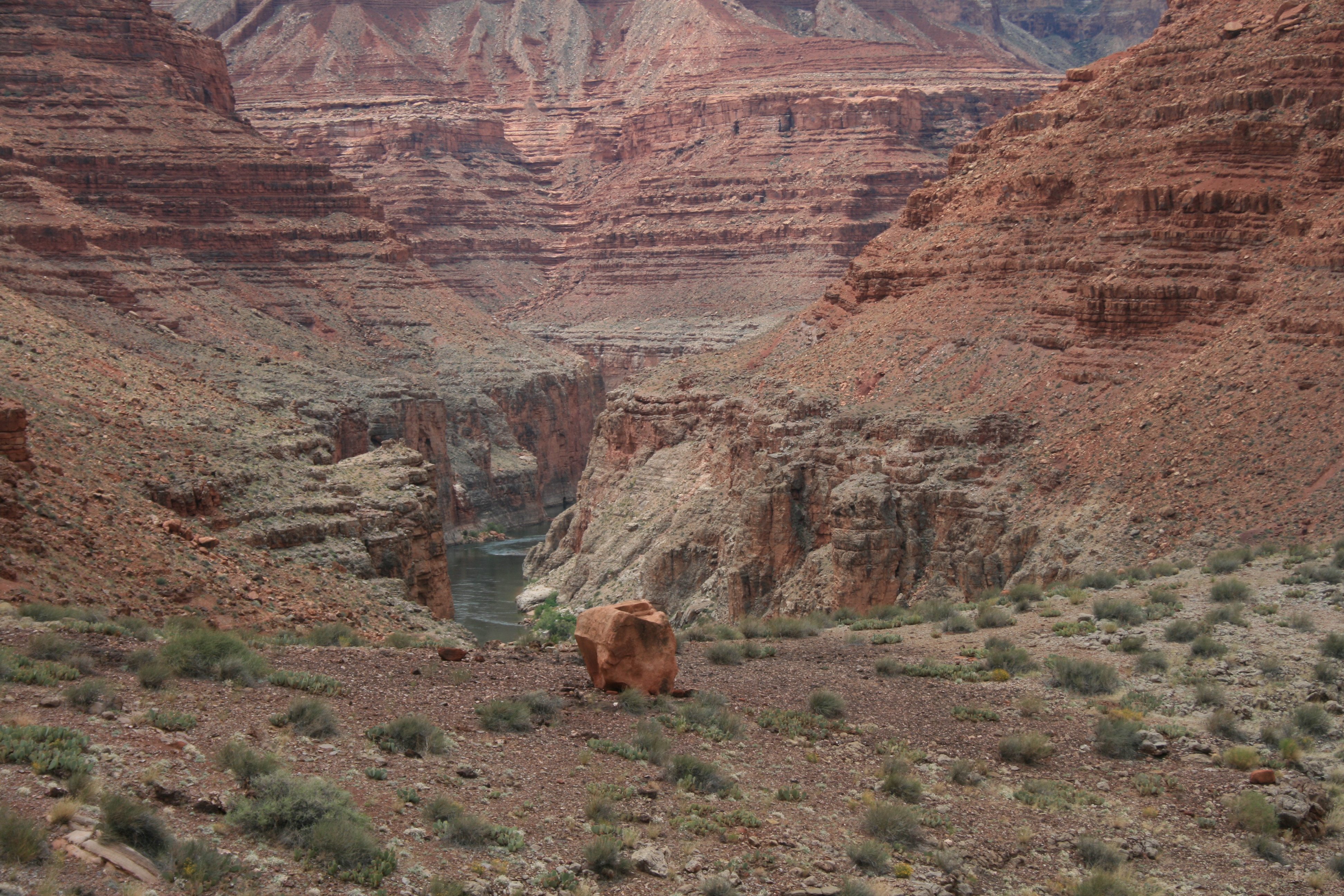
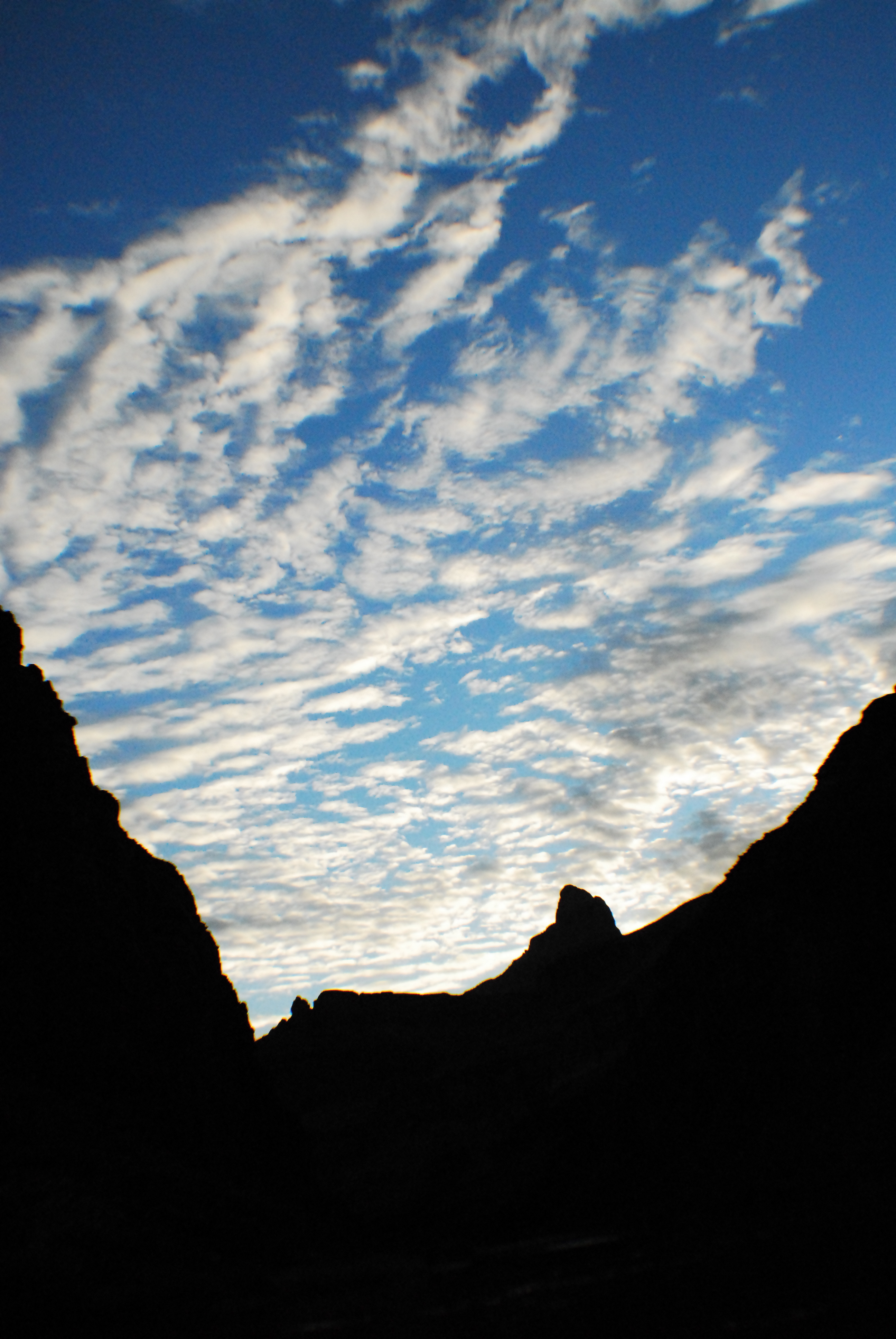
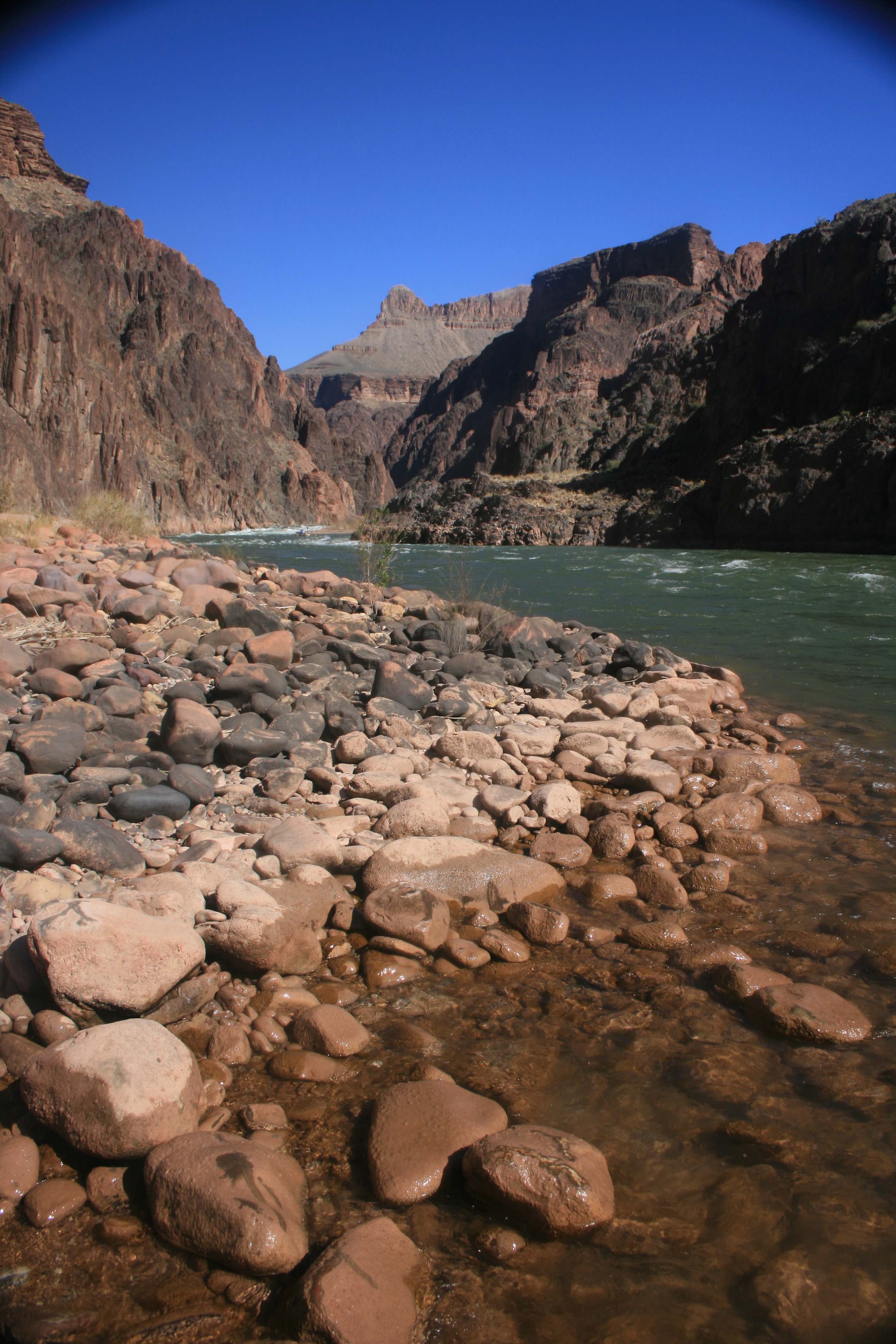
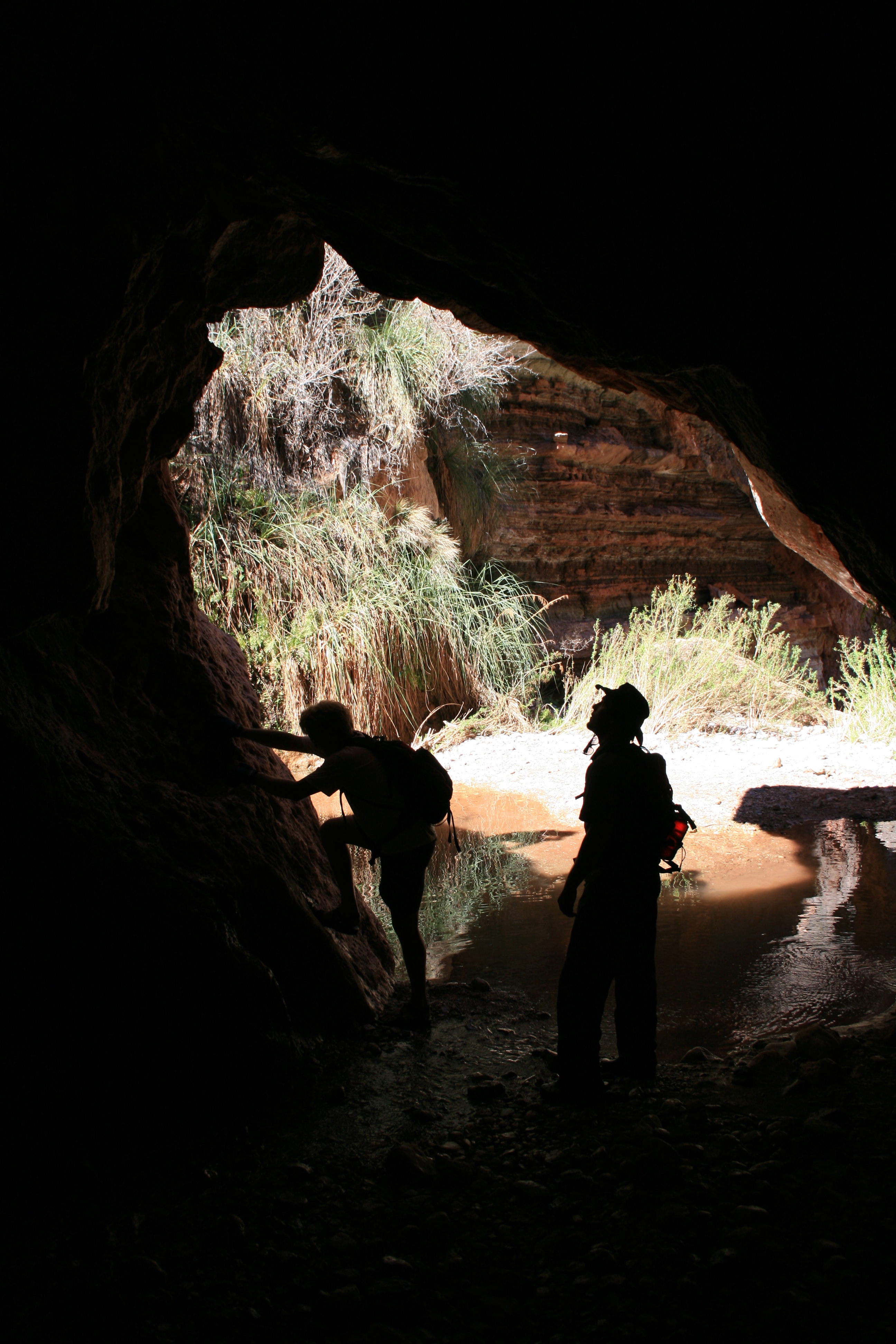
Grand Canyon, Colorado River.
Grand Canyon, Colorado River.
Grand Canyon, Colorado River.
Grand Canyon, Colorado River.
Grand Canyon, Colorado River.
Grand Canyon, Colorado River.
Grand Canyon, Colorado River.
Grand Canyon, Colorado River.
Grand Canyon, Colorado River.
Grand Canyon, Colorado River.
Grand Canyon, Colorado River.
Grand Canyon, Colorado River.

Grand Canyon, Colorado River.
Grand Canyon, Colorado River.
Grand Canyon, Colorado River.
Grand Canyon, Colorado River.
Grand Canyon, Colorado River.
Grand Canyon, Colorado River.
Grand Canyon, Colorado River.
Grand Canyon, Colorado River.
Grand Canyon, Colorado River.
Grand Canyon, Colorado River.
Grand Canyon, Colorado River.
Grand Canyon, Colorado River.
Grand Canyon, Colorado River.
Grand Canyon, Colorado River.
Grand Canyon, Colorado River.
Grand Canyon, Colorado River.
Grand Canyon, Colorado River.
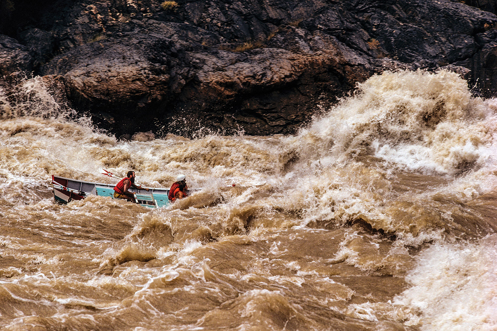
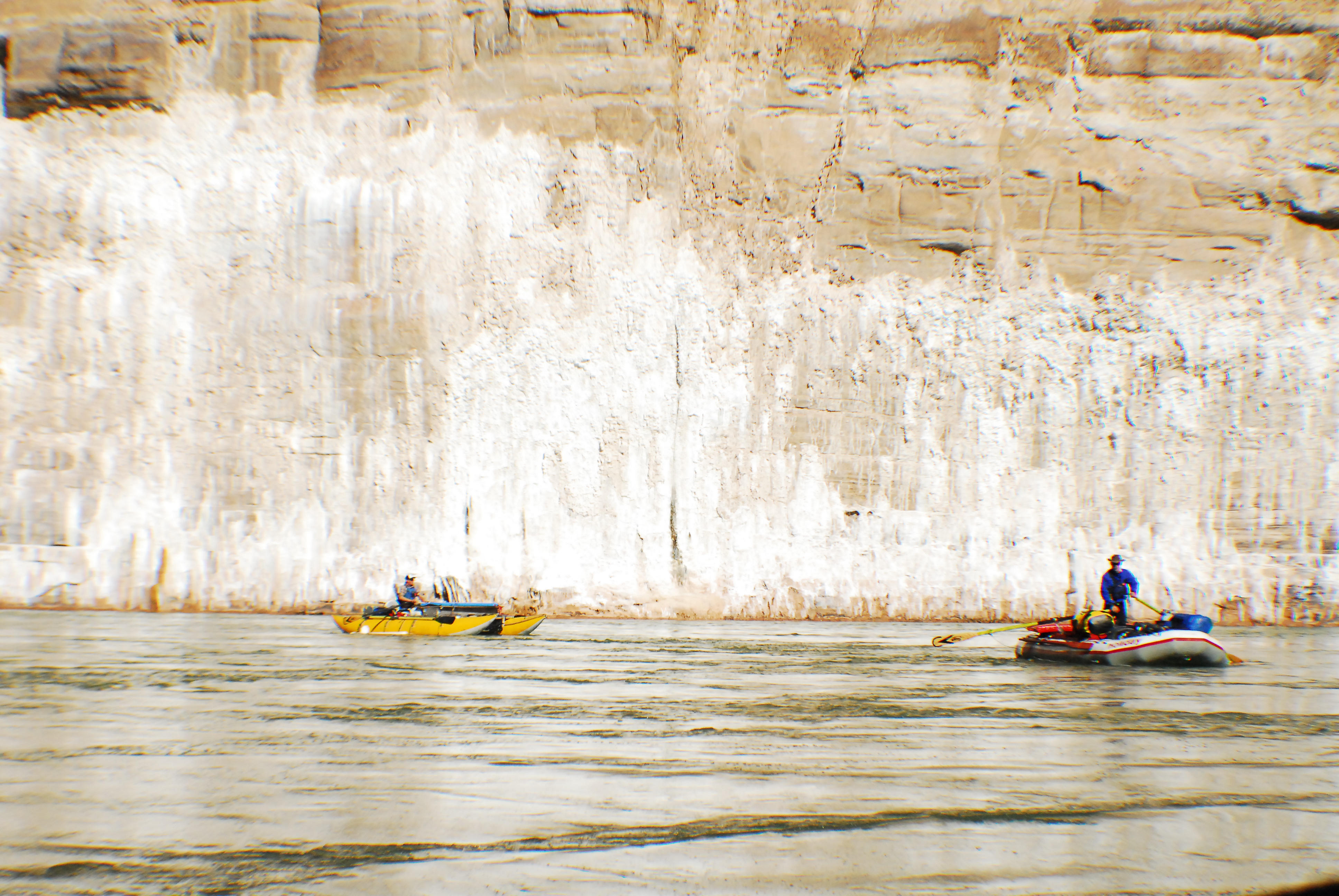
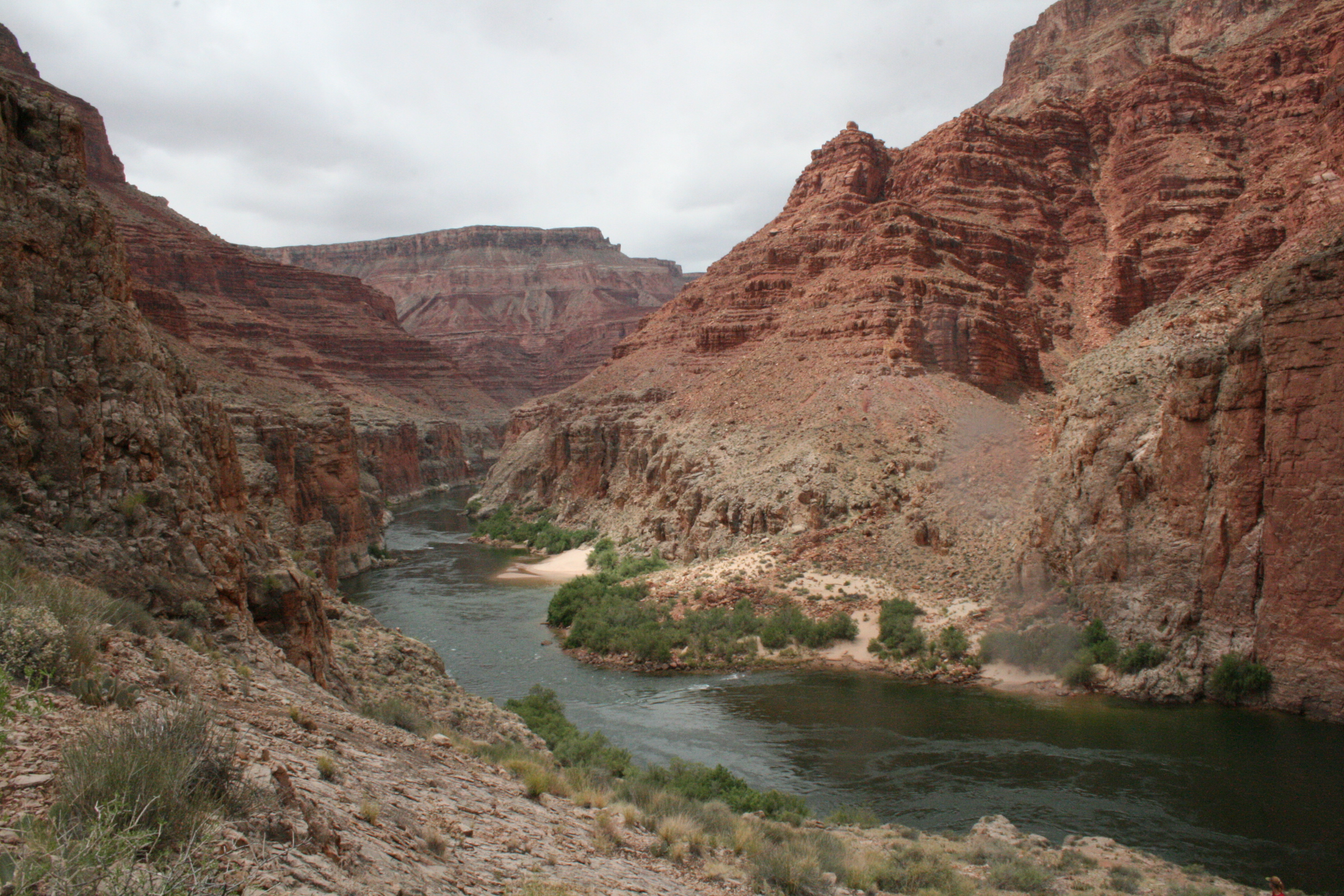
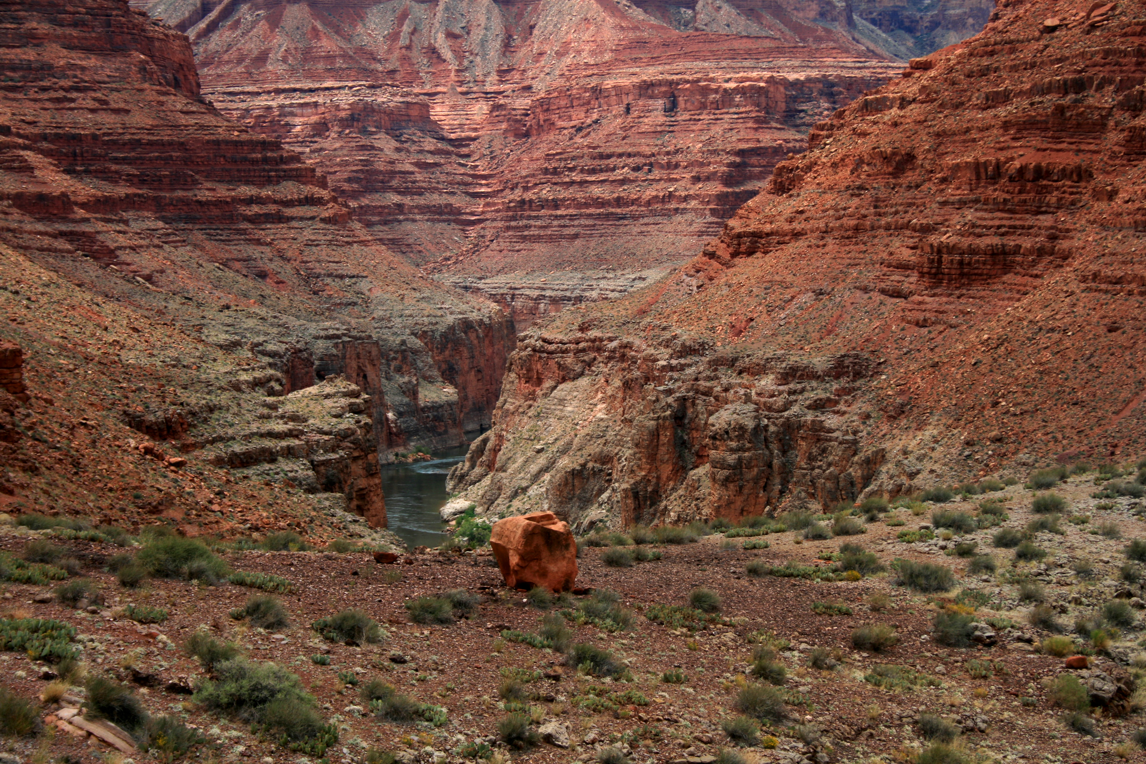
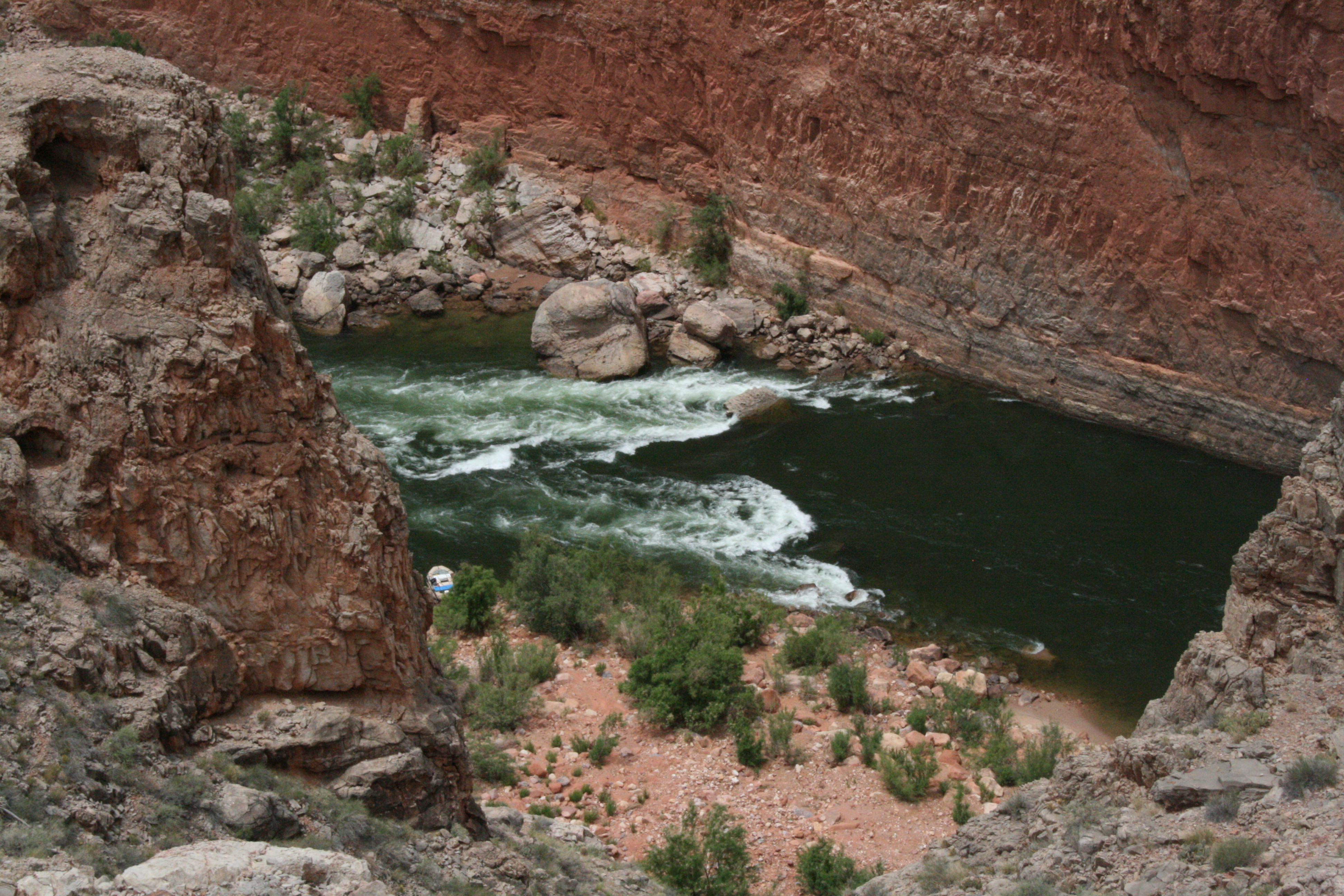
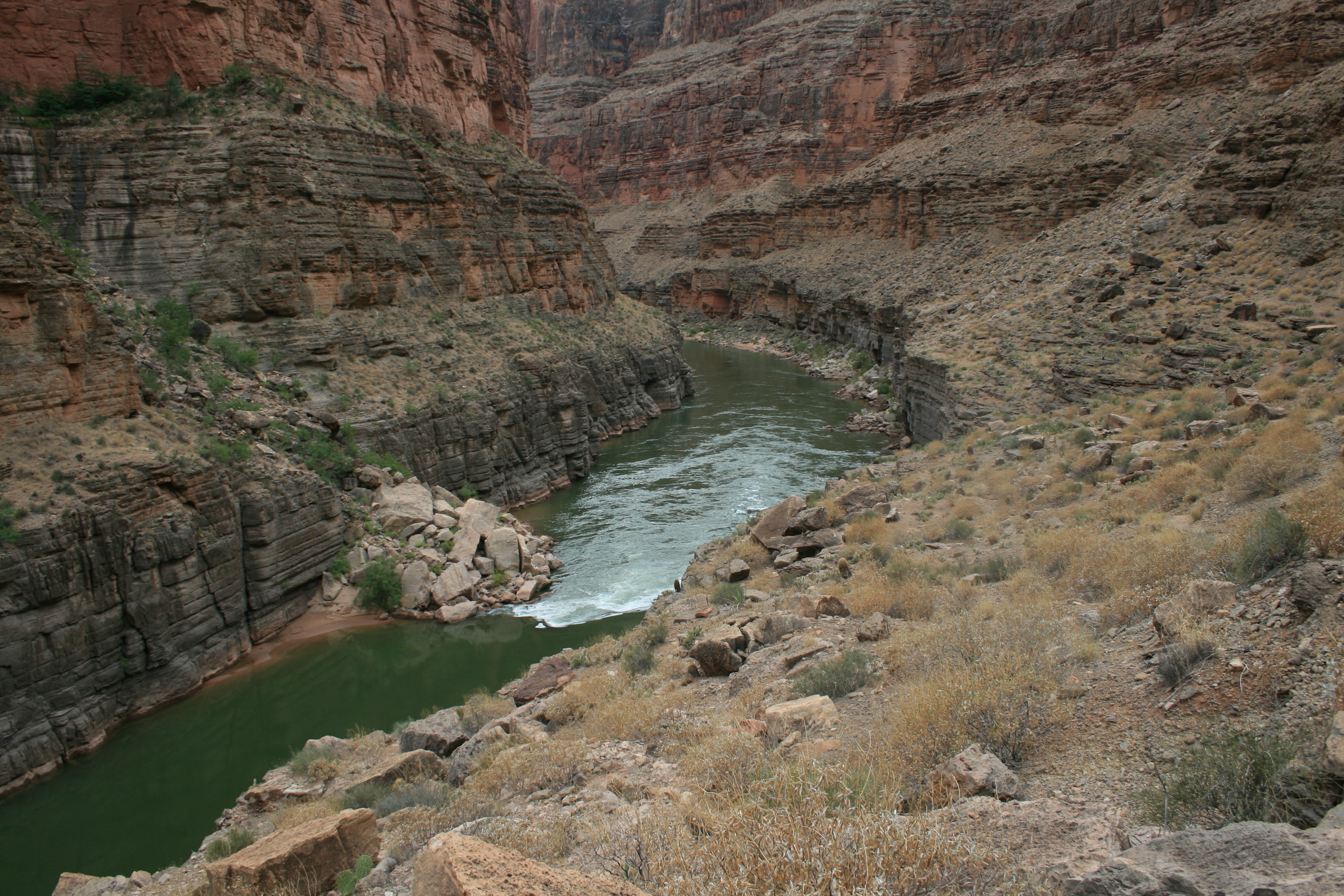
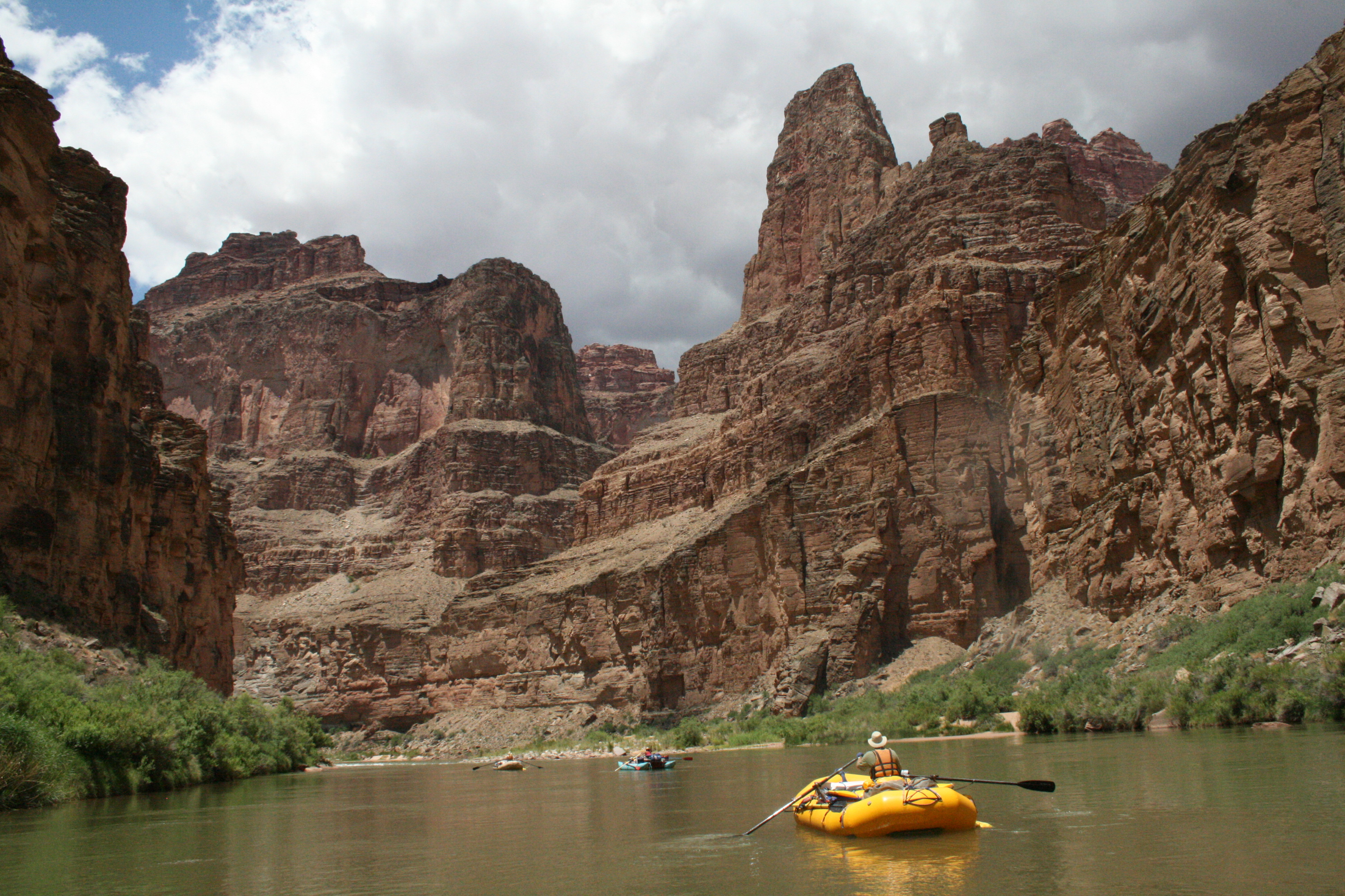
Everything about the Grand Canyon operates at a scale that makes other river trips feel like practice. The geology is deeper — two billion years of rock exposed in a mile-deep cross-section that reads like the autobiography of the continent. The rapids are more consequential — Lava Falls and Crystal have ended commercial motor rig trips, and the horizon line at Lava disappears so completely that you hear the rapid before you see it. The side canyons are more spectacular — Havasu Creek's turquoise travertine, Deer Creek's narrows and falls, Elves Chasm's grotto — each one a destination that would justify its own permit system somewhere else. And the trip is longer than almost anything else you can run in North America: sixteen to twenty-one days for oar-powered private groups, through a corridor with no road access between Lees Ferry and Diamond Creek, no cell service, no extraction option that doesn't involve a helicopter or a nine-mile hike to the rim. The permit lottery takes years. The preparation takes months. The canyon rewards every hour of both. This is the trip that Fedarko wrote about — the one that produces obsession, that turns casual river runners into people who organize their lives around the next launch date. It is also the trip that six sovereign nations have called home for thousands of years, through every chapter of the canyon's human history, before and after the expedition narratives that tend to dominate the guidebooks.
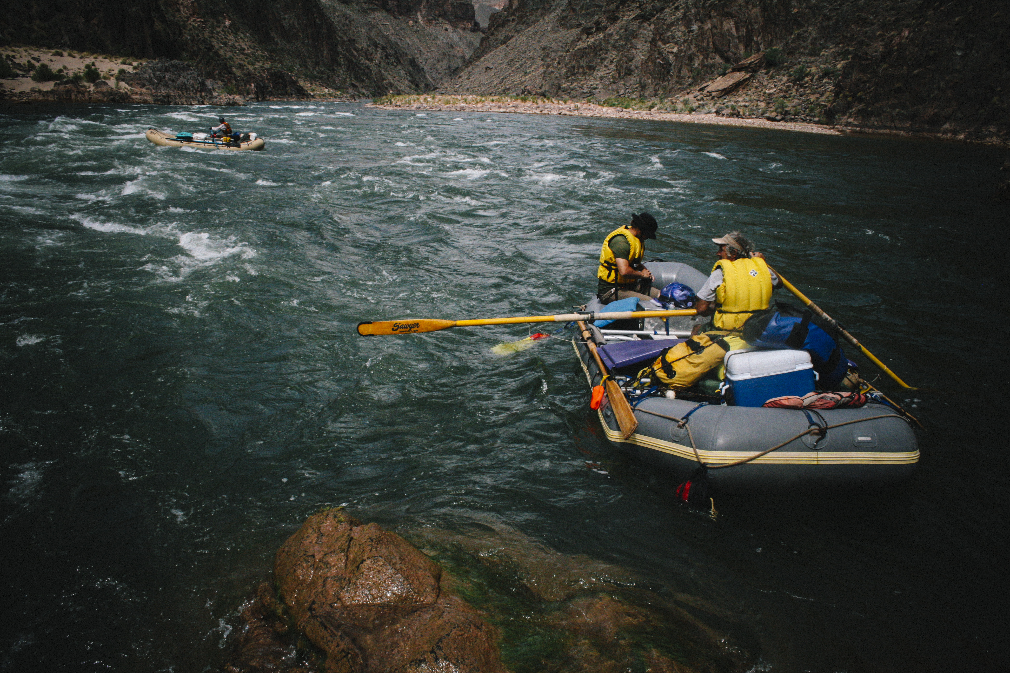
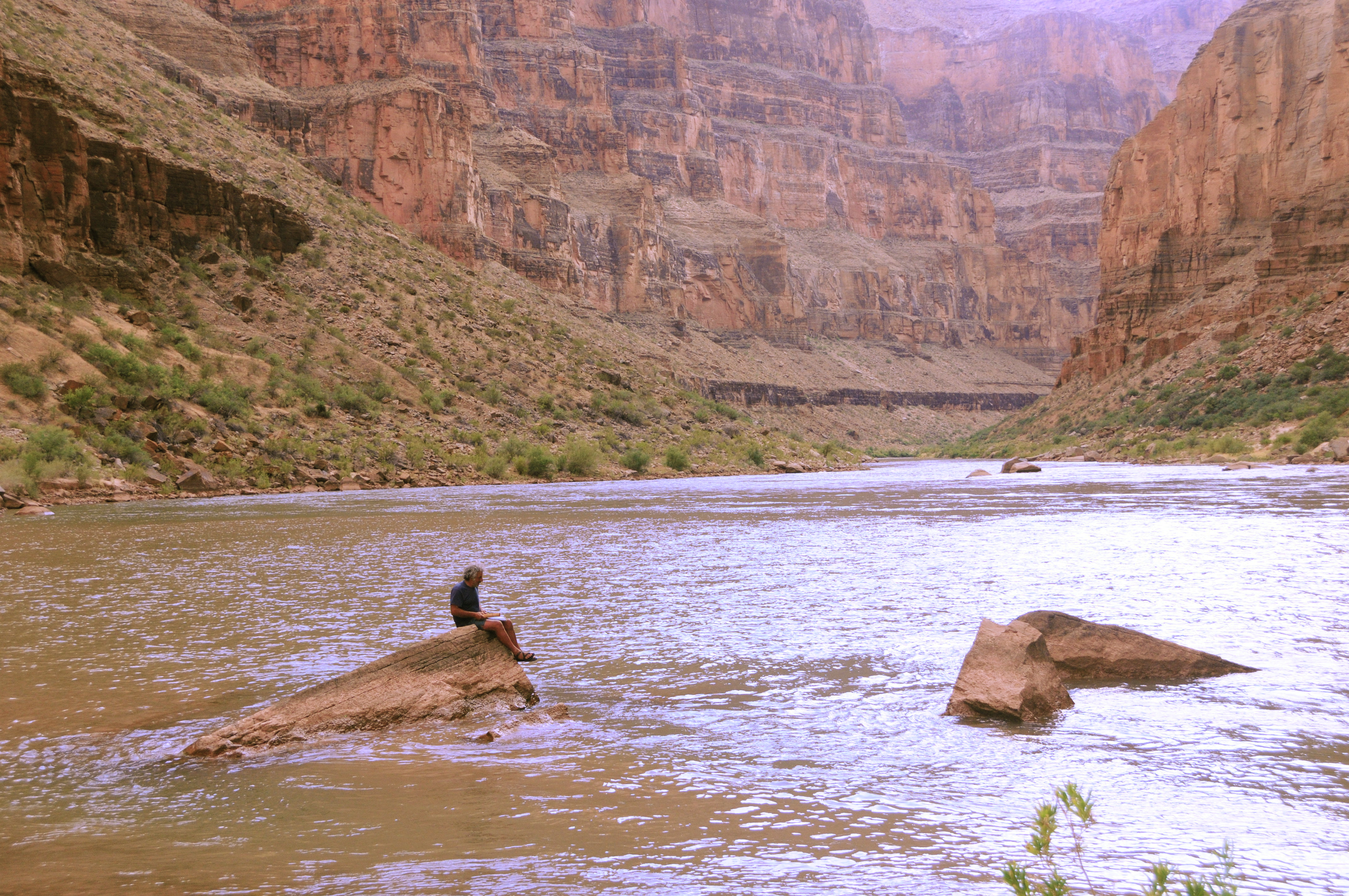
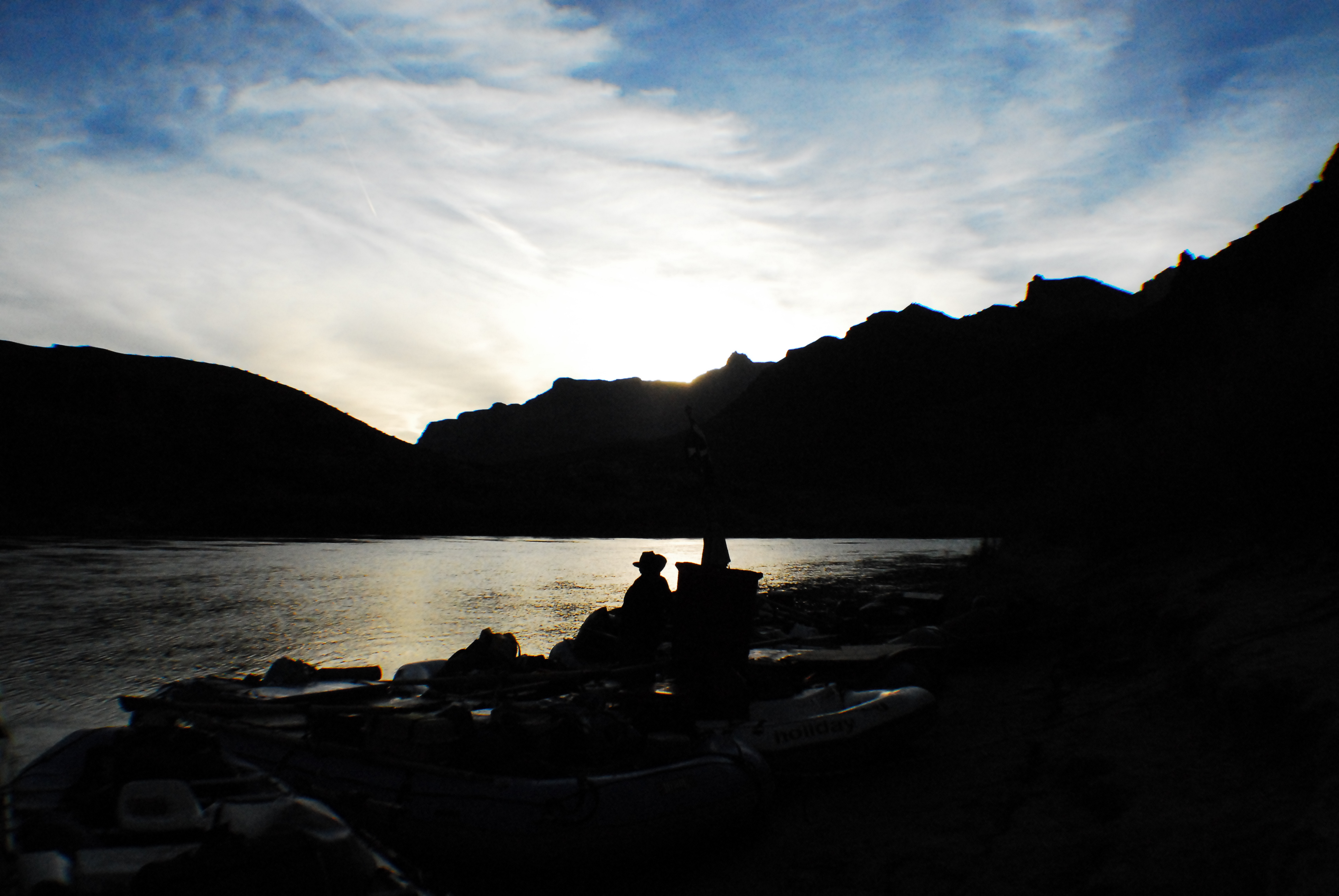
The Grand Canyon is not a river trip. It is the river trip — the one that every other section on every other river in the American West is measured against and found shorter, shallower, or less consequential. Two hundred and twenty-six miles from Lees Ferry to Diamond Creek through two billion years of exposed rock, past side canyons that would each be a national park somewhere else, over rapids that have ended careers and made reputations, and through a gorge so deep and so old that the rock at the bottom predates multicellular life by a billion years. Powell came through in 1869 and named most of what you'll see. Bert Loper spent his life trying to get back. The crew of the Emerald Mile ran it in the dark during the 1983 flood at speeds no one had attempted. The Havasupai, Hualapai, Navajo, Hopi, and Southern Paiute peoples have been here for thousands of years through all of it — before the dam, before the park, before the expedition narratives that tend to crowd them out. You wait years for the permit. The canyon rewards every one of them.
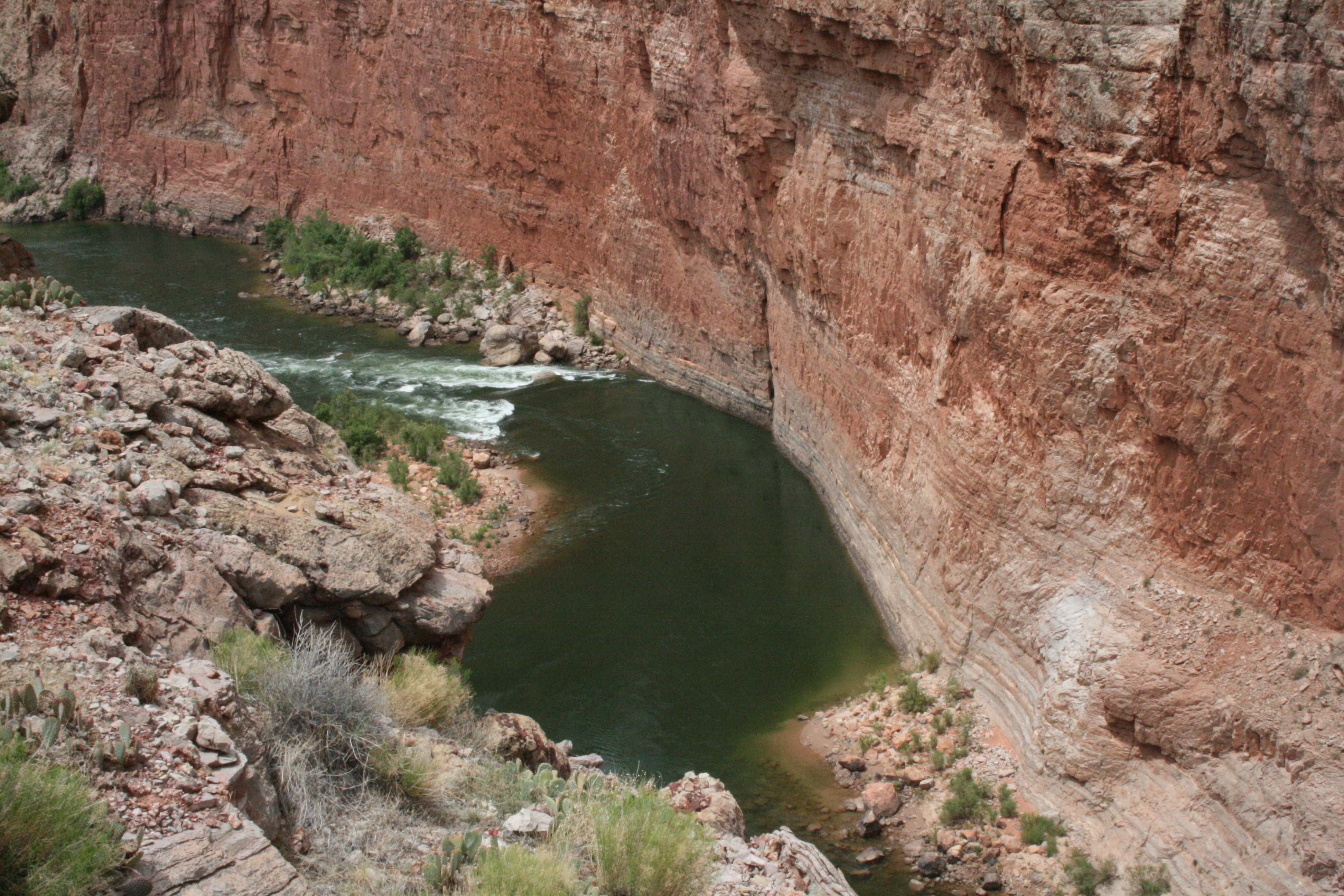
Glen Canyon Dam changed everything about this river except its course. The pre-dam Colorado was warm, silty, and violent — it flooded when the mountains said so, carried 380,000 tons of sediment daily, and scoured the beaches clean every spring. The post-dam Colorado exits the bottom of Lake Powell at 46–52 degrees year-round, carries almost no sediment, and flows according to Bureau of Reclamation power generation schedules. The Lees Ferry gauge is the authoritative reference. Typical releases run 8,000 to 25,000 cfs — enough to make every major rapid fully active and consequential. Above 25,000, Lava Falls and Crystal transform into something genuinely dangerous: massive recirculating hydraulics, limited recovery, and consequences that commercial operations train for specifically. In 1983, uncontrolled releases during the flood that Fedarko documented in The Emerald Mile sent water through at volumes the dam was never designed to pass — and the crew of the Emerald Mile ran the full canyon in a wooden dory at speeds no one had attempted, because the river was briefly, catastrophically, something like its old self. The cold water is the fact that surprises everyone. You're in a desert. The air is 105 degrees. The river is 48 degrees. A swim at Lava Falls in July is a hypothermia event, not a refreshing dip. Wetsuit or drysuit is non-negotiable in every season.
The essential Grand Canyon planning gauge. Located at the historical put-in for Grand Canyon river trips, this gauge reflects Glen Canyon Dam release data and is the primary operational reference for all Grand Canyon river section planning.
The Lees Ferry gauge (USGS 09380000) reflects dam-regulated releases from Glen Canyon Dam and is the primary reference for all Grand Canyon river planning. Flows are controlled by Bureau of Reclamation power generation schedules and can change significantly day to day. Planned release schedules can be requested from the Bureau of Reclamation's Salt Lake City office or tracked through the Lees Ferry gauge.
Below 8,000 cfs — some hydraulics in major rapids are washed out slightly; generally safer for swimmers but Lava Falls remains serious. Shallow in upper flatwater sections.
10,000–20,000 cfs — standard operating range; all major rapids are active and consequential. Most private trips run in this window.
Above 25,000 cfs (high-release years) — Lava Falls and Crystal Rapid become extremely serious. Recirculating hydraulics, limited rescue options, and powerful laterals. Expert teams only at these flows.
Water exits Glen Canyon Dam at approximately 46–52°F year-round — significantly colder than ambient desert temperatures. Cold-water immersion is a year-round risk. Wetsuit or drysuit strongly recommended for all seasons.
Dam-regulated — typical releases 8,000–25,000 cfs year-round; flash flood risk in side canyons during monsoon
Runnable but some hydraulics are reduced. Generally safer for swimmers but Lava Falls remains serious at any flow.
Most private trips run in this window. All major rapids are fully formed and consequential.
Powerful hydraulics throughout. Lava Falls and Crystal develop recirculating features. Expert teams with rescue capability.
Lava Falls becomes one of the most dangerous commercially run rapids in North America. Limited recovery, massive laterals.
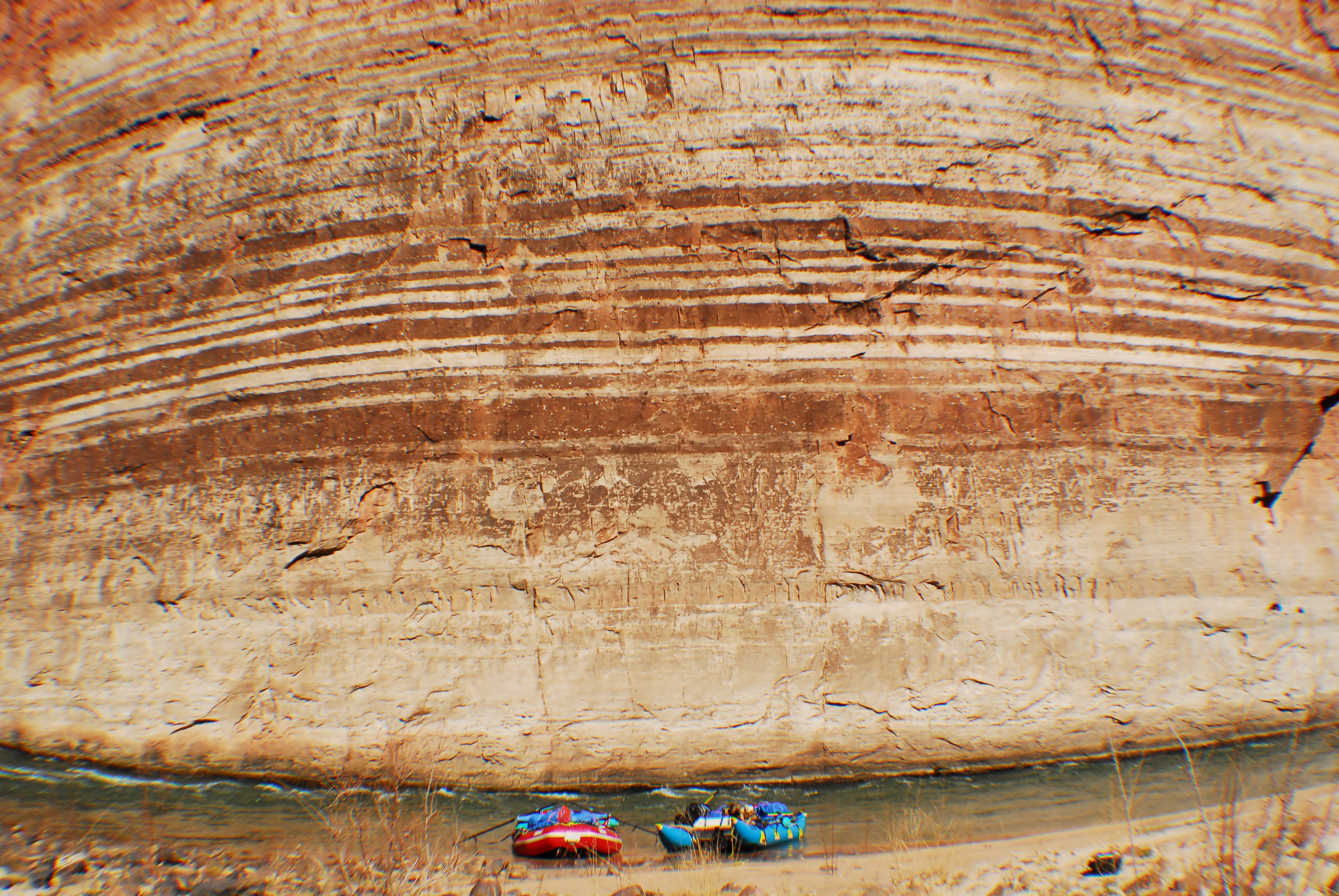
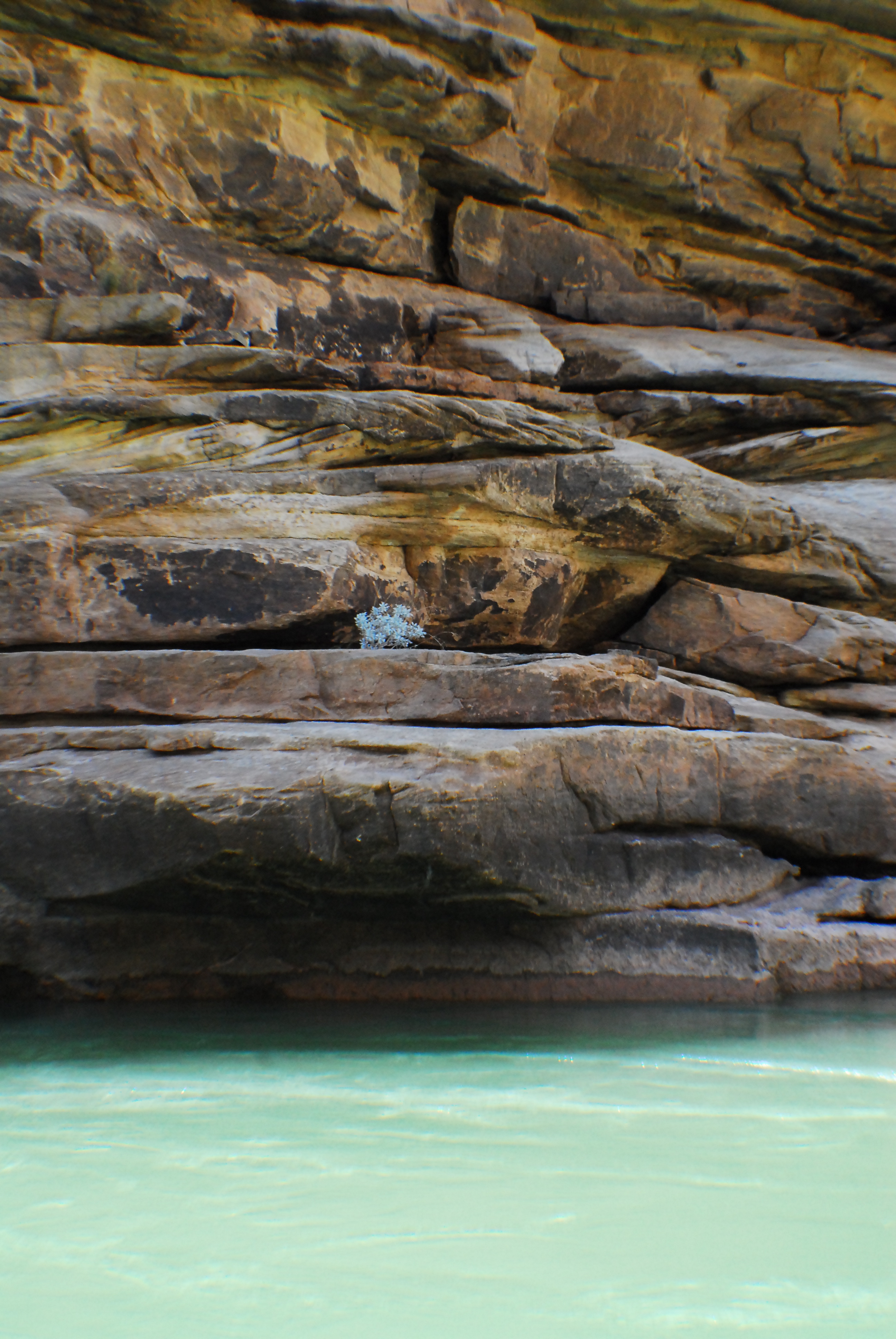
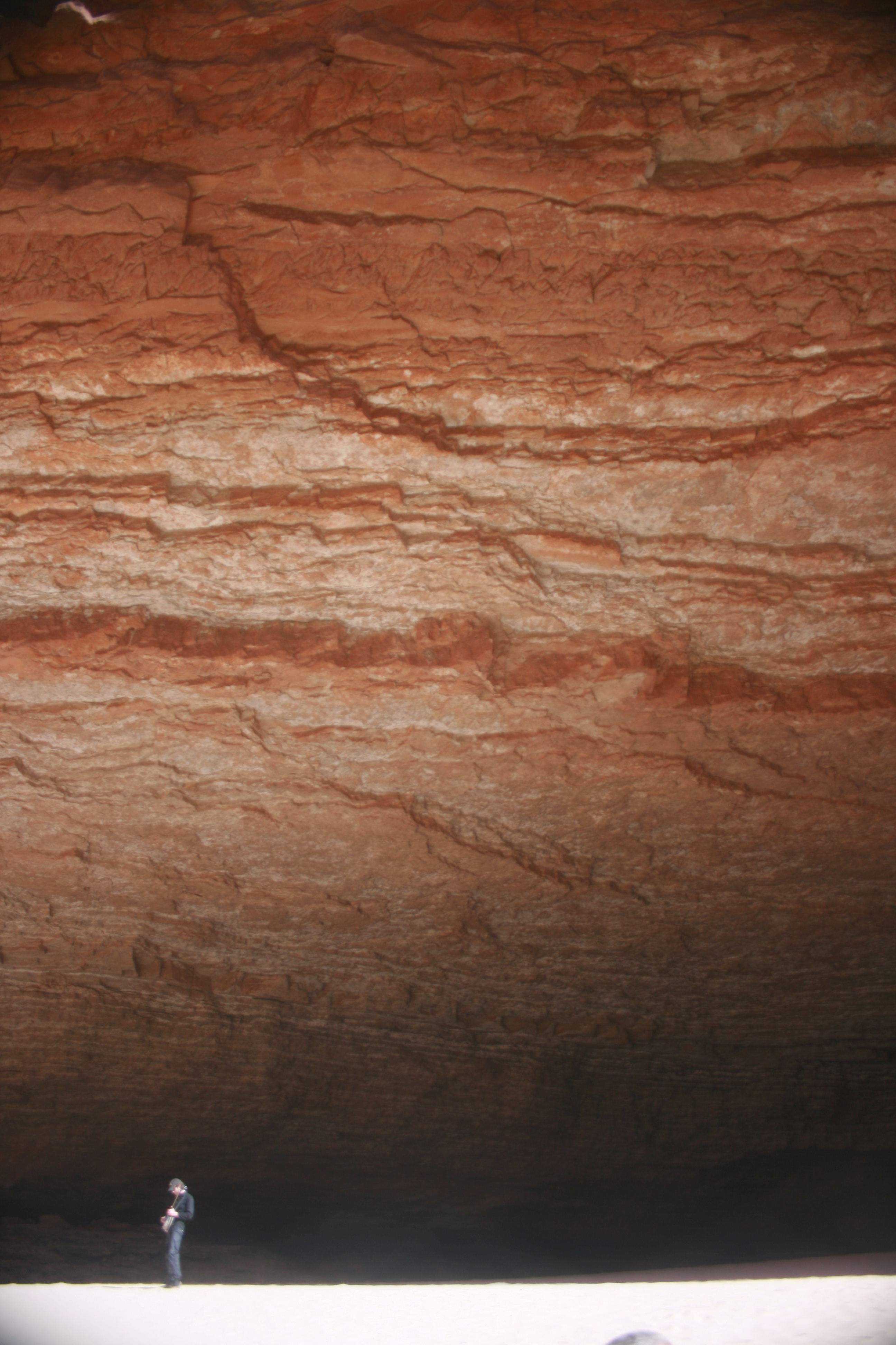
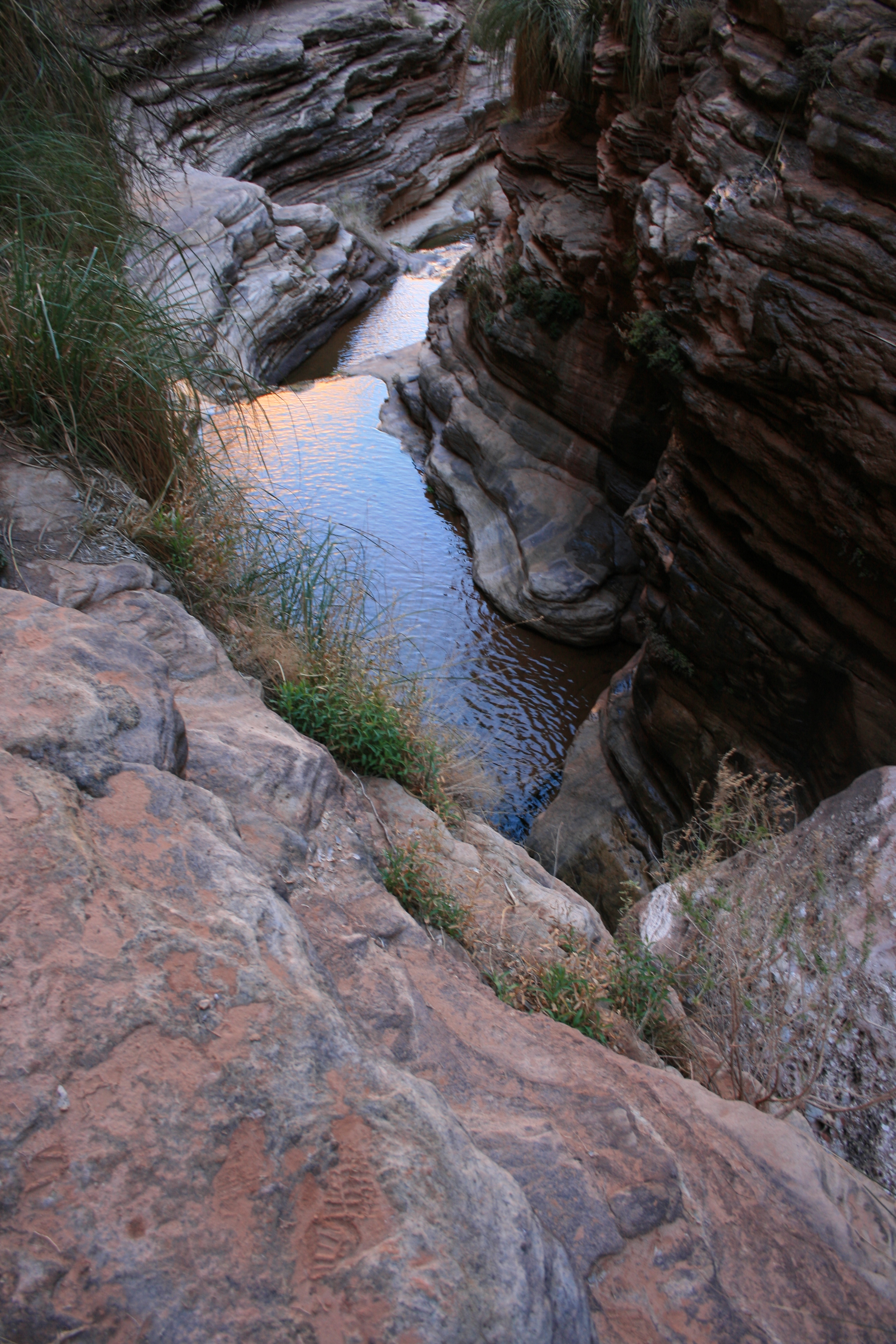
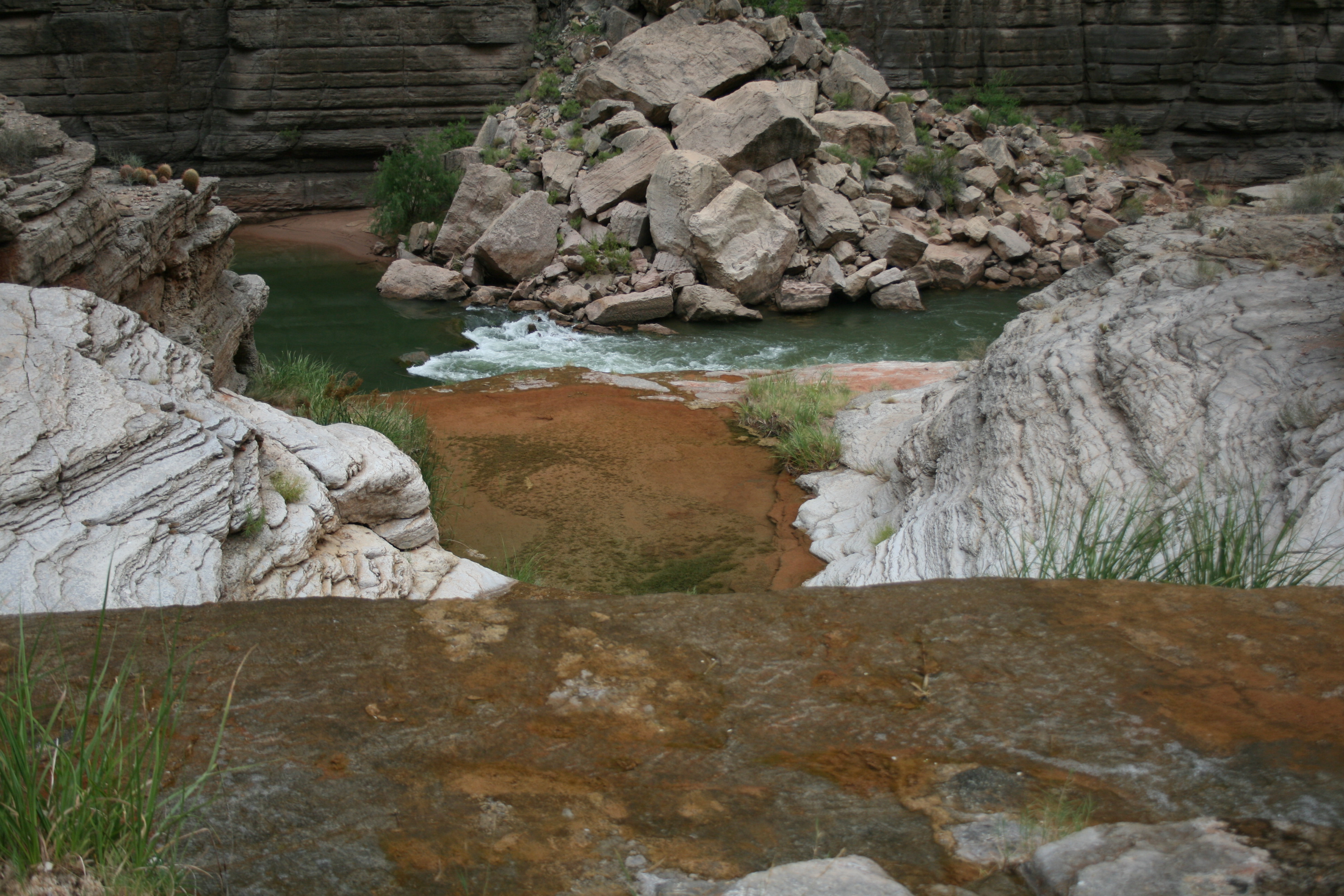
The Grand Canyon is the most complete geological cross-section accessible by river on Earth. The story reads from top to bottom: Kaibab limestone at the rim — Permian, 270 million years old, deposited when this desert was a shallow sea — down through the Toroweap, the Coconino Sandstone (ancient sand dunes, visible as sweeping cross-beds in the cliffs), the Hermit Shale, the Supai Group, and into the Redwall Limestone that forms the visual backbone of the upper canyon. Below the Redwall, the rock ages accelerate: Bright Angel Shale, Tapeats Sandstone, and then the Great Unconformity — where 500-million-year-old sedimentary rock sits directly on 1.7-billion-year-old Vishnu Schist and Zoroaster Granite, with 1.2 billion years of rock record simply missing. Eroded. Gone. The gap is visible at river level in the inner gorge, and standing at that contact point is one of the most disorienting experiences in geology — you can put one hand on rock from the Cambrian and the other on rock from the Proterozoic, and the distance between them represents more time than the entire fossil record of complex life. The inner gorge itself — dark, polished, metamorphic — is the same Precambrian basement rock exposed at Westwater Canyon and in the Uinta Mountains at Lodore, but here the exposure is sustained for miles. Below the inner gorge, the lower canyon adds a final chapter: basalt lava flows from Toroweap and Vulcan's Forge dammed the river multiple times in the last few million years, creating temporary lakes hundreds of feet deep. The river cut through every one of them. The evidence is still in the walls.
The canyon is a mile-deep cross-section through two billion years of rock. From the Kaibab limestone at the rim to the Vishnu Schist in the inner gorge, the stratigraphic column reads as the autobiography of the continent — shallow seas, ancient dune fields, marine transgressions, and the Precambrian basement that underlies everything. The Great Unconformity at the base of the Tapeats Sandstone is the defining geological feature: 500-million-year-old sedimentary rock resting directly on 1.7-billion-year-old metamorphic basement, with 1.2 billion years of rock record simply missing. Basalt lava flows from Toroweap and Vulcan's Forge dammed the river multiple times in the last few million years; the river cut through every one. The canyon is the proof that the Colorado is older than everything it cuts through.
The canyon is a mile-deep cross-section through two billion years of rock. From the Kaibab limestone at the rim to the Vishnu Schist in the inner gorge, the stratigraphic column reads as the autobiography of the continent — shallow seas, ancient dune fields, marine transgressions, and the Precambrian basement that underlies everything. The Great Unconformity at the base of the Tapeats Sandstone is the defining geological feature: 500-million-year-old sedimentary rock resting directly on 1.7-billion-year-old metamorphic basement, with 1.2 billion years of rock record simply missing. Basalt lava flows from Toroweap and Vulcan's Forge dammed the river multiple times in the last few million years; the river cut through every one. The canyon is the proof that the Colorado is older than everything it cuts through.
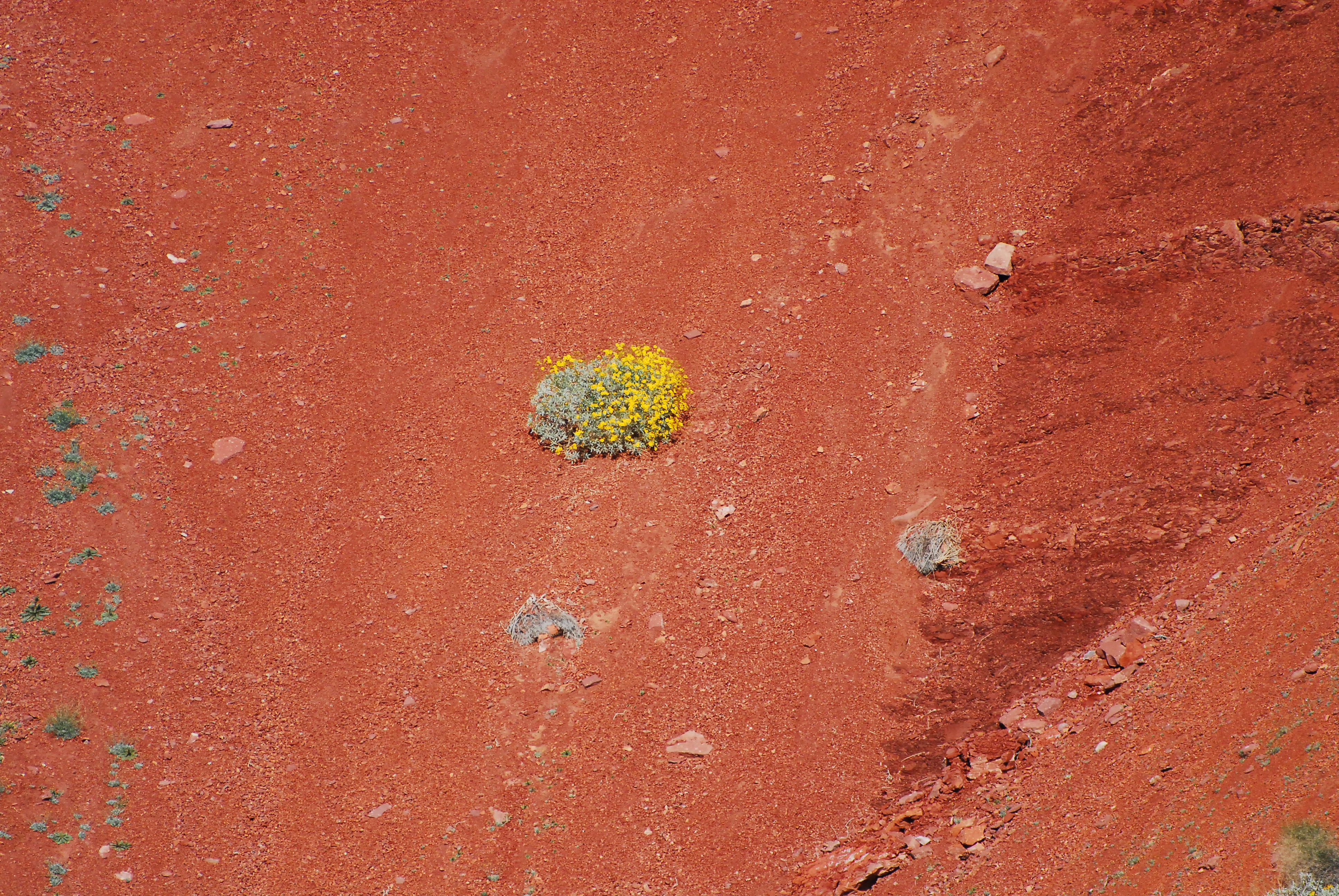
The canyon compresses five life zones into a single vertical mile — from the spruce-fir forest on the North Rim to the Sonoran desert plants at river level. The diversity per vertical foot exceeds almost anywhere in North America. At river level, the ecology is shaped by the dam. The pre-dam Colorado was warm, turbid, and flood-pulsed; the post-dam river is cold, clear, and steady. Tamarisk now colonizes benches that annual floods once scoured clean. The beaches where groups camp are eroding because the dam traps the sediment that built them — beach restoration through controlled flood releases is an ongoing and imperfect NPS management experiment. Humpback chub — endemic to the Colorado system, evolved for warm silty water that no longer exists below the dam — persist in the canyon as one of their last viable populations. Colorado pikeminnow and razorback sucker are also present. At Vasey's Paradise, the Kanab ambersnail clings to existence in a single spring-fed colony — one of the rarest invertebrates in North America. California condors, reintroduced in the 1990s, soar above the rim and are now commonly sighted. Ringtail cats visit camp at night with the casual entitlement of animals that have never needed to fear the things that sleep in their canyon. Desert bighorn sheep work the cliff faces. Great blue herons stand in the shallows below every rapid. The canyon is alive in ways that the geological spectacle can make you forget — until something moves.
The canyon compresses five life zones into a single vertical mile — from the spruce-fir forest on the North Rim to the Sonoran desert plants at river level. The diversity per vertical foot exceeds almost anywhere in North America. At river level, the ecology is shaped by the dam. The pre-dam Colorado was warm, turbid, and flood-pulsed; the post-dam river is cold, clear, and steady. Tamarisk now colonizes benches that annual floods once scoured clean. The beaches where groups camp are eroding because the dam traps the sediment that built them — beach restoration through controlled flood releases is an ongoing and imperfect NPS management experiment. Humpback chub — endemic to the Colorado system, evolved for warm silty water that no longer exists below the dam — persist in the canyon as one of their last viable populations. Colorado pikeminnow and razorback sucker are also present. At Vasey's Paradise, the Kanab ambersnail clings to existence in a single spring-fed colony — one of the rarest invertebrates in North America. California condors, reintroduced in the 1990s, soar above the rim and are now commonly sighted. Ringtail cats visit camp at night with the casual entitlement of animals that have never needed to fear the things that sleep in their canyon. Desert bighorn sheep work the cliff faces. Great blue herons stand in the shallows below every rapid. The canyon is alive in ways that the geological spectacle can make you forget — until something moves.
The Grand Canyon is where American river running, American conservation law, and Indigenous American sovereignty converge in the same gorge — and the tension between those narratives is the canyon's deepest layer. At least six sovereign nations — Havasupai, Hualapai, Navajo, Hopi, Southern Paiute, and Zuni — have continuous relationships with this landscape spanning thousands of years. The Havasupai live in it. The Hualapai control Diamond Creek and operate river access from Peach Springs. The canyon is not an uninhabited wilderness that Powell discovered — it is an inhabited landscape that Powell described, partially and with the biases of his era. His 1869 expedition was the first recorded non-Indigenous navigation of the full canyon. Three men left the expedition at Separation Rapid rather than continue — the Howland brothers and William Dunn walked up to the rim and were never seen again. Dolnick's account captures the psychological texture of that moment: the fracture between those who trusted the river and those who trusted the land, and the cost of being wrong. The canyon's modern river-running culture grew from the guides who followed — Bert Loper, who died at 79 still running rapids; Norman Nevills, who built the first commercial operation out of Mexican Hat; the generations of Grand Canyon boatmen whose oral history the BQR has preserved. The conservation battles came later: the proposed Marble Canyon and Bridge Canyon dams in the 1960s would have flooded significant stretches of the corridor. Brower and the Sierra Club stopped them — having learned from the Echo Park fight and the Glen Canyon bargain that some canyons cannot be traded. Glen Canyon Dam itself, built upstream in 1963, fundamentally altered the river it was supposed to control: the sediment regime, the temperature profile, the flood pulse, the native fish populations, the beach dynamics. The debates about what the dam has done and whether anything can be undone continue today. In 1983, the dam nearly failed — uncontrolled releases sent water through the canyon at volumes the spillways couldn't handle, and the crew of the Emerald Mile used the chaos to run the full canyon in a wooden dory faster than anyone had before. Fedarko's account of that run is the defining piece of Grand Canyon river literature: a story about obsession, risk, and the moment when the river briefly became something like its old self.
At least six sovereign nations — Havasupai, Hualapai, Navajo, Hopi, Southern Paiute, and Zuni — have continuous relationships with this landscape spanning thousands of years. The Havasupai live in it. The Hualapai control Diamond Creek. The canyon is not an uninhabited wilderness that Powell discovered — it is an inhabited landscape that Powell described. His 1869 expedition was the first recorded non-Indigenous navigation; three men left at Separation Rapid rather than continue and were never seen again. The guide culture that followed — Loper, Nevills, the generations of Grand Canyon boatmen whose oral history the BQR preserves — grew from that expedition's legacy.
The NPS permit lottery is the gate, and it is narrow enough that most private boaters wait years before drawing a launch date. Apply January 1–31 through Recreation.gov for the following year. Previous launch experience weights your application lower — the system favors first-timers, which means experienced trip leaders often wait longest. The trip itself demands logistics proportional to its ambition: sixteen days on the water is typical for oar trips; the shuttle to Diamond Creek is 280 miles via Page and Peach Springs on a road that requires 4WD, a Hualapai tribal permit, and a pre-arranged driver who knows the road; satellite communication is essential for a 226-mile corridor with no cell service and only one mid-trip access point (Phantom Ranch at mile 87); fire pan and groover are NPS requirements inspected at takeout; and the medical kit needs to account for the fact that a genuine evacuation from the inner canyon — anywhere between mile 88 and mile 226 — requires a helicopter. Commercial trips are a legitimate alternative for those unwilling to wait. They run motor rigs that complete the canyon in six to eight days, or oar-supported trips that take twelve to sixteen. The motor trips are faster but miss the canyon's rhythm. The oar trips are closer to the private experience. Neither replaces the thing itself.
Lees Ferry is accessed via US-89A and Lees Ferry Road from Page, AZ or Marble Canyon, AZ. Paved road to the ramp. Permit check-in required here. The only developed river access between Glen Canyon Dam and Diamond Creek.
Diamond Creek Road is a 26-mile dirt road on Hualapai Nation land. A Hualapai tribal permit and road access fee are required — paid at Peach Springs, AZ. 4WD strongly recommended, especially after rain. Road conditions vary dramatically by season.
Shuttle from Lees Ferry to Diamond Creek requires driving through Page, AZ and south to Peach Springs. Diamond Creek Road is the critical variable — confirm road conditions and obtain Hualapai permit in advance. Commercial shuttle services operate from Page and Flagstaff.
NPS weighted lottery system — apply January 1–31 for the following year's launch dates. Lottery is extremely competitive; most applicants wait multiple years before drawing a permit. Trip leaders who have previously launched are weighted lower. Commercial operator trips are a viable alternative for those unwilling to wait. A separate Hualapai tribal permit and road access fee is required for Diamond Creek takeout — obtain at Peach Springs, AZ before the trip.
The Grand Canyon demands the most complete gear reckoning of any river trip in North America — sixteen to twenty-one days of full expedition commitment through a corridor where the nearest hospital is a helicopter ride away. Three facts shape every gear decision: the water is cold year-round (46–52 degrees from Glen Canyon Dam), the air can exceed 110 degrees in the inner gorge during summer, and the rapids include Class V features that have flipped fully loaded commercial motor rigs. Wetsuit or drysuit is non-negotiable in every season — a swim at Lava Falls in August, when the air is 108 degrees, puts you in 48-degree water with powerful hydraulics and a long downstream swim. Sun protection is as important as rescue gear: UV-blocking clothing, quality broad-spectrum sunscreen, wide-brim hat, and shade systems for camp. Boats must be appropriate for Class V whitewater — oar rigs are the standard private craft, allowing a skilled oarsman to run technical lines while passengers brace. Dories are the traditional boat and produce the most beautiful relationship between craft and canyon, but they take water and demand skilled handling. Kayaks are appropriate for expert paddlers. Fire pan and groover are NPS requirements, inspected at Diamond Creek — bring spares for both. The medical kit should account for heat stroke, hypothermia, orthopedic injury, dehydration, and the 16-day timeline of a remote expedition. Satellite communicator is essential. And the single most important piece of gear is the one you can't buy: a trip leader who has planned with the thoroughness and humility the canyon demands.
On a seven-day trip, you'll cook roughly 20 meals on a folding table in the sand. The constraint isn't ambition — it's ice management. Days one through three, you have real cooler capacity. Days four and five are the transition zone. Days six and seven are pantry cooking.
The best river cooks plan backward from the last night. If your final dinner is still good — not just edible, but genuinely good — the trip ends on a high.
Night one. Fresh cooler. Cast iron over charcoal. The best steak you'll eat all week.

Marinated at home, grilled in camp. The best taco night on the river.
Real lasagna. Dutch oven. Day 3 of a river trip. It works.

One pot. Canned coconut milk. Twenty-five minutes. The transition meal.

Pizza dough holds for five days. Cast iron and charcoal do the rest.

Every ingredient is shelf-stable. Day 6 dinner that doesn't taste like day 6.

Canned beans. Rice. Cumin. Lime. Whatever's left. The last night done right.
The night-one showstopper. Thick-cut ribeyes seared in a screaming-hot cast iron over charcoal, with halved bell peppers and onions charring on the grate alongside. This is the meal you cook while the cooler is still cold and the group is still clean. Finish with flaky salt and a squeeze of lime. It takes ten minutes and sets the tone for the whole trip.
Salt the steaks before you set up camp — by the time you've rigged the kitchen, they've had their 30 minutes. The cast iron needs to be genuinely smoking before the first steak goes in. If it's windy, position the fire pan so you're shielded and the coals stay hot. In desert heat above 100F, pull steaks from the cooler only 10 minutes ahead — they'll come to temp fast. Keep a spray bottle of water nearby for flare-ups from the dripping fat.
Pre-marinated chicken thighs grilled over charcoal, sliced thin, and piled into warm flour tortillas with crunchy cabbage slaw and crumbled cotija. The marinade does all the work at home — lime, cumin, garlic, and green chile — so in camp you just grill and assemble. This is the meal that makes people stop what they're doing and walk over to the kitchen.
The key to this recipe is the frozen marinade bags. They keep the cooler cold on day 1 and produce perfectly thawed, deeply marinated chicken by day 2. If it's extremely hot (105F+), check the bags on the morning of day 2 — they may thaw faster than expected. Don't skip the towel for the tortillas; they go from warm and pliable to stiff and cracked in two minutes of desert air. If it's windy, the charcoal will burn hot and fast — watch for flare-ups from the marinade dripping.
Proper lasagna built in a 12-inch Dutch oven over charcoal. Layer no-boil noodles, pre-made meat sauce (frozen flat in gallon bags at home), ricotta, and mozzarella. Charcoal on top and bottom, 45 minutes, and you pull out something that shouldn't be possible at a sandbar camp. The meat sauce freezes flat and doubles as an ice pack for the first two days.
The coal ratio is everything. Too many coals on the bottom and you'll scorch it. Roughly 1/3 underneath, 2/3 on top. In windy conditions, position the fire pan in a sheltered spot — wind cools coals unevenly and you'll get hot spots. If you're cooking on sand, clear the area thoroughly first; sand gets everywhere when the wind picks up, and nothing ruins lasagna like grit. Bring a lid lifter or channel-lock pliers — the lid will be 400 degrees. Start the charcoal earlier than you think. Dutch oven cooking always takes longer than expected, and hungry river people get impatient.
A one-pot curry that comes together in 25 minutes on a propane stove. Canned coconut milk, Thai curry paste, and pre-cut vegetables over rice. By night 4, the cooler is thinning out and the pantry starts pulling weight — canned coconut milk and curry paste do all the heavy lifting here. The vegetables just need to be crisp-tender. This is the meal that proves one-pot cooking doesn't have to taste like compromise.
This recipe is almost wind-proof because it's all in a pot with a lid. The propane stove handles it better than charcoal. The key mistake people make is adding all the vegetables at once — carrots need a head start or they'll be raw while the snap peas turn to mush. If you only have one burner, cook the rice first, set it aside covered (it holds heat for 20 minutes), then make the curry. In cold weather (below 50F), the coconut milk may have solidified in the can — it melts fast once heated, but give it an extra minute.
Real pizza made in a cast iron skillet over charcoal. Press pre-made dough into an oiled skillet, top with canned San Marzano sauce, hard salami, olives, and parmesan, then cover and cook over charcoal for 12 minutes. The bottom gets crisp and almost fried in the oil while the lid traps heat to melt the cheese. Make 3-4 pizzas to feed 8. The dough is made at home and keeps 4-5 days in the cooler — this is a day-5 meal built on foresight.
The oil in the skillet is non-negotiable. It prevents sticking and creates the fried-bottom texture that makes this work. Don't skimp. The dough will fight you if it's cold — let it warm up for 10 minutes before pressing. If it springs back, let it rest 5 more minutes. People will crowd the kitchen for pizza night, which is great for morale but means you need a system: one person on dough, one on toppings, one managing coals. Batch cooking takes an hour — serve each pizza as it comes out instead of waiting for all four. In wind, the coals cool quickly between pizzas. Keep extra lit coals ready.
The ultimate pantry meal. Every single ingredient is shelf-stable: canned tomatoes, olives, capers, anchovies, garlic, red pepper flakes, dried pasta. No cooler required. Boil pasta in filtered river water, make the sauce in another pot, combine. Fifteen minutes of active cooking and you have a dinner that tastes like you planned it, not like you ran out of options. This is the recipe that proves the last nights of a trip don't have to be sad.
This is the most reliable recipe in the entire trip menu. Nothing can go wrong with the ingredients — they're all shelf-stable and nearly indestructible. The one thing to watch is the pasta water. At elevation (Desolation Canyon is around 4,500 feet at put-in), water boils at a lower temperature and pasta takes slightly longer to cook. Taste it. On a single-burner stove, boil the pasta first, drain it, then make the sauce in the same pot to save fuel. The olives and capers provide so much salt that you probably won't need to add any to the sauce — taste first.
The last-night staple. Canned black beans seasoned with cumin and lime over rice, topped with whatever survives the trip — cheese rinds, crisped tortilla strips, pickled jalapeños, hot sauce. This is the meal that asks nothing of the cooler and everything of the pantry. It's cheap, fast, filling, and the toppings make it feel like a real dinner instead of a concession. Every trip ends here, and nobody complains.
This meal is intentionally designed to absorb scraps. Take inventory of the cooler and dry boxes before you start — whatever is left becomes a topping. Cheese rinds that would be trash at home become crispy bits when grated and scattered over hot beans. Stale tortillas become croutons when fried. The cumin and lime do the real work; without them, it's just beans and rice. With them, it tastes intentional. On cold last nights, this warm bowl is exactly what people want before the takeout drive home. If you have a second burner, heat the beans and cook rice simultaneously. Single-burner: cook rice first, set aside, then do the beans.
Two coolers, segregated by access frequency. A well-managed deep cooler will hold usable ice through day 6 in 100°F air temps.
Learn about ice managementFolding table, two-burner propane stove, cast iron skillet, Dutch oven, and a large pot. The Dutch oven is the single most versatile piece.
Learn about kitchen setupBooks that shape the science, history, and stories behind this place.
The dramatic story of John Wesley Powell's first expedition through the Grand Canyon and the birth of river exploration in the American West.
The story of Norman Nevills and the birth of commercial river running in the Colorado River basin.
A classic guide to the Colorado River through Grand Canyon with geology, ecology, and river running notes.
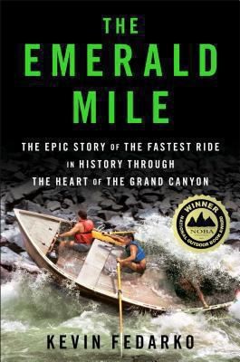
The thrilling story of the dory daredevils who set a speed record through the Grand Canyon at the height of the legendary flood of 1983 — and of the river that made it possible.
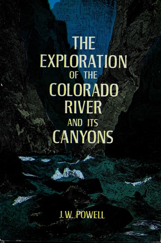
Powell's original account of the first scientific expedition through the Grand Canyon, documenting the geology, natural history, and challenges of navigating the unknown Colorado River.

A clear geological explanation of the formation of the Grand Canyon and the deep-time processes that shaped the Colorado River.
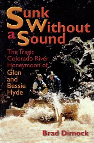
Brad Dimock's exhaustive biography of Bert Loper — gold prospector, early Colorado River boatman, and one of the great stubborn characters of Western river history — who died in Grand Canyon at 79, alone in his boat in a rapid, on the river he refused to leave. The definitive account of the Colorado River's pioneer running era.
A foundational book on Western water development, dams, irrigation politics, and the long struggle over the Colorado River and the arid American West.

An accessible introduction to the rock layers, canyon formation, and landscapes of the Colorado Plateau and canyon country.
An in-depth environmental and human history of Cataract Canyon and the rivers of Canyonlands, exploring Indigenous presence, exploration, dam impacts, river ecology, and the evolution of modern river running.
Edward Abbey's classic portrait of canyon country, solitude, and wilderness, influential to the identity and mythology of the Colorado Plateau.

A foundational scientific text on river geomorphology, covering sediment transport, channel form, fluvial dynamics, and the physical processes that shape river systems.

A geological exploration of Utah’s major river systems explaining how tectonics, sedimentation, and erosion shaped the canyon landscapes of the Colorado Plateau and surrounding regions.
Craig Childs traces the routes of the ancient Anasazi across the Colorado Plateau, uncovering evidence of a lost civilization's migrations through canyon country.
A guide to understanding the subtle clues in water movement—from puddles and rivers to oceans—teaching readers how currents, waves, surface textures, and patterns reveal information about wind, depth, obstacles, and landscape.
A river-running memoir by Roy Webb capturing the spirit, humor, and culture of Western river expeditions and the people who chase moving water through canyon country.
A rigorous, university-level introduction to physical hydrology covering the full water cycle — precipitation, evapotranspiration, infiltration, groundwater, runoff generation, and streamflow — with quantitative methods throughout. The scientific foundation for understanding how rivers work at the watershed scale, from snowpack in the Rockies to baseflow in canyon rivers.
A rigorous graduate-level treatment of river hydraulics and sediment transport, covering flow resistance, bedforms, channel stability, and the physical mechanics that govern river behavior.
A comprehensive guidebook to whitewater rivers in Utah and neighboring regions, covering river access, rapids, flow considerations, trip logistics, and historical context for river runners.

A key geological reference for understanding the uplift, stratigraphy, tectonics, and erosional history of the Colorado Plateau.

Three deeply reported narratives about humanity's attempts to stop rivers, lava, and debris flows — and what the land does in return. A masterwork of geological journalism that asks whether nature can ever truly be controlled.
The story of the final free-flowing run of Glen Canyon before Lake Powell filled the canyon, capturing a vanished landscape and the culture it held.

A gang of desert outlaws wage a reckless, irreverent war against the machines carving up the American Southwest.
Craig Childs explores the hidden water sources and desert hydrology of the American Southwest, revealing how water shapes and sustains life in the most arid landscapes on Earth.
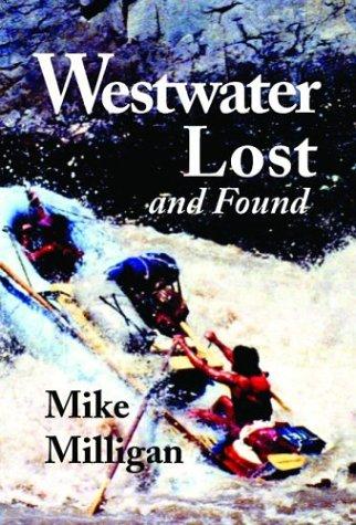
A story centered on the legendary Westwater Canyon stretch of the Colorado River, blending river-running culture, history, and storytelling from one of the most iconic whitewater sections in the Southwest.