Cataract Canyon
An in-depth environmental and human history of Cataract Canyon and the rivers of Canyonlands, exploring Indigenous presence, exploration, dam impacts, river ecology, and the evolution of modern river running.
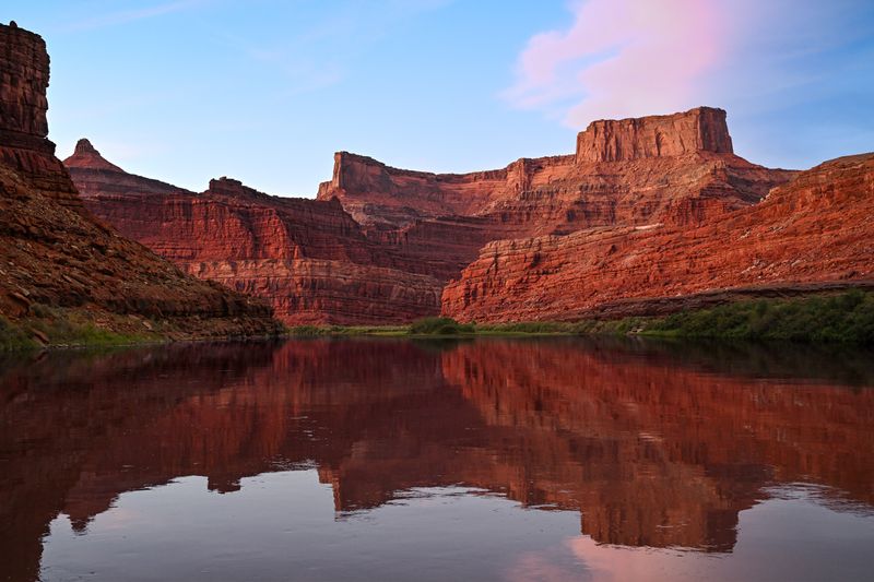
Meander Canyon is the quiet before the storm — 48 miles of total flatwater through the heart of Canyonlands, winding toward the Confluence and the whitewater of Cataract Canyon beyond.
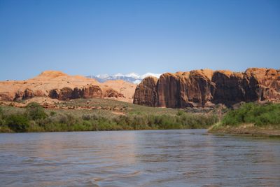
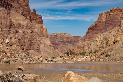
Meander Canyon is the long flatwater approach section of the Colorado River from Potash Boat Ramp through approximately 48 miles of deep, winding canyon country in Canyonlands National Park to the Confluence with the Green River. The river traces massive entrenched meanders beneath the Island in the Sky mesa, with canyon walls rising hundreds of feet from sandy beaches — total flatwater, no significant rapids, and profound remoteness. Most river parties running Cataract Canyon include this stretch as the approach, making it the gateway to one of the most committing river journeys in the American West.
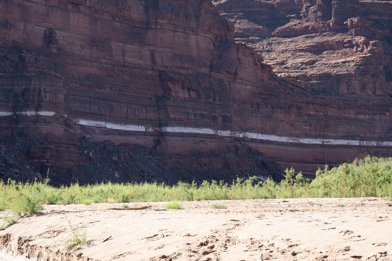
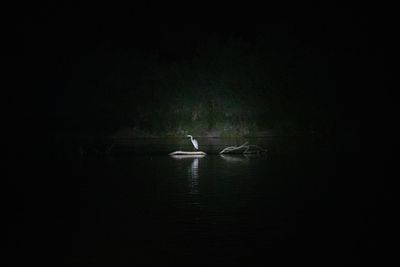
A low-water beach camp at Sheep Bottom (Whitestripe), Meander Canyon, eighteen and a half miles above the Confluence.
Monitored by the USGS Potash gauge at the put-in; spring runoff is the classic planning window for the combined Meander–Cataract trip.
Slow current and quiet water — the meanders drift peacefully but Cataract Canyon downstream will be lower class with more rock exposure.
Steady current through the meanders; Cataract Canyon in good condition downstream.
Strong current pushes through meanders efficiently; Cataract Canyon at high water is a serious undertaking — plan accordingly.
Spring runoff (Mar–Jun) and fall (Sep–Oct); summer is hot but manageable
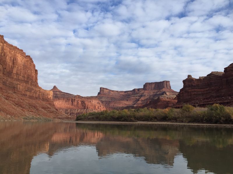
Meander Canyon cuts through the lower stratigraphy of the Colorado Plateau, exposing the Cedar Mesa Sandstone and White Rim layers that define Canyonlands' architecture. The entrenched meanders are ancient — the river established its course before the land uplifted, and has since cut downward to create the dramatic canyon walls that now rise hundreds of feet above the waterline. In the authoritative geologic/guidebook framing, Meander Canyon extends upstream from Potash another ~17 miles through The Portal at the Moab Valley escarpment — Desert Maritime tracks that upstream reach as the separate 'The Portal' section for navigation and climbing-resource clarity while preserving the ~61.5 mi total geologic extent note here. The corridor crosses into Canyonlands National Park at river mile 31; below the boundary, 44 river miles run inside the park before reaching the Confluence.
↑ Rim
↓ River level
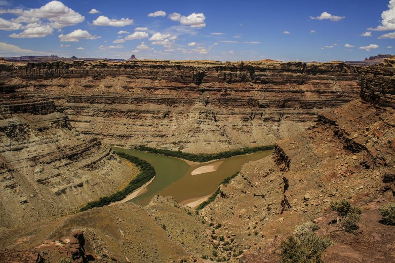
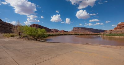
The Confluence is the largest meeting of two rivers in the southwestern United States — the Green drains the larger basin, but the Colorado delivers the greater volume. The geography here is so consequential that the names themselves were rewritten around it: before June 25, 1921, the Colorado River began at this point as the union of the Green and the Grand, until a joint resolution of Congress extended the name Colorado the length of the former Grand. John Wesley Powell's 1869 and 1871 expeditions passed through this corridor and documented it in detail, and the surrounding country became Canyonlands National Park when President Lyndon Johnson signed it into existence on September 12, 1964 — 527.5 square miles, with 44 of the river's miles below the boundary running inside the park.
The Confluence of the Green and Colorado Rivers has been a significant landmark for Indigenous peoples and explorers alike. John Wesley Powell's 1869 and 1871 expeditions passed through this corridor and documented the landscape in detail. Until June 25, 1921, the Colorado River began at the Confluence as the union of the Green and the Grand, when a joint resolution of Congress extended the name Colorado the length of the former Grand. Canyonlands National Park was established by President Lyndon Johnson on September 12, 1964 (527.5 square miles).
NPS overnight permit required; launch at Potash Boat Ramp; typical takeout at North Wash after Cataract Canyon; groover required throughout.
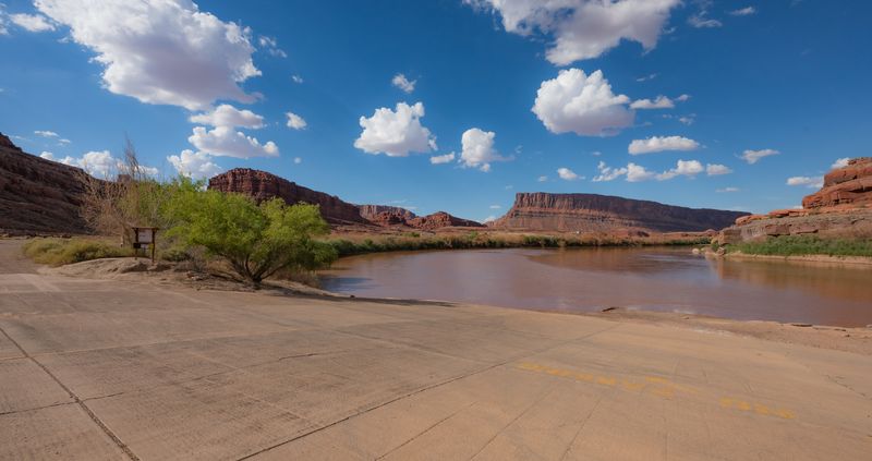
The Meander Canyon put-in at mile 47.3 (also called Jackson Bottom Boat Ramp), and the most common launch for standard Cataract trips — which run Meander Canyon down to the Confluence and on into Cataract. Good for Colorado-side approach mileage. Ramp and staging are more developed than backcountry alternative launches, but trip leaders should still verify seasonal conditions, parking rules, and current launch procedures.
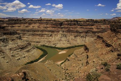
The confluence of the Green and Colorado Rivers in Canyonlands National Park. **No vehicle access. No boat ramp. No road of any kind reaches this point.** Boaters arrive only by floating in (Meander Canyon down the Colorado from Potash, or Stillwater Canyon down the Green from Mineral Bottom or Green River, UT) or by foot from the Doll House (via the Spanish Bottom trail, which itself is reached only by 4WD via the Maze District). Serves as the take-out point for Meander Canyon (Colorado) and Stillwater Canyon (Green) via river shuttle — Tex's Riverways / Big Tex Expeditions operates jetboat pickup here and returns boaters to Moab or Potash. The geographic put-in for Cataract Canyon — every Cataract trip enters at this point regardless of where the trip itself launched. Trip-level shuttles (Potash → North Wash, Mineral Bottom → North Wash, etc.) live on the river-trip entities, not on the Cataract section.
Potash Boat Ramp to Colorado-Green Confluence
Shuttle from Potash to North Wash/Dirty Devil runs via US-191 south and UT-95 — approximately 110 road miles. A jetboat pickup from Cataract Canyon is the alternative for parties continuing through whitewater.
Google used a car, their times do not account for towing a trailer, driving on washboard, pitted pavement, and dirt that goes to grease in the rain — our adjusted times help align to the reality of running real river shuttles.
NPS overnight river permit required for Canyonlands National Park. Apply through recreation.gov approximately 4 months in advance. Permits are competitive in spring. Day use does not require a permit. lottery:false / selfIssueAllowed:false set 2026-09-15 — covered by the Canyonlands overnight river permit (recreation.gov 621748), which the park states is not a lottery; same booleans as cataract-canyon.
On a seven-day trip, you'll cook roughly 20 meals on a folding table in the sand. The constraint isn't ambition — it's ice management. Days one through three, you have real cooler capacity. Days four and five are the transition zone. Days six and seven are pantry cooking.
The best river cooks plan backward from the last night. If your final dinner is still good — not just edible, but genuinely good — the trip ends on a high.
Two coolers, segregated by access frequency. A well-managed deep cooler will hold usable ice through day 6 in 100°F air temps.
Folding table, two-burner propane stove, cast iron skillet, Dutch oven, and a large pot. The Dutch oven is the single most versatile piece.
Books that shape the science, history, and stories behind this place.
An in-depth environmental and human history of Cataract Canyon and the rivers of Canyonlands, exploring Indigenous presence, exploration, dam impacts, river ecology, and the evolution of modern river running.
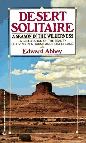
Edward Abbey's classic portrait of canyon country, solitude, and wilderness, influential to the identity and mythology of the Colorado Plateau.
A river-running memoir by Roy Webb capturing the spirit, humor, and culture of Western river expeditions and the people who chase moving water through canyon country.
A comprehensive guidebook to whitewater rivers in Utah and neighboring regions, covering river access, rapids, flow considerations, trip logistics, and historical context for river runners.
The thrilling story of the dory daredevils who set a speed record through the Grand Canyon at the height of the legendary flood of 1983 — and of the river that made it possible.
Powell's original account of the first scientific expedition through the Grand Canyon, documenting the geology, natural history, and challenges of navigating the unknown Colorado River.