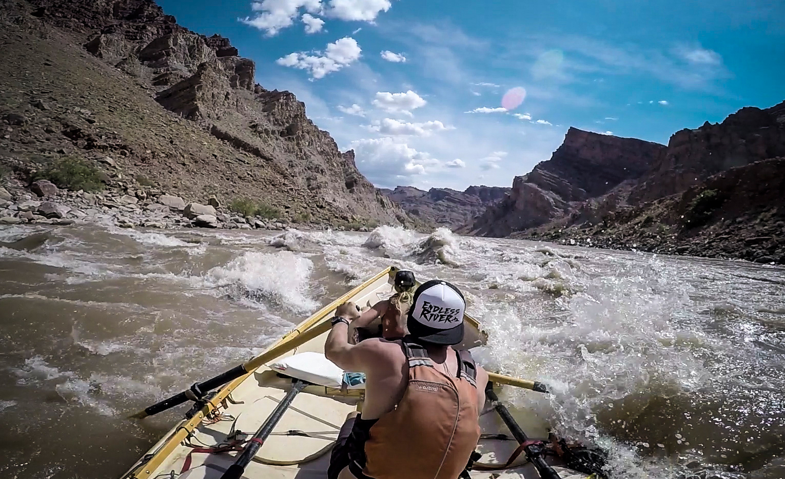
Big Drop 2 at High Water
criticalWhat goes wrong
- entering off-angle into a lateral or breaking wave
- missing the main tongue at high speed
- side surf or flip in a large hydraulic
Consequence
- high-volume swim
- boat flip or wrap risk
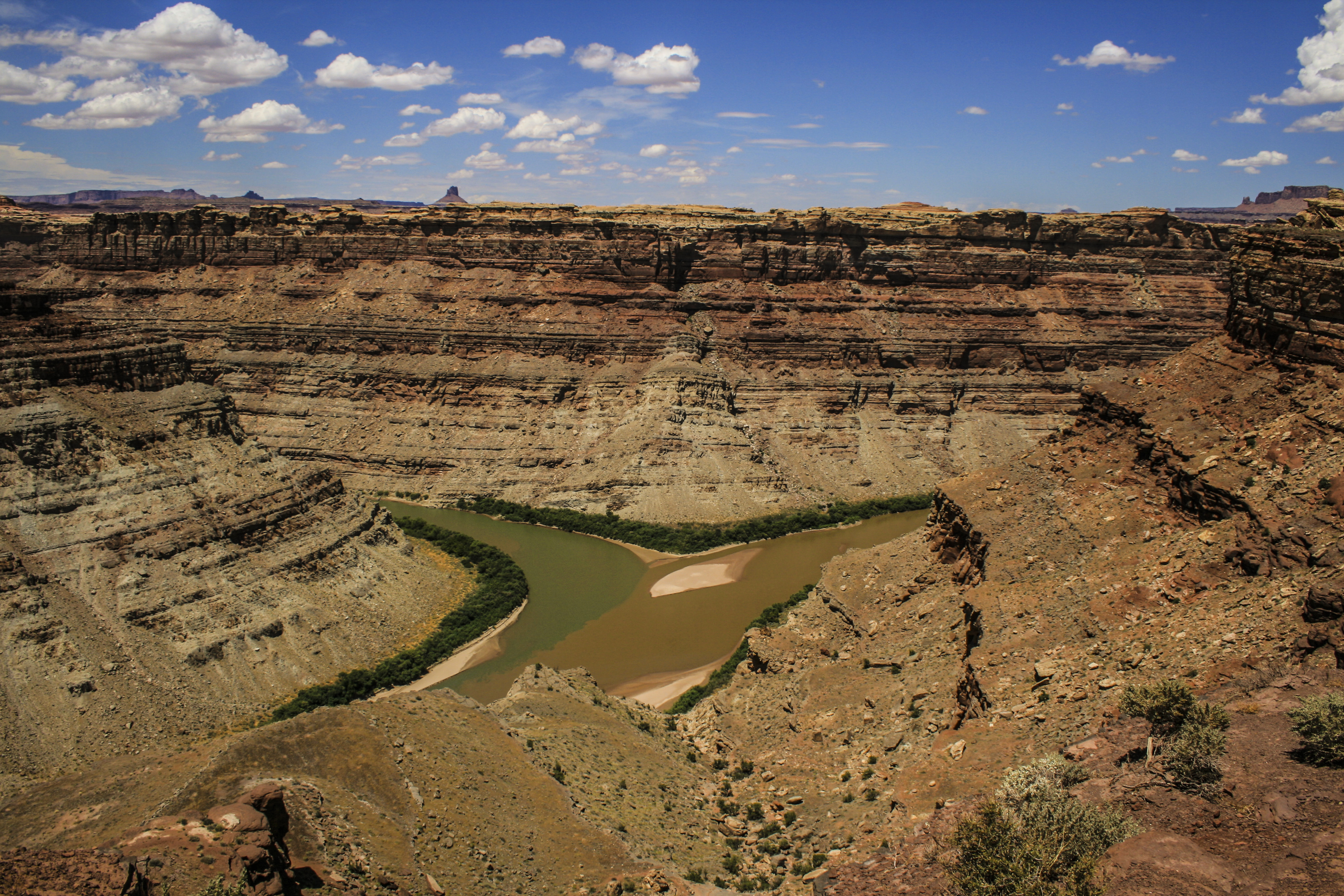
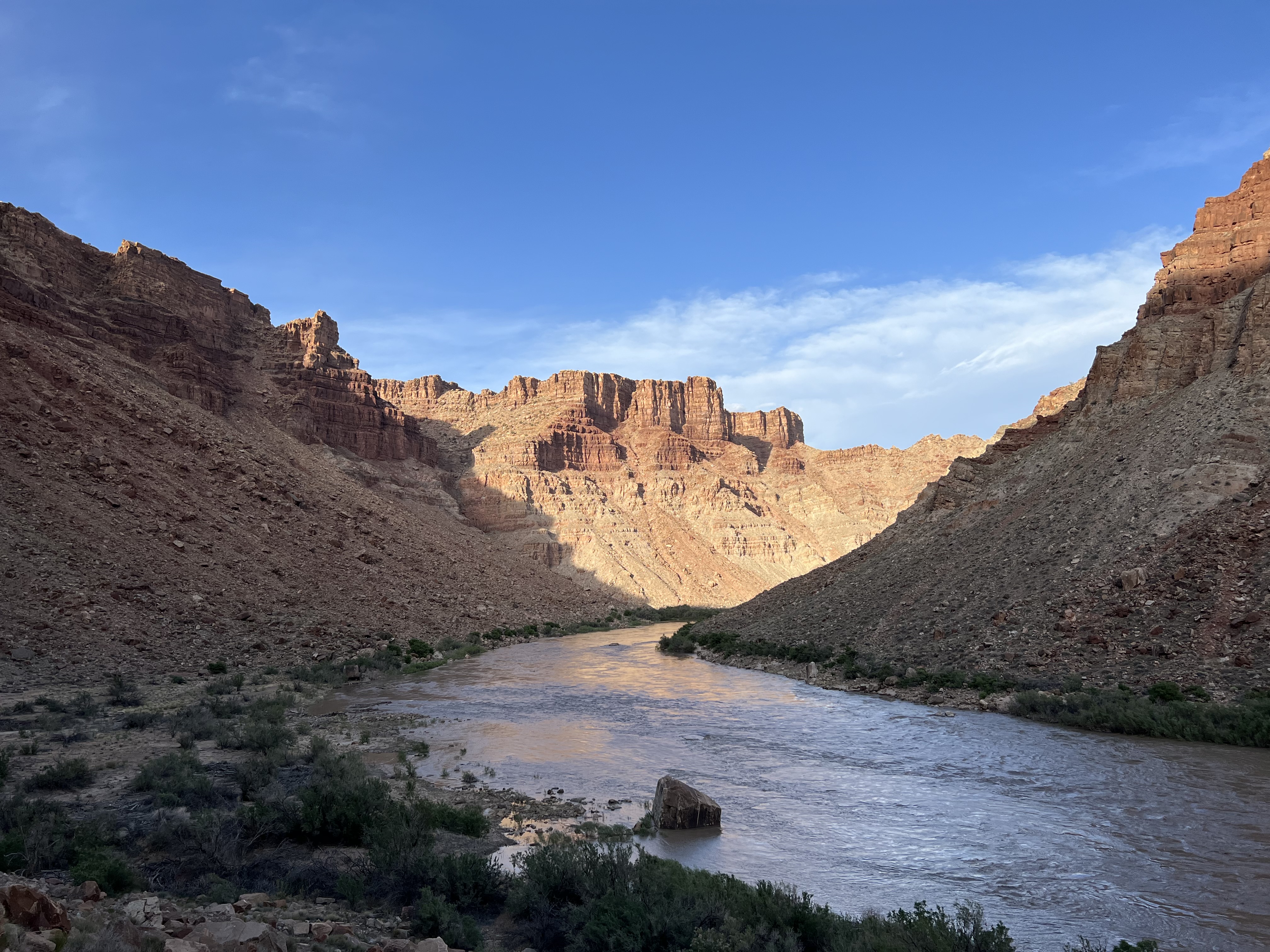
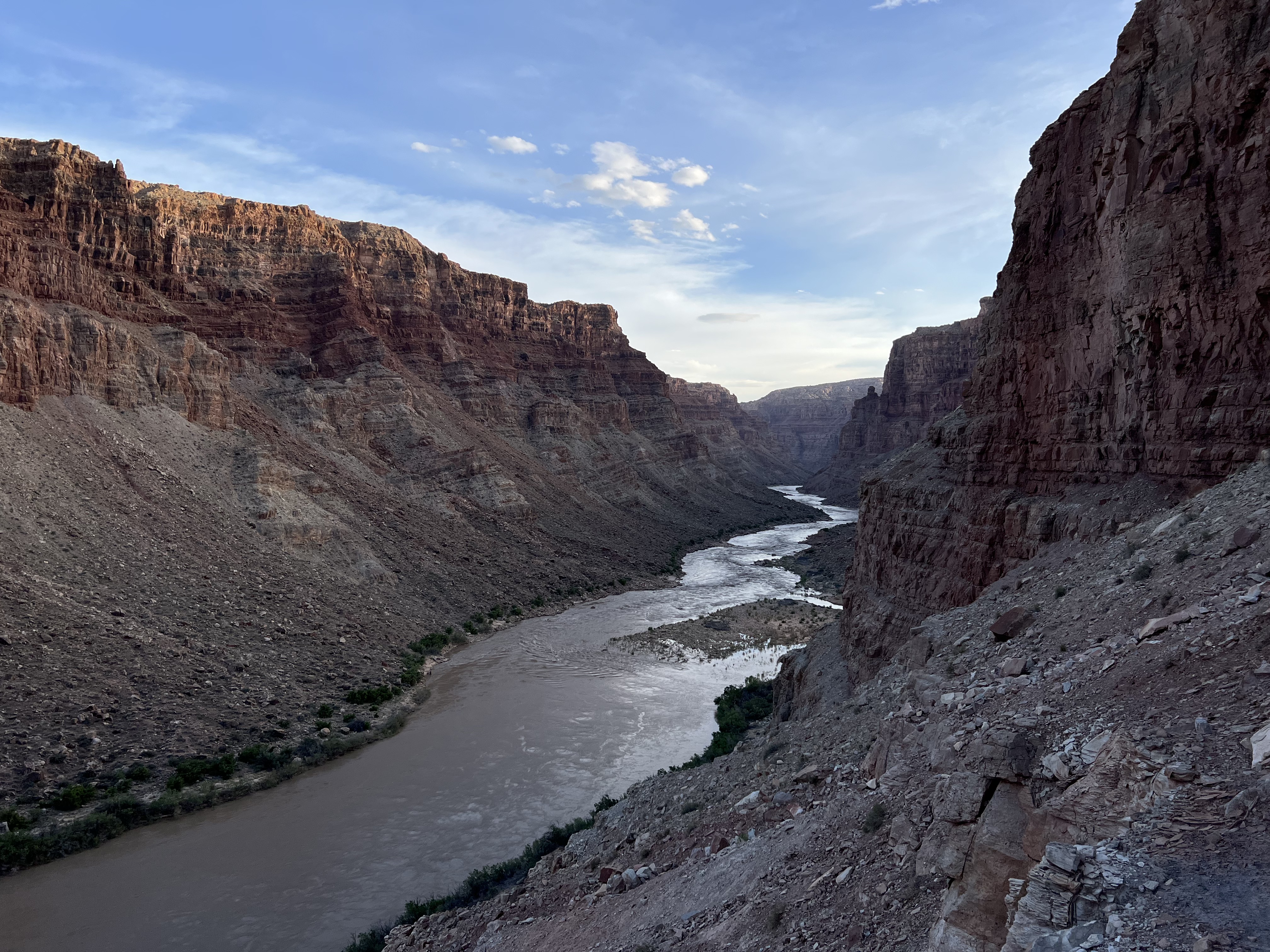
Two rivers merge beneath a billion years of rock. Then the canyon gets serious.
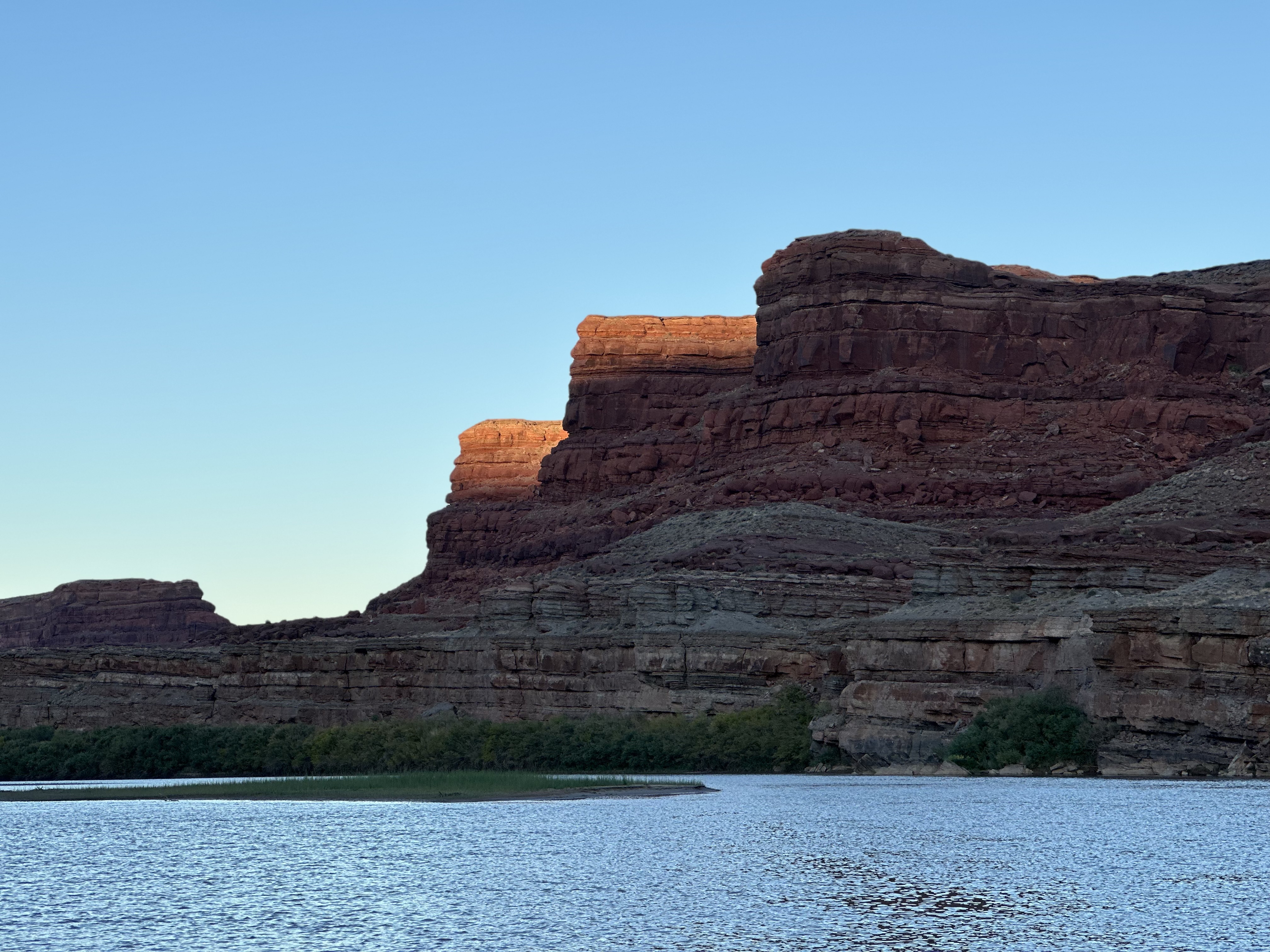
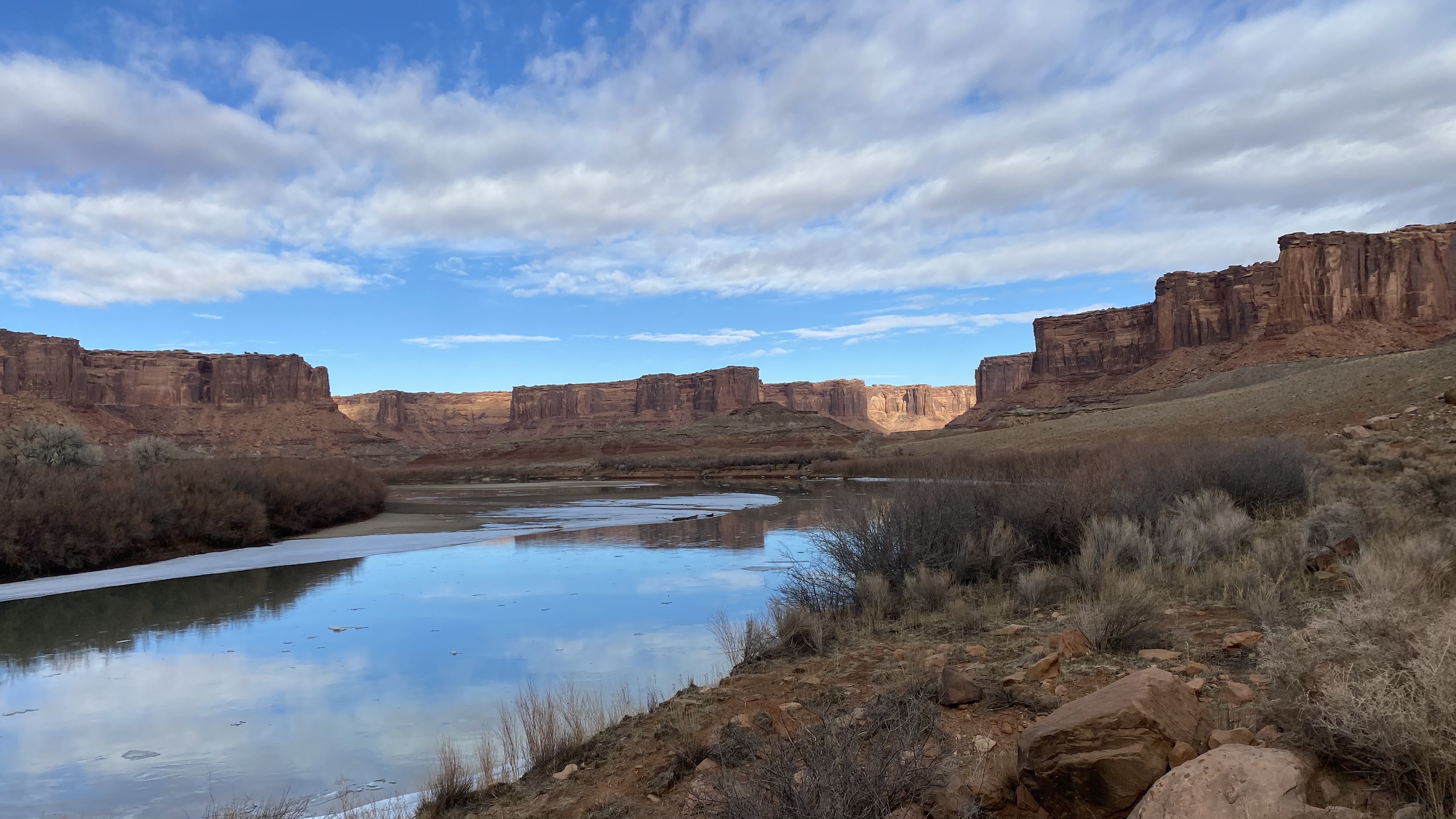
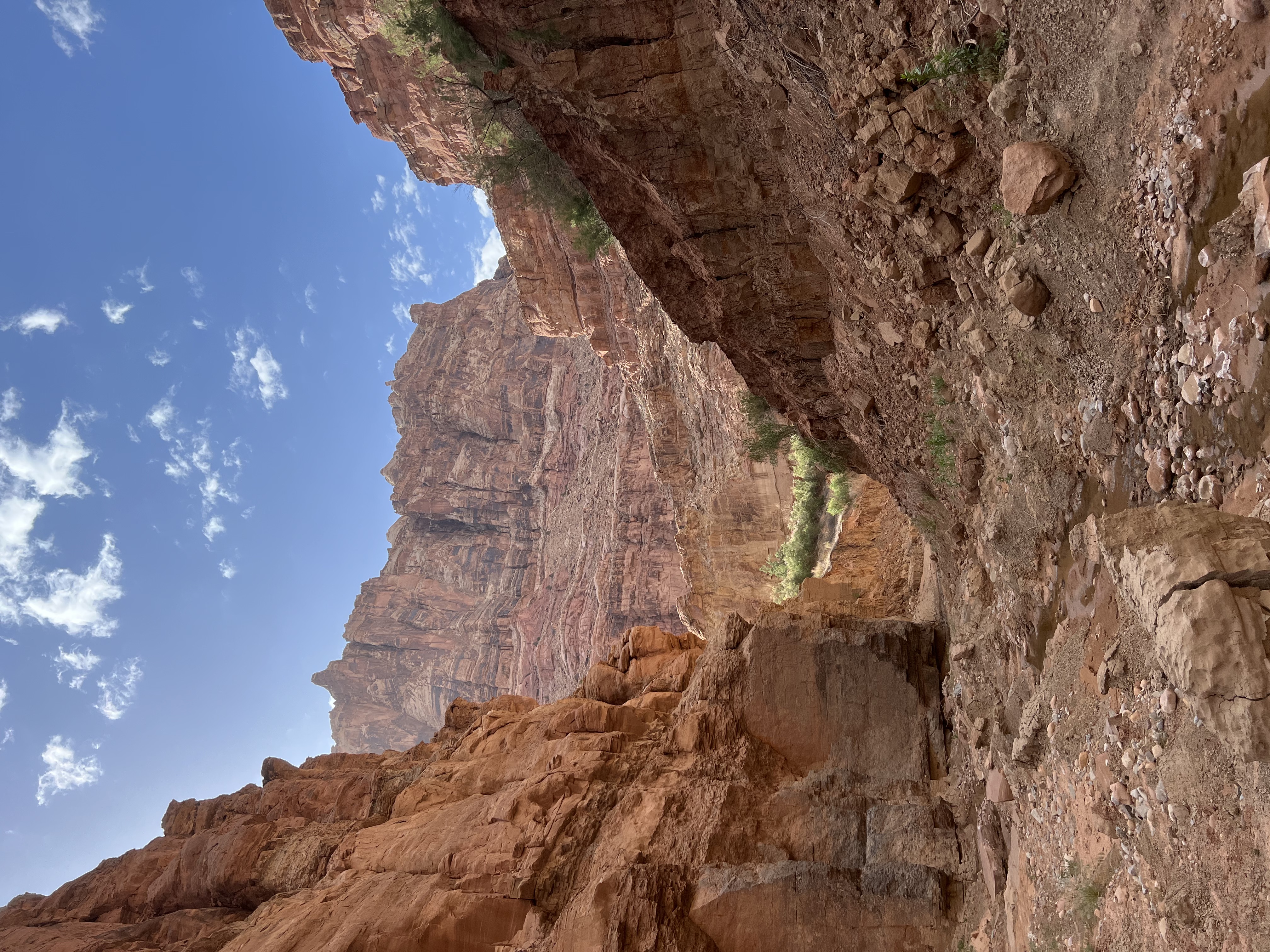
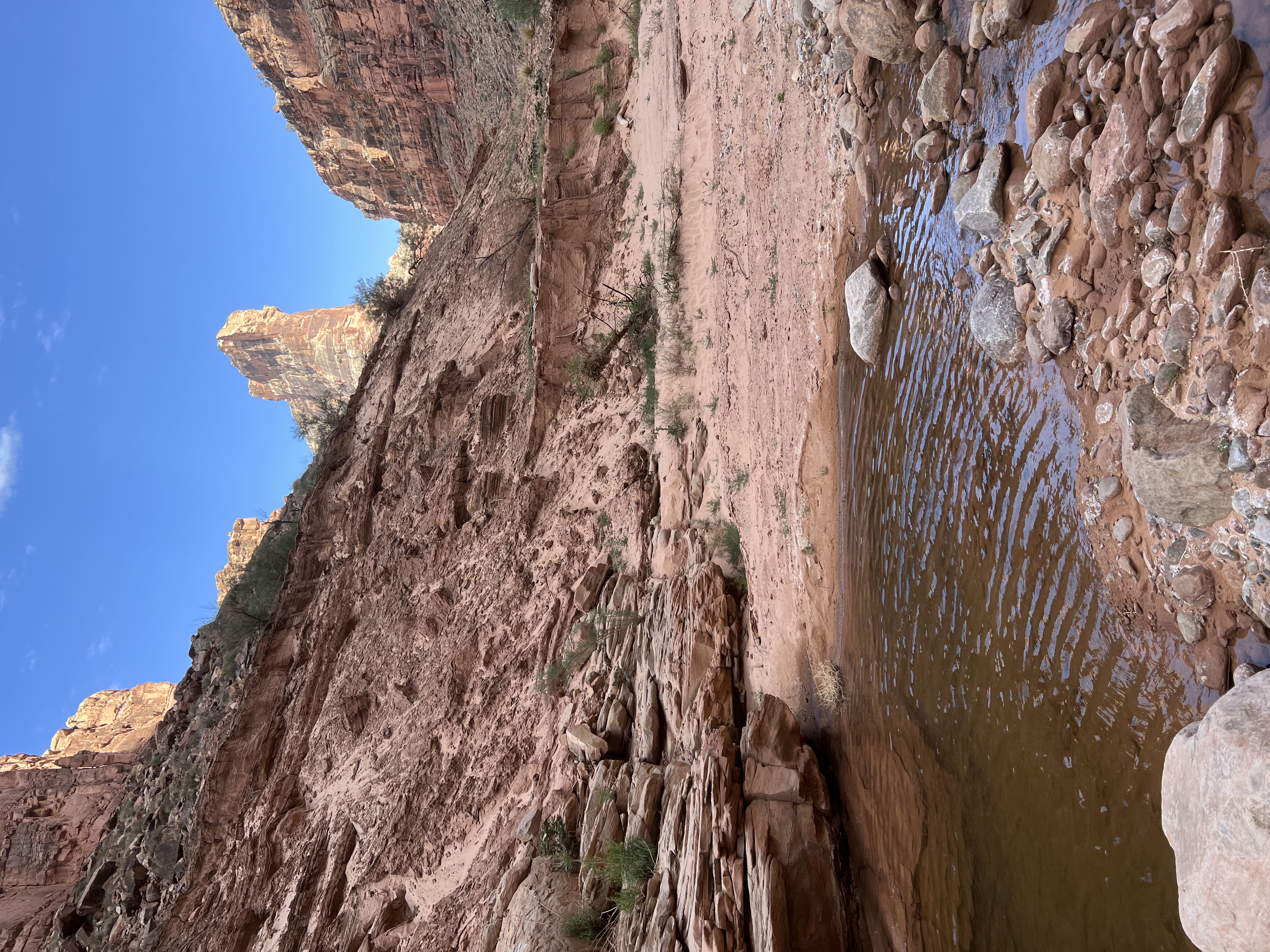
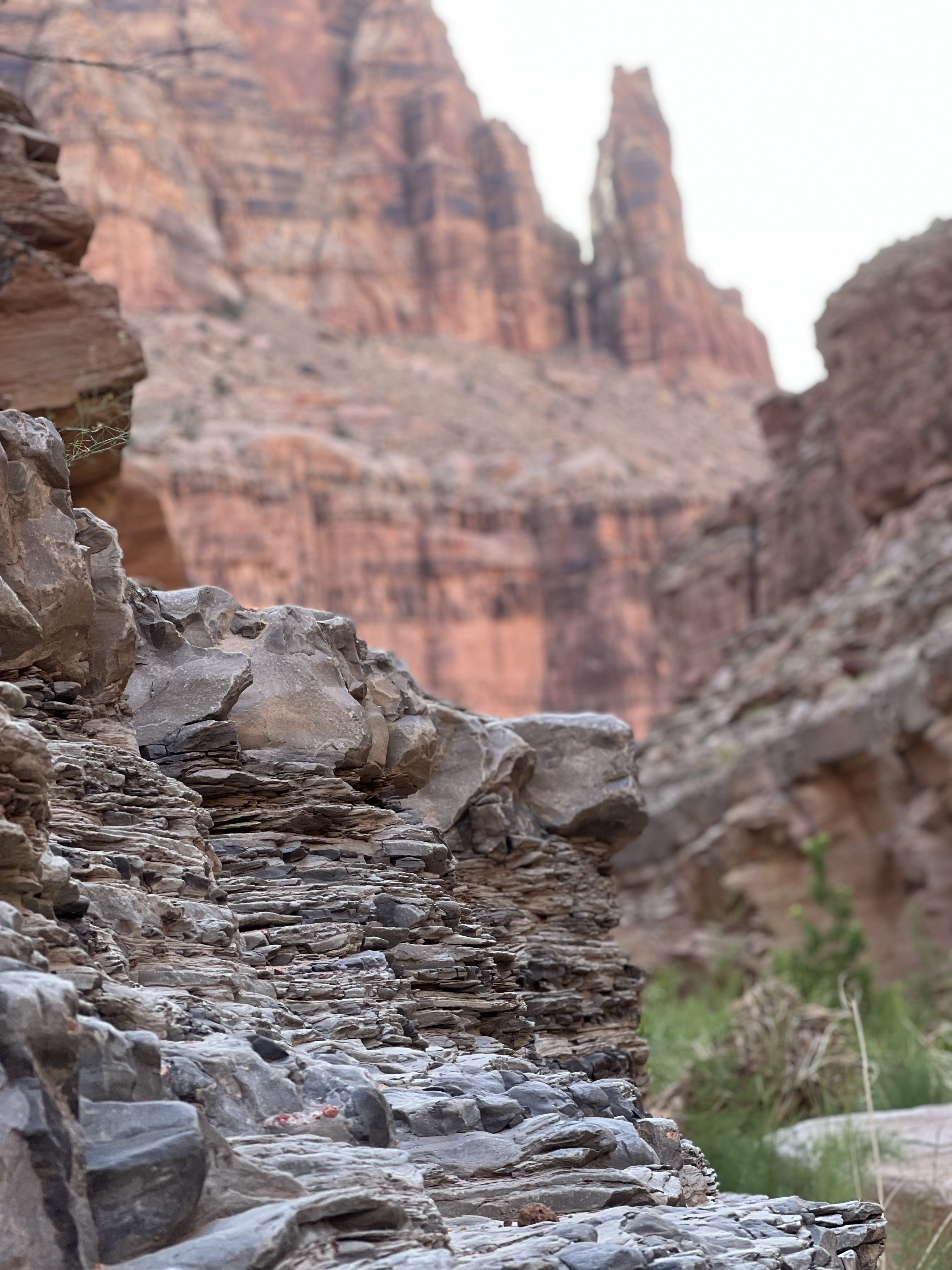
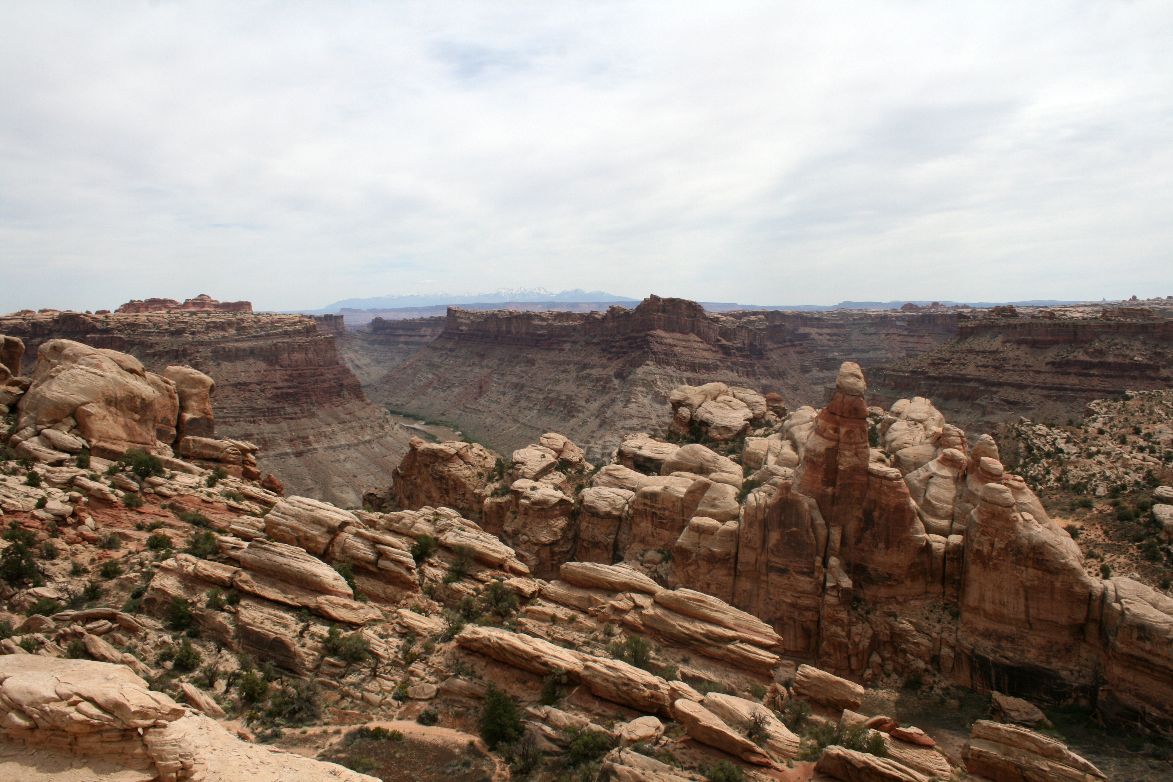
Cataract Canyon, Colorado River.
Cataract Canyon, Colorado River.
Cataract Canyon, Colorado River.
Cataract Canyon, Colorado River.
Cataract Canyon, Colorado River.
Cataract Canyon, Colorado River.

Cataract Canyon, Colorado River.
Cataract Canyon, Colorado River.
Cataract Canyon, Colorado River.
Cataract Canyon, Colorado River.
Cataract Canyon, Colorado River.
Cataract Canyon, Colorado River.

Cataract Canyon, Colorado River.
Cataract Canyon, Colorado River.
Cataract Canyon, Colorado River.
Cataract Canyon, Colorado River.
Cataract Canyon, Colorado River.

Cataract Canyon, Colorado River.
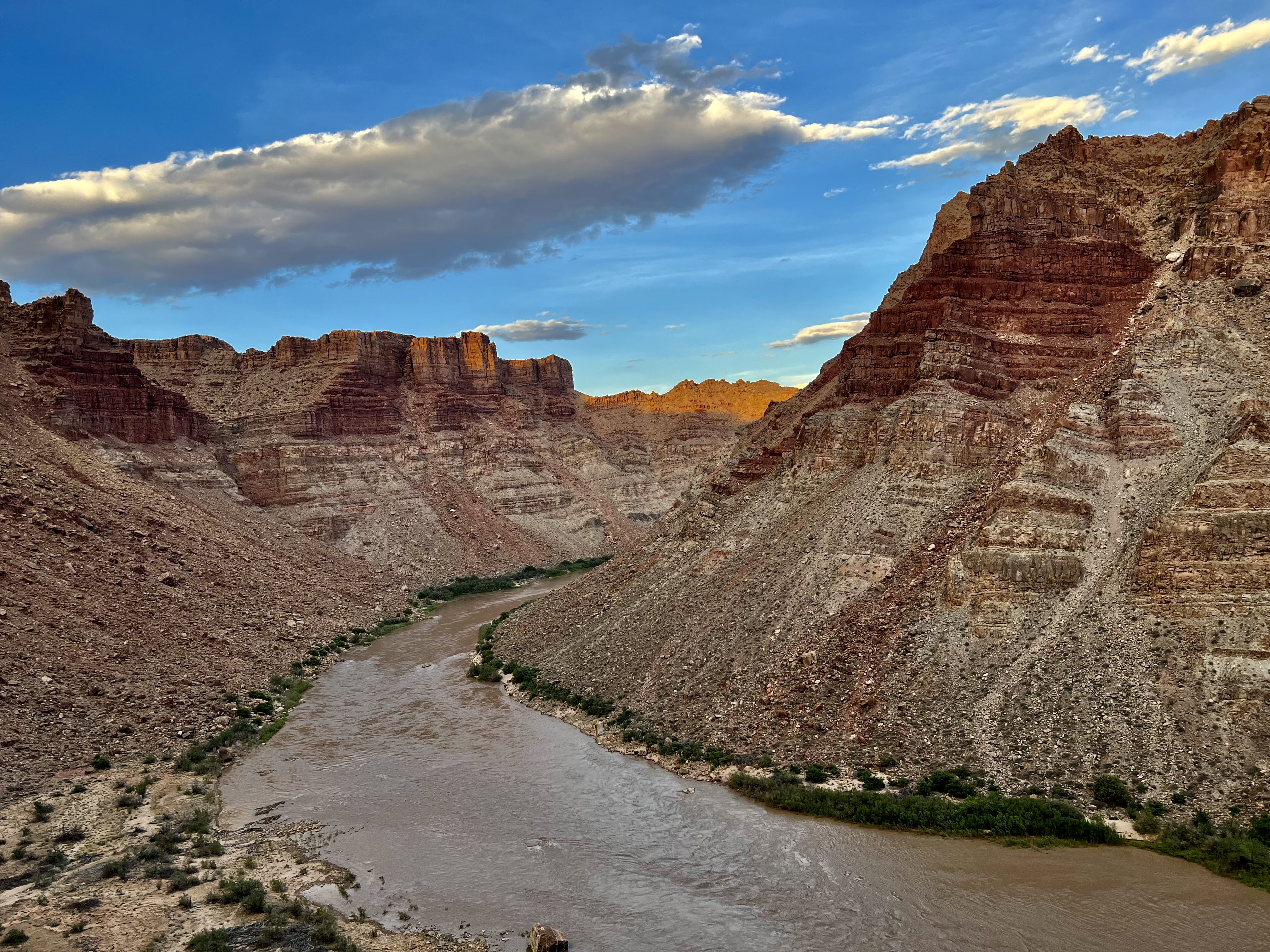
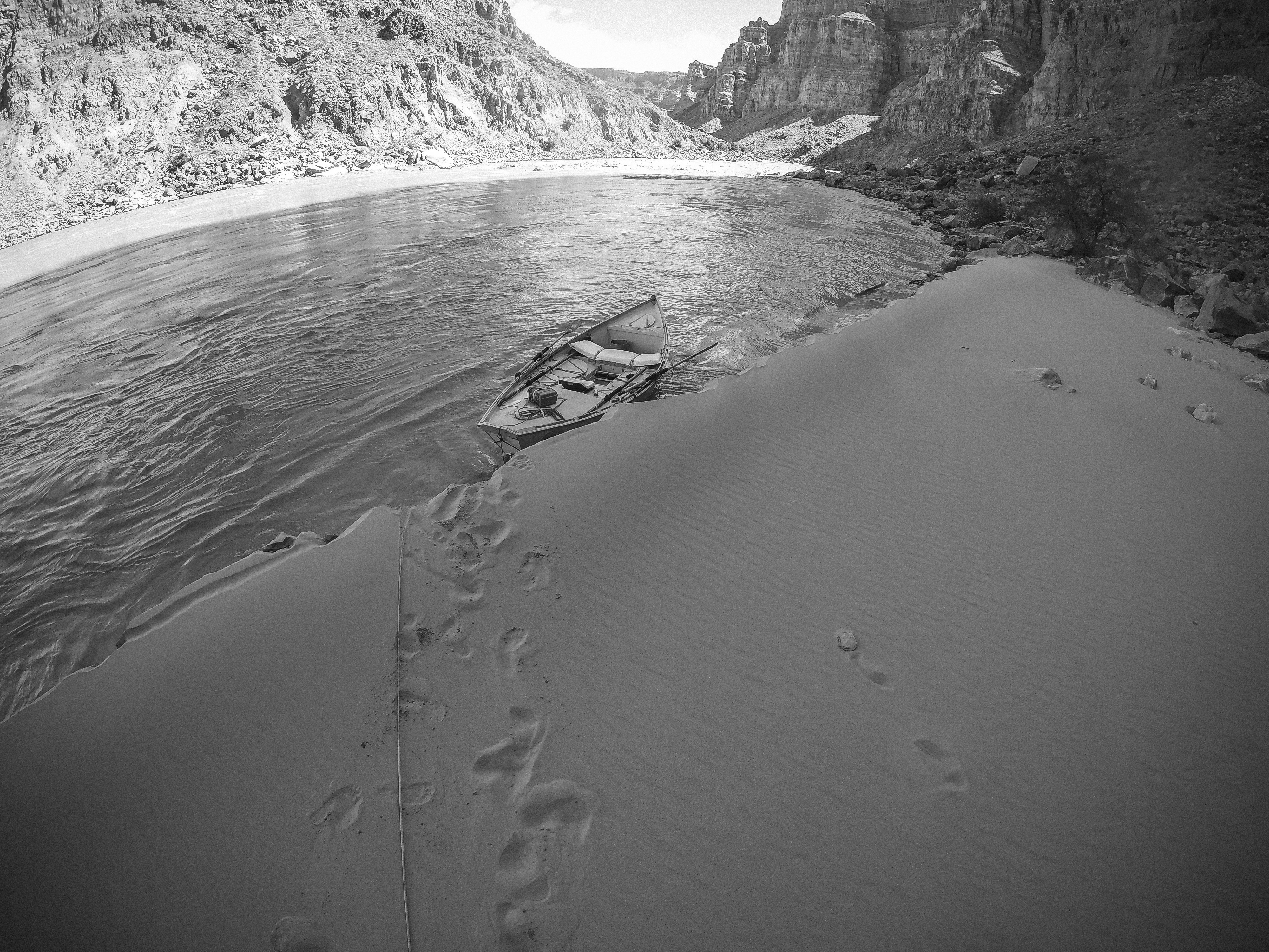
Cataract is two trips joined by a confluence. The first is a long, wind-bitten flatwater approach — forty miles of meander below Potash where the canyon walls climb and the current slows and you begin to understand that the Colorado takes its time before it gets violent. The second begins just past Spanish Bottom, where the Green River arrives from the north and the combined discharge enters a fourteen-mile rapid corridor that produces some of the largest standing waves on any commercially run river in North America. The Big Drops arrive in sequence — three of them in less than a mile — and at high water, the hydraulics aren’t puzzles to solve. They’re physics you survive. Below them, the canyon tells a different story: reservoir sedimentation, re-emerging rapids, and a take-out that shifts with Lake Powell’s elevation like a shoreline that can’t make up its mind.
Cataract Canyon begins where two rivers stop being separate. At the Confluence, the Green slides in from the north and doubles the Colorado’s volume in a quarter mile — and for the next fourteen miles, the combined river drops through a canyon it carved by being older than the mountains that tried to rise around it. The long flatwater approach from Potash teaches patience; the Big Drops teach physics. Below them, the lower canyon tells a more recent story — of reservoir sedimentation, re-emerging rapids, and a landscape still negotiating its relationship with Glen Canyon Dam. This is not a casual float. It is a committing, weather-exposed, logistically serious expedition through one of the most consequential stretches of whitewater in the American West.
Low-to-medium sandbar camp; a popular jet-boat pickup spot for trips ending their Stillwater run above Cataract.
A large white sign on river left marks entry into Cataract Canyon and serves as a courtesy campsite register — sign in as you pass.
River-right camp just above Spanish Bottom.
The Paradox Formation first appears at Colorado River mile 213.2 — the salt-bearing unit whose subsurface flow (salt tectonics) deforms the overlying Cataract strata.
Major landmark near the Confluence and Doll House access. Important layover, ranger, and route-logic node.
River-left beach camp in the upper rapid approach.
River-left camp just above Brown Betty (Rapid 1).
First named rapid for many Potash-origin trips after the long approach.
Large river-right beach below Brown Betty; good at all levels — a classic Cataract camp.
Unnamed upper Cataract read-and-run drop.
Fast-moving wave-train style rapid in the upper rapid corridor.
Unnamed upper Cataract rapid. Mile from Webb/Belnap/Weisheit.
Large beach below; wave-train drop.
River-right camp at all water levels with a great beach — don't miss the eddy.
Historical site of an early Powell-era Cataract boat-wrecking incident per Webb/Belnap/Weisheit.
Rapid 7 reads as a tidy S-turn at low water — but let the river rise and its lower half erupts into the North Sea: a boulder-strewn Toreva-block maelstrom of waves that break back upstream and stack into walls of muddy water. Flip here when it is big and your boat may not stop until North Wash, with or without you. Sneak the breakers on the left, or charge the middle and find out why they named a rapid after an ocean. (The guidebook uses “North Sea,” singular, for this specific feature — not the larger composite.)
Between North Sea (209.5) and Rapid 9 (208.7).
In the Tilted Park reach; dipping strata visible from river level.
River-right camp at Colorado River mile 208.5, in the X-Y reach of Cataract Canyon.
River-right camp at Colorado River mile 208.4, in the X-Y reach of Cataract Canyon.
In the Tilted Park reach.
River-right camp at Colorado River mile 208.3, in the X-Y reach of Cataract Canyon.
Pairs with Rapid 12 immediately below.
Last rapid before Mile Long begins at Rapid 13.
A Cataract Canyon camp at the mouth of Range Canyon, paired with a scree-hill scout perch overlooking Mile Long and the Button Hole.
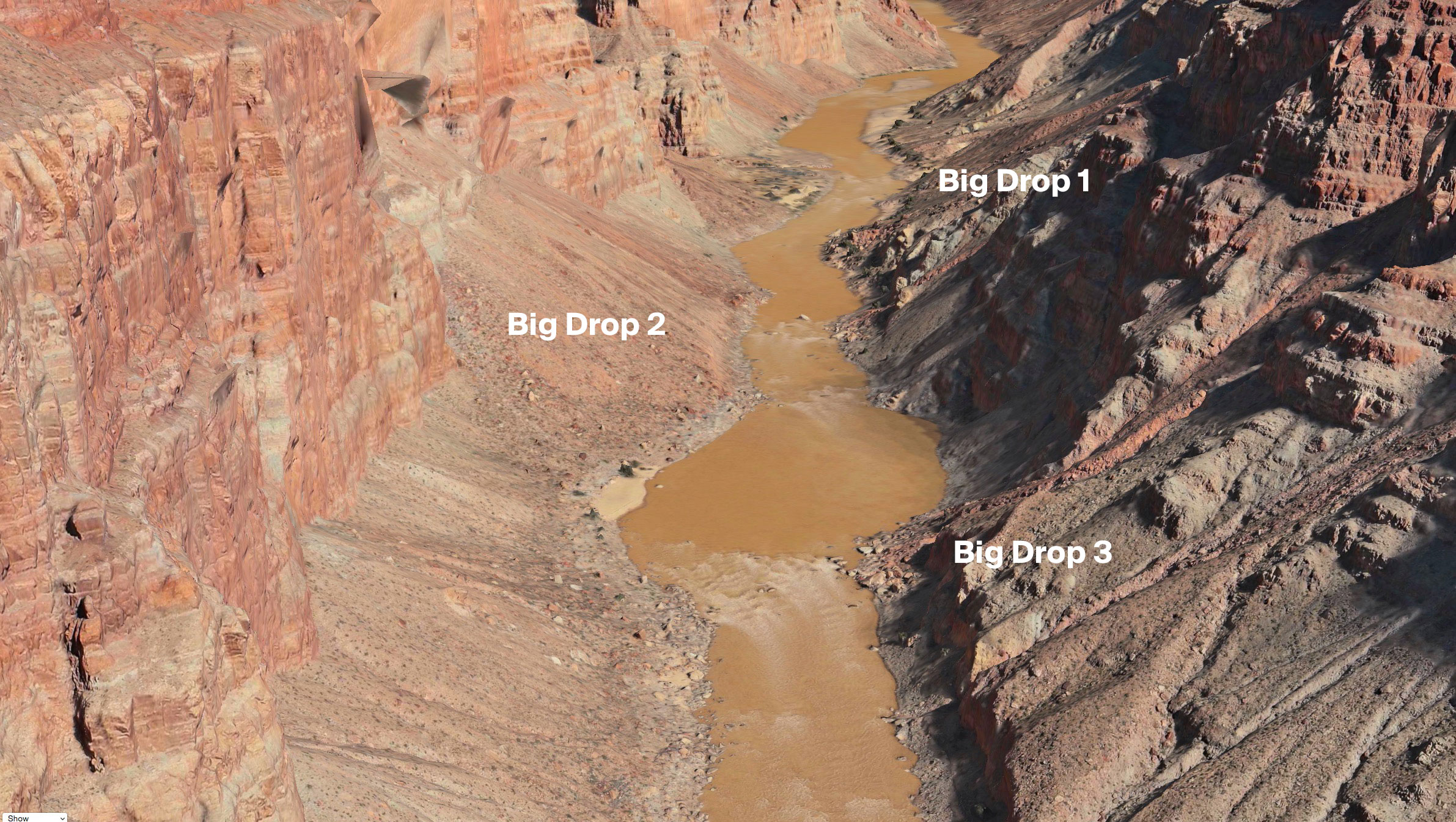
Rapid 13 is the upstream end of the Mile Long sequence — the rapid created by the Range Canyon debris-flow outwash entering the Colorado on river-right. The character of the rapid is directly shaped by boulders delivered from the Range Canyon drainage during flash floods. Immediately below Range Canyon Camp, which is the common staging camp for parties scouting Mile Long from the scree-hill perch above. Range Canyon debris-flow outwash is the sediment-science story here: flash floods from Range Canyon deposit boulders and cobbles onto the river, and the Green-Colorado combined discharge works those boulders through the channel creating the Rapid 13 drop. It is a live debris-fan rapid whose character can shift significantly after major Range Canyon flash-flood events.
Rapid 14 is the second rapid within the Mile Long sequence — the last drop before Capsize (Rapid 15). At moderate flows there is a commonly-used scouting eddy between Rapid 14 and Capsize where groups can land to look at the technical crux. At high water that eddy flushes out and the sequence becomes committed from Rapid 13. The scouting eddy between Rapid 14 and Capsize (Rapid 15) is one of the most important flow-dependent features in Cataract — available at moderate flows, unavailable at high water when the sequence must be committed from Rapid 13 through the island at Rapid 20.
Mile Long's technical crux. Scouted by most groups.
Rapid 16 is the first rapid within the South Seas core of Mile Long. At moderate flows it runs as a distinct wave-train drop after Capsize; at high water it becomes the upstream end of the continuous South Seas sequence (Rapids 16–19). At moderate flows, Rapid 16 runs as a distinct drop below Capsize with recovery water below. At high water it's the upstream entry to the South Seas wave-train core (Rapids 16-19) and Mile Long's character becomes one continuous push.
Rapid 17 is the second rapid within the South Seas core, sitting immediately above Button Hole (Rapid 18). At high water it is part of the continuous South Seas wave train. Middle of the South Seas core. Limited downstream recovery before Button Hole (Rapid 18); positioning matters for parties setting up the Button Hole line.
Button Hole lateral river-right; standard line is river-left. Most powerful at ~28,000 cfs per Webb/Belnap/Weisheit.
Rapid 19 is the lower end of the South Seas core and the final rapid of the Mile Long sequence at moderate flows. At lower water, Mile Long ends here and Ben Hurt (Rapid 20) stands as a distinct rapid below. At high water, Rapid 19 is the downstream end of the continuous South Seas wave train which merges into Ben Hurt and extends Mile Long through Rapid 20 to the island. Exit of the South Seas and terminus of Mile Long at lower flows. At high water, R19 continues directly into Ben Hurt (R20) and the sequence runs as one continuous wave train from Rapid 13.
Island Rapid. Final warm-up before the Big Drops at moderate flow; folds into Mile Long at high water.

Kolb Rapid.

Features: Marker Rock, Little Niagara, Fang Rocks, Ledge Wave, Red Wall, Window.
River-right camp between Big Drop 2 and Big Drop 3.
Satan's Gut / Ross Falls. Features: Frogg's Hole, Big Bertha/Brahma, Big Mossy, Table Rock.
First rapid below the Big Drops. Named for a pocket watch lost during Powell's 1869 expedition.
River-right camp just below the Big Drops, near Rapid 24.
Class III- wave-train drop below the Big Drops — the second of three recovery rapids, with Rapid 26 right below it.
River-left camp at the foot of the Mile Long sequence, near Rapid 25.
Ten Cent Camp sits on river-left immediately below.
River-left camp in the Ten Cent reach below the Big Drops; named by Don Harris (1952).
River-left camp in the Ten Cent reach, just downstream of Upper Ten Cent.
Largest rapid below the Big Drops. Previously numbered Rapid 25 in older guides before Repeat/Rerun were recognized.
River-right camp at the mouth of Imperial Canyon.
River-left camp at Imperial Canyon.
Re-emerged rapid documented by Returning Rapids Project at ~river mile 200. Visible since 2002-2003 drought dropped Lake Powell.
River-right camp just above Waterhole Rapid (Rapid 29).
Re-emerged debris-fan rapid at the mouth of Waterhole Canyon. Photographed by Returning Rapids Project at 6,500 cfs.
Historically submerged under Lake Powell, re-emerging as reservoir levels drop. Character varies with reservoir state. Returning Rapids Project is the current authoritative source.
River-left camp at the mouth of Gypsum Canyon below Gypsum Rapid; a side-canyon hike departs from here.
River-right side canyon at mile 191.9 in lower Cataract Canyon.

Useful lower-canyon camp area for parties exploring the re-emergent lower section and Dark Canyon vicinity when conditions allow.
Field-memory moments that define this run.
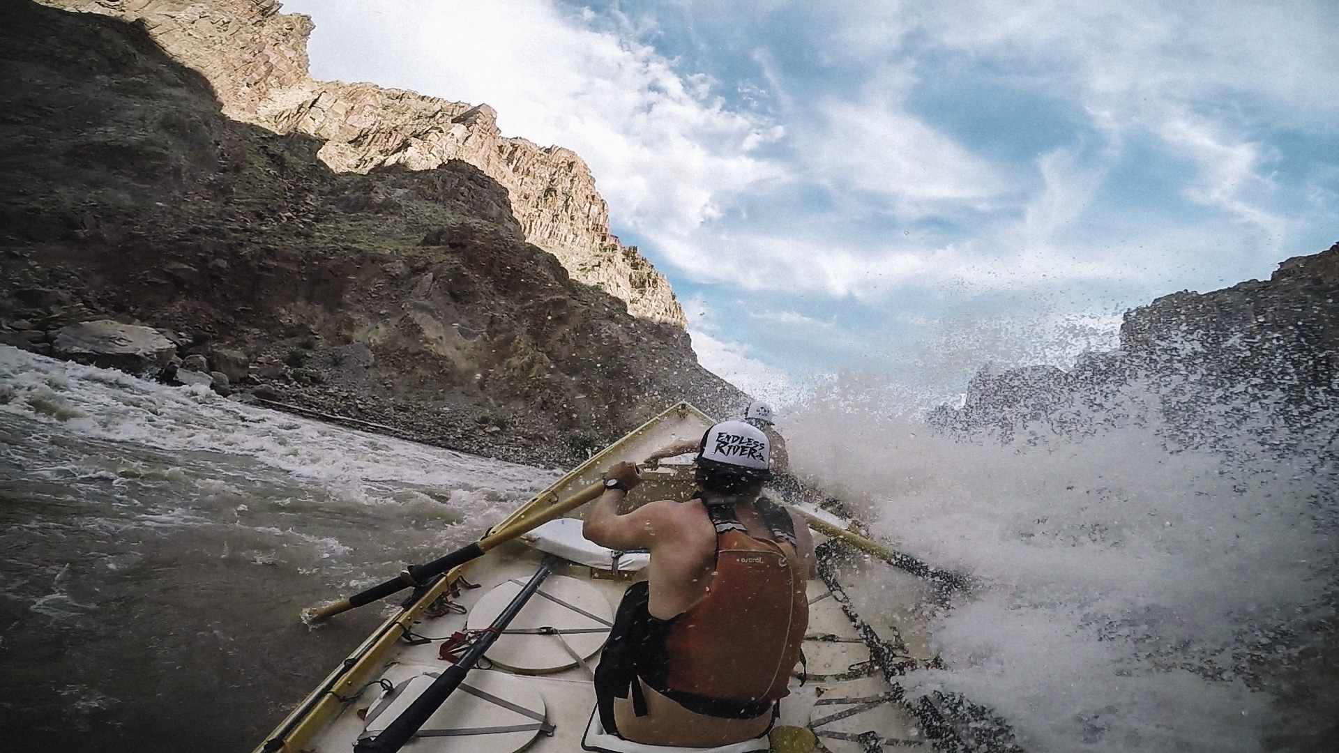
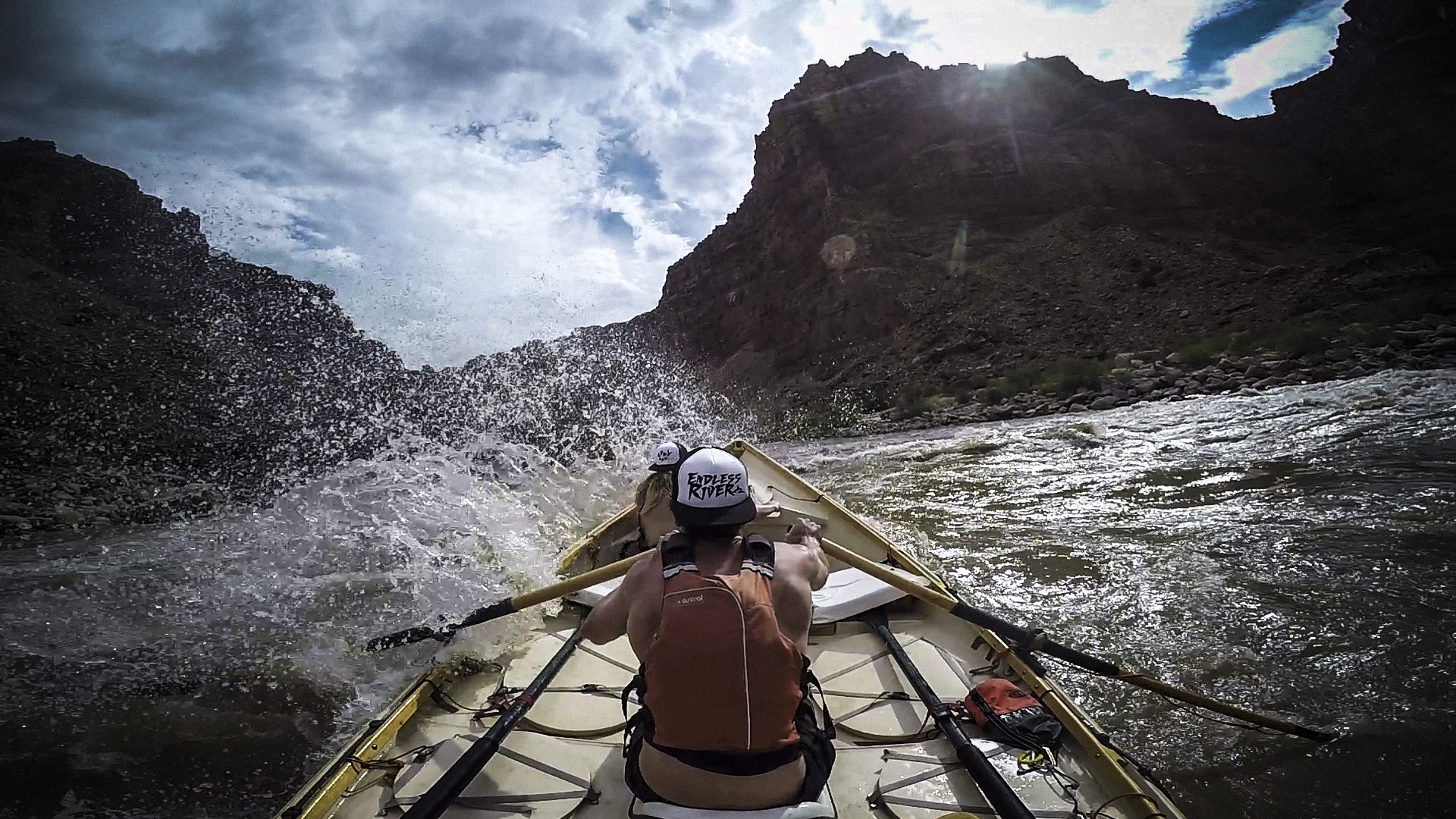
Big Drop 2 at high water is the moment when the river stops offering suggestions and starts issuing terms. The line is still readable, but the scale has changed: waves are taller, recovery is shorter, and every casual decision made upstream arrives at once with a clipboard and a legal department.
A named line at a specific flow becomes more than a move; it becomes a referendum on judgment. At this level the river is no longer theoretical and every correction arrives late.
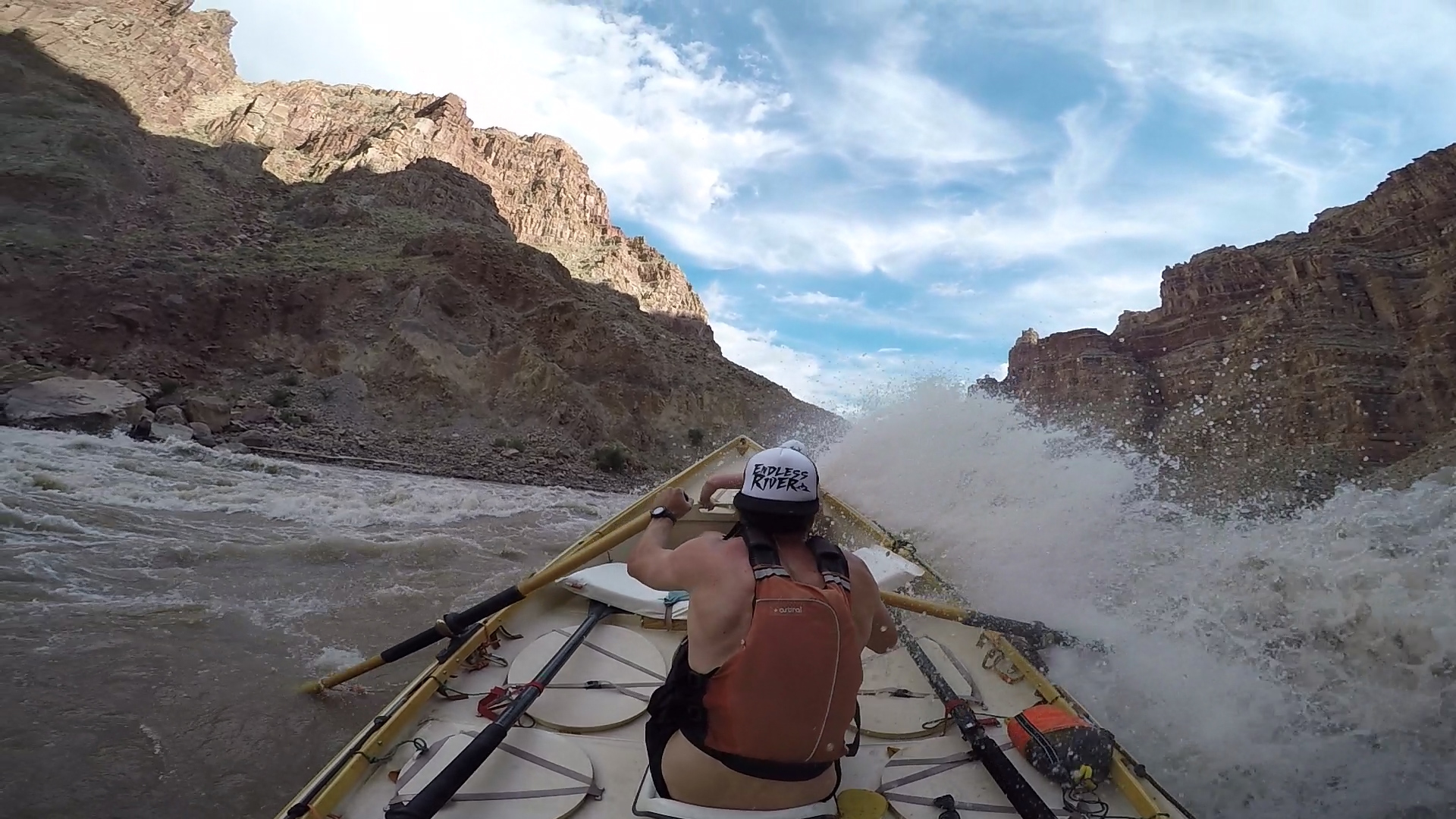
The Big Drops in Cataract Canyon are the moment the trip stops being scenic river travel and becomes a negotiation with scale. The approach is designed to make a reader feel the weight of the place—intimidated, alert, a little afraid—before revealing that passage is possible when fear is converted into clean angle, timing, rigging, and trust.
A high-consequence precision move through a tightening slot in big water, where the line appears late, the boat is already committed, and the margin between clean passage and full river possession is measured in one oar stroke.
A boat goes too far left, corkscrews in the ledge wave, and puts people in the water in a big rapid — and the trip becomes, for a few loud minutes, entirely about the person downstream with a throw bag and the discipline of everyone who set safety before the run.
The river simplifies itself into one impossible instruction: miss the single large boulder. Then the boulder begins behaving like it has legal custody of the boat, drawing the bow closer and closer until the raft folds around it in a spectacular river taco and the crew is promoted, against their will, to the unpinning department.
In Cataract Canyon at big water, Purgatory is the unstable pause between Big Drop 2 and Big Drop 3: a gurgling, swirling, never-ending eddy that pretends to be a recovery zone while quietly deciding how it will spit the boat into the next consequence.
A pinned boat or trapped load turns the riverbank into a wet, slippery rescue workshop: static rope, pulleys, prusiks, slings, anchors, commands, and nervous jokes all trying to become one clean system. It looks like chaos until the rigging starts to make sense, and then everyone understands that rescue is not a heroic moment so much as a careful orchestration performed with cold hands and elevated heart rates.
At high spring runoff in Cataract Canyon, the captain may issue an instruction that sounds like a nervous breakdown disguised as seamanship: empty the ammo cans and coolers, then fill them with sand. It is absurd, sacrificial, confusingly serious, and sometimes exactly the kind of ballast that keeps a lightly loaded boat from standing on end when the canyon is full of moving architecture.
At the bottom of the runnable range, the Big Drops stop being a big-water problem and become a rock problem — and in a rigid dory, where hesitation costs a high side and even a clean line can end in a hull-cracking rock hit, low water turns out to be its own kind of hazard.
The failure modes and consequences that recur on this run, drawn from the field archive. Judgment and preparation, not fear.
What goes wrong
Consequence
What goes wrong
Consequence
What goes wrong
Consequence
What goes wrong
Consequence
What goes wrong
Consequence
What goes wrong
Consequence
Runoff is the variable that makes Cataract a different river from month to month. The flow that reaches the whitewater is the Colorado at Potash plus the Green at Mineral Bottom, summed — two launch-zone gauges roughly fifty river miles above the Big Drops. Below the canyon, the Gypsum Canyon gauge reads that combined discharge on a single dial, a cleaner vantage on what actually ran. Either way, the range is enormous. At 4,000 cfs the rapids are technical and rocky, line-dependent, slower than you’d expect. At 25,000 the same features become powerful, pushy wave trains with real lateral force. Above 40,000 the canyon transforms into a true big-water venue: massive holes, breaking laterals, exploding pillow waves, and recovery windows measured in seconds. The same rapid that felt manageable last week can flip a fully loaded eighteen-foot raft this week. That’s not hyperbole. That’s what stream power means when sediment load, channel constriction, and gradient conspire in a confined space.
USGS gauge measuring discharge and gage height on the Colorado River at Potash, UT — downstream of the Moab valley and upstream of the Confluence. Reads the Colorado’s contribution at the Potash put-in; sum it with the Green at Mineral Bottom for the combined flow that reaches Cataract Canyon.
Launch-day Colorado-side reading at the Potash put-in. Sum with Mineral Bottom for the combined flow that reaches the Big Drops.
USGS gauge measuring discharge and gage height on the Green River at Mineral Bottom, near the Canyonlands National Park boundary. Sits at the take-out for Labyrinth Canyon and the put-in for Stillwater Canyon — the Green-side launch point for Cataract Canyon trips. Reads the Green's contribution to the Confluence at the actual put-in.
Launch-day Green-side reading at the Mineral Bottom put-in. Sum with Potash for the combined flow that reaches the Big Drops.
USGS gauge measuring discharge on the Colorado River at the mouth of Gypsum Canyon, near Hite — below the Big Drops sequence and in the reservoir-influenced lower miles of Cataract Canyon. Reads the combined Colorado + Green flow after the Confluence and after the Cataract whitewater corridor.
Post-Big-Drops single-gauge reading of the combined Confluence flow. Useful for take-out conditions at Hite / North Wash and for tracking reservoir-effect changes as Lake Powell rises and falls. Thinner historical data than the upstream gauges (newer station).
Cataract has two operational gauge layers. **Launch-day combined flow (what's actually in the canyon):** Potash + Mineral Bottom, summed — these sit at the two put-ins above the Confluence; their sum is what reaches the Big Drops. **Post-Big-Drops (what's running through the lower canyon):** Gypsum Canyon, a single gauge below the Big Drops; reads the combined flow naturally but has thinner historical data. The Recommended Flow Ranges chart below uses the combined Potash + Mineral Bottom reading. For multi-day forecasting (what's coming downstream), see the upstream gauges on the Colorado and Green River overview pages.
Lower flows generally create more exposed rock, more technical line choice, slower travel, and more scouting emphasis at named rapids. Consequence remains high even when overall wave size is reduced.
Medium flows often deliver the classic Cataract mix: powerful but readable wave trains, major reaction time demands, and significant but manageable consequence for well-rigged expert groups.
High water transforms the canyon into a true big-water venue with massive laterals, breaking waves, exploding holes, fewer recovery opportunities, and rapidly compounding consequences through the Big Drops and downstream wave trains.
Water can be deceptively cold in spring runoff. Even in warm weather, swims are serious because of distance, force, and the remoteness of the canyon.
Best known for late-spring and early-summer snowmelt, with character shifting from rocky low-water whitewater to large, dynamic big-water conditions.
Combined Potash + Mineral Bottom reading — the two launch-zone gauges, summed. Equivalent post-Big-Drops reading available on the Gypsum Canyon gauge, which has thinner historical data.
Class III character with technical, rocky lines through the Big Drops. Pool-drop sequencing dominates; the long flatwater approach drags. Best for boulder-garden navigation and skill development.
The sweet spot for experienced self-guided crews. Big Drops are powerful but scout-and-run with clean lines. Sandy beaches above water; hydraulics are well-defined and readable.
Big-water Class IV. Hydraulics intensify, the sequence feels compressed, and pool recovery shrinks. Rewarding for crews with prior big-water experience; not a first run. (Class V territory begins at flood-stage flows above ~50,000 cfs.)
Pools start to wash out and beaches flood. Of the big water levels, this flow band is the most washed out. Now, North Seas & South Seas are starting 10-15', the Claw in Big Drop 2 is the major gotcha, Button Hole is washed. As always Rig to flip.
Most beaches are gone. North Seas, Mile Long South Seas top out around 20' and the Big Drops are in full flex. Expedition-grade above 50,000 cfs — commercial outfits shift tactics or cancel; private trips at that level only with a deep big-water experience.
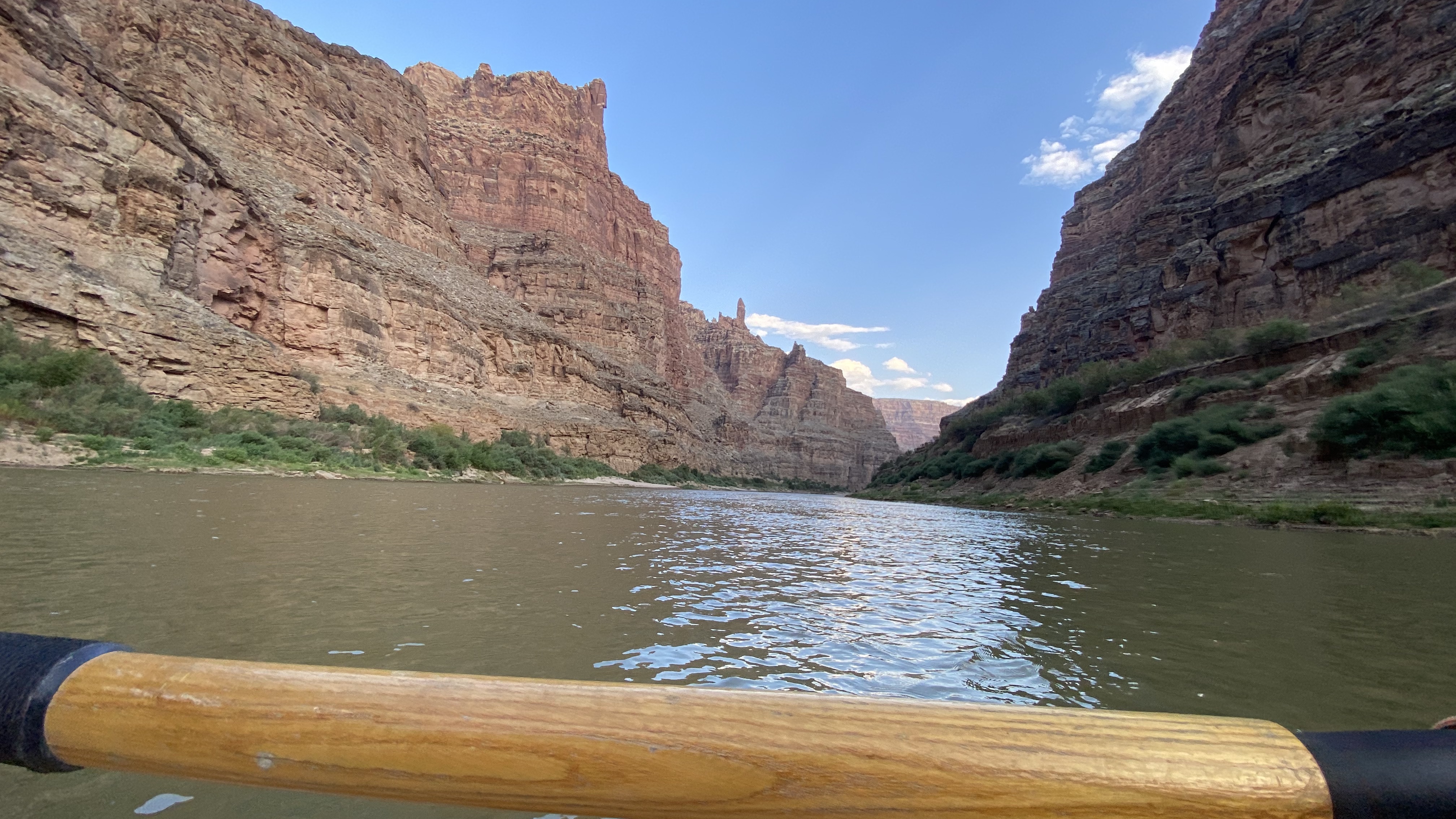
You are floating through the autobiography of the Colorado Plateau. The canyon exposes a stratigraphic column that begins with Pennsylvanian-age Honaker Trail Formation — marine limestones laid down 300 million years ago when this desert was a shallow sea — and rises through the Lower Cutler beds, the Moenkopi, the Chinle, and into the great Mesozoic sandstone sequence that gives Canyonlands its architecture. The rapids themselves are geological events: debris fans delivered from tributary canyons, constriction points where resistant rock units narrow the channel, and boulder fields created by canyon-wall collapse. At the Confluence, you can see the structural story clearly — the Meander Anticline flexing the Honaker Trail beds, salt tectonics from the Paradox Basin deforming rock that was deposited before the first dinosaur walked. The river is older than the uplift. It carved downward as the plateau rose, maintaining its course through sheer persistence — what geologists call antecedent drainage. The canyon is the proof.
The canyon is a cross-section through 300 million years of deposition, uplift, and erosion. At river level, the Honaker Trail Formation records a Pennsylvanian-age shallow sea; above it, the Lower Cutler beds mark the transition to terrestrial red-bed deposition as the sea retreated. The Moenkopi, Chinle, and the great Mesozoic eolian sandstones — Wingate, Kayenta, Navajo — build the skyline. Rapids form where tributary debris fans constrict the channel, where resistant rock units create gradient breaks, and where canyon-wall collapse delivers boulders faster than the river can move them. The Meander Anticline near the Confluence exposes Paradox Basin salt tectonics — subsurface salt movement that has been deforming overlying strata since the Permian. The river itself is an antecedent stream: it established its course before the Laramide orogeny lifted the plateau, and carved downward as the land rose around it. The canyon is the evidence of that persistence.
The canyon is a cross-section through 300 million years of deposition, uplift, and erosion. At river level, the Honaker Trail Formation records a Pennsylvanian-age shallow sea; above it, the Lower Cutler beds mark the transition to terrestrial red-bed deposition as the sea retreated. The Moenkopi, Chinle, and the great Mesozoic eolian sandstones — Wingate, Kayenta, Navajo — build the skyline. Rapids form where tributary debris fans constrict the channel, where resistant rock units create gradient breaks, and where canyon-wall collapse delivers boulders faster than the river can move them. The Meander Anticline near the Confluence exposes Paradox Basin salt tectonics — subsurface salt movement that has been deforming overlying strata since the Permian. The river itself is an antecedent stream: it established its course before the Laramide orogeny lifted the plateau, and carved downward as the land rose around it. The canyon is the evidence of that persistence.
The riparian corridor here is a biological thread through otherwise bare rock. Tamarisk and willow crowd the banks where sediment has accumulated; cottonwood groves mark the rare points where groundwater reaches the surface. Side canyons concentrate the life — seep-fed hanging gardens, maidenhair fern clinging to alcove walls, desert varnish streaking the Wingate above. Bighorn sheep work the ledges and talus. Golden eagles and peregrines hunt the thermals. Great blue herons stand in the shallows below camp, unbothered. But the ecology is also a story about disturbance. Tamarisk is invasive and persistent. Flash floods reshape beach habitat on a storm-by-storm basis. The dam upstream altered the river’s sediment regime — the pre-dam Colorado carried 380,000 tons of sediment per day past this point; the post-dam river carries a fraction of that. Camps that existed before Lake Powell’s maximum pool were buried. Some are re-emerging now. The humpback chub — endemic to the Colorado system, adapted to the warm, silty, violent river that no longer exists — persists here in one of its last remaining strongholds.
The riparian corridor here is a biological thread through otherwise bare rock. Tamarisk and willow crowd the banks where sediment has accumulated; cottonwood groves mark the rare points where groundwater reaches the surface. Side canyons concentrate the life — seep-fed hanging gardens, maidenhair fern clinging to alcove walls, desert varnish streaking the Wingate above. Bighorn sheep work the ledges and talus. Golden eagles and peregrines hunt the thermals. Great blue herons stand in the shallows below camp, unbothered. But the ecology is also a story about disturbance. Tamarisk is invasive and persistent. Flash floods reshape beach habitat on a storm-by-storm basis. The dam upstream altered the river’s sediment regime — the pre-dam Colorado carried 380,000 tons of sediment per day past this point; the post-dam river carries a fraction of that. Camps that existed before Lake Powell’s maximum pool were buried. Some are re-emerging now. The humpback chub — endemic to the Colorado system, adapted to the warm, silty, violent river that no longer exists — persists here in one of its last remaining strongholds.
People have been in this canyon for more than ten thousand years. Ancestral Puebloan granaries and rock art mark the alcoves. Fremont-culture sites appear in the side canyons. Ute and Paiute peoples — whose cultural continuity with earlier inhabitants is documented but often overlooked — used the river corridor seasonally and knew it intimately long before Powell arrived in 1869 half-starved and terrified, gave the rapids numbers instead of names, and wrote about them in language that mixed genuine awe with Victorian expedition bravado. Bert Loper spent decades trying to get back to this canyon. He died at 79, running a rapid in Grand Canyon, still committed to the river as a life’s work rather than a vacation. In 1983, an uncontrolled release from Glen Canyon Dam sent floodwater downstream and reminded everyone that the Colorado is older than the infrastructure built to contain it. Kevin Fedarko’s account of the speed run through Grand Canyon during that flood — the crew of the Emerald Mile pushing a wooden dory through water no one had seen in a generation — captures something essential about this river: it rewards obsession and punishes overconfidence in equal measure. The lower canyon adds a more recent chapter. Lake Powell’s rise buried rapids that boatmen had run for decades. Its decline is exposing them again — along with sediment terraces, re-emerging shorelines, and the physical evidence of what Marc Reisner called the West’s most ambitious experiment in rearranging nature.
People have been in this canyon for more than ten thousand years. Ancestral Puebloan granaries and rock art appear in the alcoves; Fremont-culture sites mark the side canyons. Ute and Paiute peoples — whose cultural continuity with earlier inhabitants is documented but routinely overlooked in expedition narratives — knew this river corridor intimately before Powell arrived in 1869. His expedition named the rapids by number, recorded genuine terror in Victorian prose, and established Cataract in the American exploration mythology. Bert Loper, one of the first generation of Colorado River boatmen, spent decades returning to these canyons and died at 79 still running rapids — a life committed to the river as vocation, not recreation. The 1983 flood, when uncontrolled releases from Glen Canyon Dam overwhelmed the spillways and sent water downstream at volumes not seen since the dam's construction, demonstrated that the Colorado's power had been contained, not eliminated. Lake Powell's rise buried rapids and camps; its recent decline is exposing them again, along with the sediment record of what the reservoir era actually did to the lower canyon.
Cataract planning rewards the methodical and punishes the optimistic. The shuttle alone — Potash to North Wash — is 215 miles of highway and remote desert road that takes five to six hours in good conditions and can take longer when weather, road damage, or reservoir access complications intervene. Most parties launch from Potash; Mineral Bottom and Green River State Park are standard alternatives that add approach miles but change the trip’s character. The take-out question is never fully settled until you get there. North Wash and the Dirty Devil confluence are the common options, but usability shifts with lake elevation, road conditions, mussel-inspection requirements, and seasonal closures. Professional shuttle support is the norm, not the exception. Satellite communication is essential. Self-support groups without motors should plan conservatively — wind on the approach and lower canyon can cost you an entire day.
The confluence of the Green and Colorado Rivers in Canyonlands National Park. **No vehicle access. No boat ramp. No road of any kind reaches this point.** Boaters arrive only by floating in (Meander Canyon down the Colorado from Potash, or Stillwater Canyon down the Green from Mineral Bottom or Green River, UT) or by foot from the Doll House (via the Spanish Bottom trail, which itself is reached only by 4WD via the Maze District). Serves as the take-out point for Meander Canyon (Colorado) and Stillwater Canyon (Green) via river shuttle — Tex's Riverways / Big Tex Expeditions operates jetboat pickup here and returns boaters to Moab or Potash. The geographic put-in for Cataract Canyon — every Cataract trip enters at this point regardless of where the trip itself launched. Trip-level shuttles (Potash → North Wash, Mineral Bottom → North Wash, etc.) live on the river-trip entities, not on the Cataract section.
Primary take-out for Cataract Canyon trips. As of June 2026, North Wash is served by an improved temporary boat ramp — roughly 16 feet wide, surfaced with articulating concrete-block mats, handling one party at a time, and built for high-clearance four-wheel-drive vehicles only due to the steep grade. It sits slightly downstream of the historic take-out and replaced the failing primitive landing after Lake Powell's drawdown left the old Hite-area ramp unusable. It is explicitly a temporary structure on a shoreline the river is still downcutting through reservoir sediment, so mud, shoreline change, lake elevation, and road damage can still alter usability. Parties must verify the current take-out calendar, access advisories, and lake conditions before launch.
Note: the figures here describe the typical Potash → North Wash trip-shuttle (Meander Canyon launch + this section + take-out), not a shuttle for this section alone. The Cataract section's geographic put-in is the Colorado–Green Confluence, which has no road access and no boat ramp — every Cataract trip enters by floating in (Meander down the Colorado from Potash, or Stillwater down the Green from Mineral Bottom or Green River, UT). Trip-level shuttles live on the river-trip entities (e.g., potash-to-north-wash, mineral-bottom-to-north-wash); this section-level field is retained for now as a planning convenience for the most common Potash-launched path. Actual mileage and time vary with routing, launch choice, weather, and whether shuttle operators stage through Hanksville, Moab, or Bullfrog corridors.
All trips through Cataract Canyon require a river permit. Canyonlands states there is no lottery for river permits; overnight permits are reserved through Recreation.gov on seasonal release schedules, and day-use permits are handled separately.
Canyonlands river regulations require a portable human-waste system and fire pan for river trips. Lake Powell mussel-cleaning rules may also apply after take-out, depending on route and launch/take-out interaction with affected waters.
Cataract demands expedition-grade systems. This is not a trip where you find out what you forgot — it’s a trip where forgetting the wrong thing becomes consequential by mile forty. Most parties rig fully self-contained oar rigs with overnight frames, strapped loads, and whitewater-rated dry storage. Rescue capacity is non-negotiable: throw bags, pin kits, spare oars, and at least one person in the group who has practiced the skills rather than just packed the equipment. Sun protection matters more than people expect — reflected UV off water and sandstone compounds the exposure. Cold-water preparedness matters more than the air temperature suggests — spring runoff can be in the forties, and a swim in the Big Drops is not a thirty-second inconvenience. Motors are common and defensible. The flatwater approach and lower-canyon headwinds can consume days for oar-only groups. The question isn’t whether motors are ‘cheating’ — it’s whether your group has a realistic plan for making thirty miles of flatwater and reservoir travel without them.
The section rewards expedition-grade systems over minimalist packing. Even expert kayakers generally rely on strong group support. Raft crews should prioritize spare rigging, frame integrity, rescue systems, and realistic contingency planning for flips, lost time, wind, and changing take-out conditions.
Non-negotiable for this launch. Rangers may check for several of these at the put-in.
Field-tested picks that earn their place on this trip.
Not essential, but worth the boat space if you have it.
On a seven-day trip, you'll cook roughly 20 meals on a folding table in the sand. The constraint isn't ambition — it's ice management. Days one through three, you have real cooler capacity. Days four and five are the transition zone. Days six and seven are pantry cooking.
The best river cooks plan backward from the last night. If your final dinner is still good — not just edible, but genuinely good — the trip ends on a high.
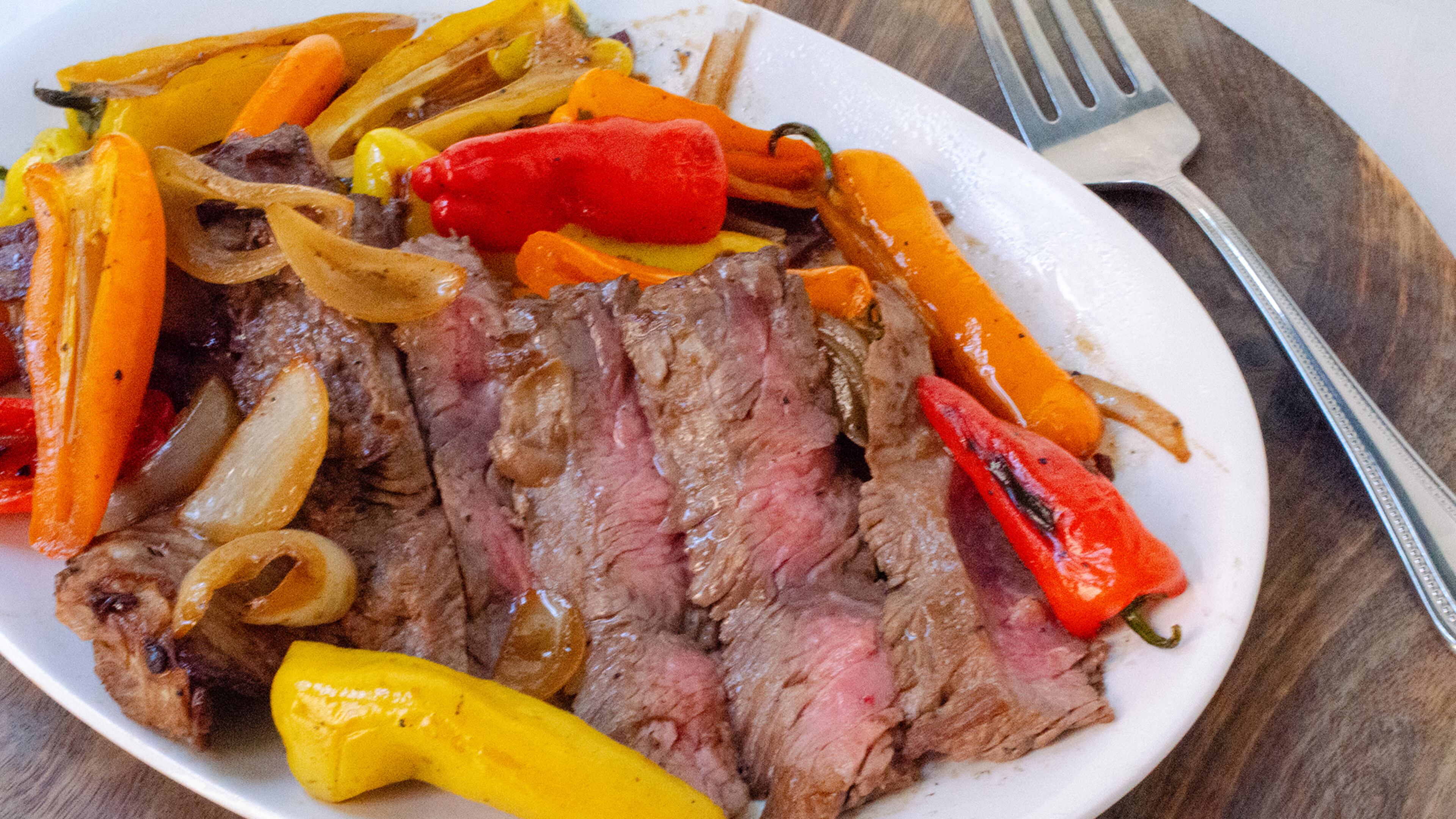
Night one. Fresh cooler. Cast iron over charcoal. The best steak you'll eat all week.

Marinated at home, grilled in camp. The best taco night on the river.
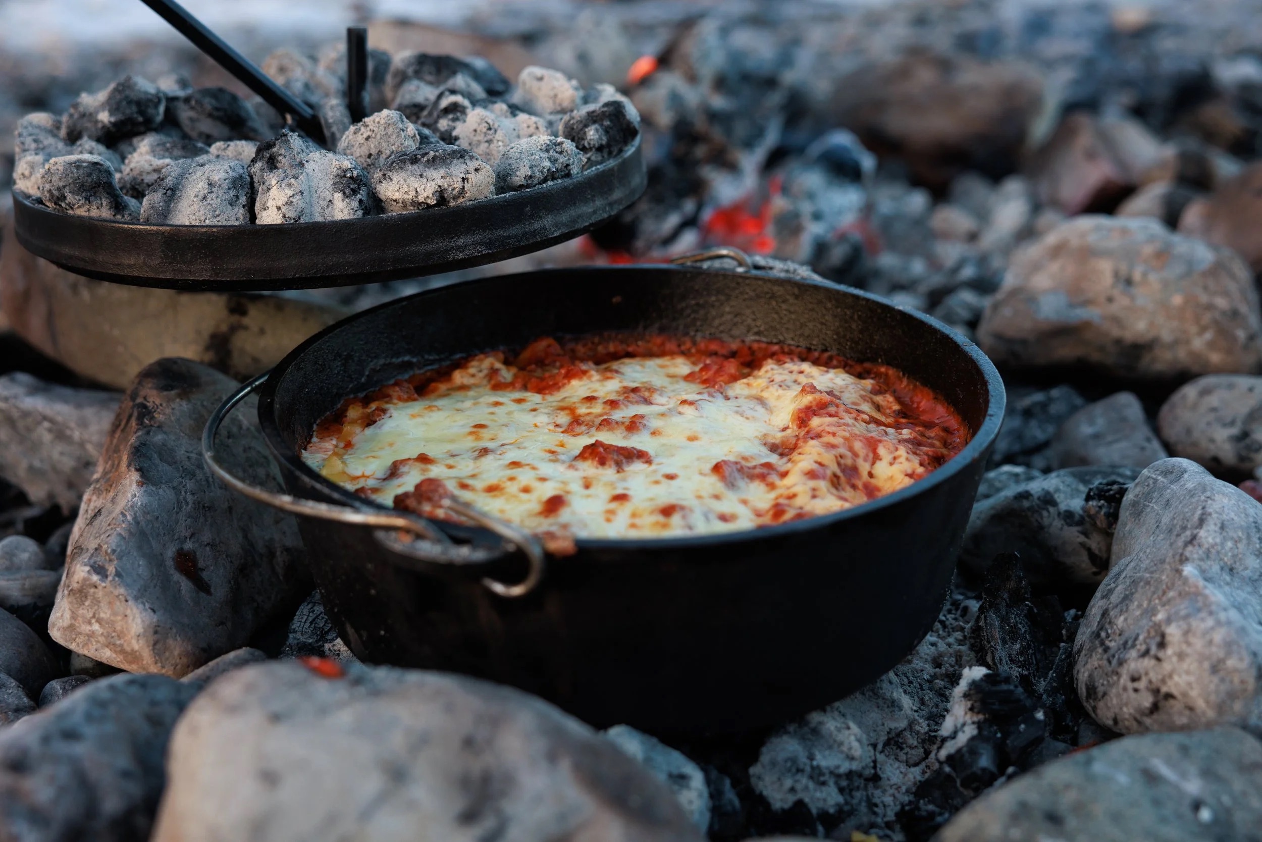
Real lasagna. Dutch oven. Day 3 of a river trip. It works.

One pot. Canned coconut milk. Twenty-five minutes. The transition meal.

Pizza dough holds for five days. Cast iron and charcoal do the rest.

Every ingredient is shelf-stable. Day 6 dinner that doesn't taste like day 6.

Canned beans. Rice. Cumin. Lime. Whatever's left. The last night done right.
The night-one showstopper. Thick-cut ribeyes seared in a screaming-hot cast iron over charcoal, with halved bell peppers and onions charring on the grate alongside. This is the meal you cook while the cooler is still cold and the group is still clean. Finish with flaky salt and a squeeze of lime. It takes ten minutes and sets the tone for the whole trip.
Salt the steaks before you set up camp — by the time you've rigged the kitchen, they've had their 30 minutes. The cast iron needs to be genuinely smoking before the first steak goes in. If it's windy, position the fire pan so you're shielded and the coals stay hot. In desert heat above 100F, pull steaks from the cooler only 10 minutes ahead — they'll come to temp fast. Keep a spray bottle of water nearby for flare-ups from the dripping fat.
Pre-marinated chicken thighs grilled over charcoal, sliced thin, and piled into warm flour tortillas with crunchy cabbage slaw and crumbled cotija. The marinade does all the work at home — lime, cumin, garlic, and green chile — so in camp you just grill and assemble. This is the meal that makes people stop what they're doing and walk over to the kitchen.
The key to this recipe is the frozen marinade bags. They keep the cooler cold on day 1 and produce perfectly thawed, deeply marinated chicken by day 2. If it's extremely hot (105F+), check the bags on the morning of day 2 — they may thaw faster than expected. Don't skip the towel for the tortillas; they go from warm and pliable to stiff and cracked in two minutes of desert air. If it's windy, the charcoal will burn hot and fast — watch for flare-ups from the marinade dripping.
Proper lasagna built in a 12-inch Dutch oven over charcoal. Layer no-boil noodles, pre-made meat sauce (frozen flat in gallon bags at home), ricotta, and mozzarella. Charcoal on top and bottom, 45 minutes, and you pull out something that shouldn't be possible at a sandbar camp. The meat sauce freezes flat and doubles as an ice pack for the first two days.
The coal ratio is everything. Too many coals on the bottom and you'll scorch it. Roughly 1/3 underneath, 2/3 on top. In windy conditions, position the fire pan in a sheltered spot — wind cools coals unevenly and you'll get hot spots. If you're cooking on sand, clear the area thoroughly first; sand gets everywhere when the wind picks up, and nothing ruins lasagna like grit. Bring a lid lifter or channel-lock pliers — the lid will be 400 degrees. Start the charcoal earlier than you think. Dutch oven cooking always takes longer than expected, and hungry river people get impatient.
A one-pot curry that comes together in 25 minutes on a propane stove. Canned coconut milk, Thai curry paste, and pre-cut vegetables over rice. By night 4, the cooler is thinning out and the pantry starts pulling weight — canned coconut milk and curry paste do all the heavy lifting here. The vegetables just need to be crisp-tender. This is the meal that proves one-pot cooking doesn't have to taste like compromise.
This recipe is almost wind-proof because it's all in a pot with a lid. The propane stove handles it better than charcoal. The key mistake people make is adding all the vegetables at once — carrots need a head start or they'll be raw while the snap peas turn to mush. If you only have one burner, cook the rice first, set it aside covered (it holds heat for 20 minutes), then make the curry. In cold weather (below 50F), the coconut milk may have solidified in the can — it melts fast once heated, but give it an extra minute.
Real pizza made in a cast iron skillet over charcoal. Press pre-made dough into an oiled skillet, top with canned San Marzano sauce, hard salami, olives, and parmesan, then cover and cook over charcoal for 12 minutes. The bottom gets crisp and almost fried in the oil while the lid traps heat to melt the cheese. Make 3-4 pizzas to feed 8. The dough is made at home and keeps 4-5 days in the cooler — this is a day-5 meal built on foresight.
The oil in the skillet is non-negotiable. It prevents sticking and creates the fried-bottom texture that makes this work. Don't skimp. The dough will fight you if it's cold — let it warm up for 10 minutes before pressing. If it springs back, let it rest 5 more minutes. People will crowd the kitchen for pizza night, which is great for morale but means you need a system: one person on dough, one on toppings, one managing coals. Batch cooking takes an hour — serve each pizza as it comes out instead of waiting for all four. In wind, the coals cool quickly between pizzas. Keep extra lit coals ready.
The ultimate pantry meal. Every single ingredient is shelf-stable: canned tomatoes, olives, capers, anchovies, garlic, red pepper flakes, dried pasta. No cooler required. Boil pasta in filtered river water, make the sauce in another pot, combine. Fifteen minutes of active cooking and you have a dinner that tastes like you planned it, not like you ran out of options. This is the recipe that proves the last nights of a trip don't have to be sad.
This is the most reliable recipe in the entire trip menu. Nothing can go wrong with the ingredients — they're all shelf-stable and nearly indestructible. The one thing to watch is the pasta water. At elevation (Desolation Canyon is around 4,500 feet at put-in), water boils at a lower temperature and pasta takes slightly longer to cook. Taste it. On a single-burner stove, boil the pasta first, drain it, then make the sauce in the same pot to save fuel. The olives and capers provide so much salt that you probably won't need to add any to the sauce — taste first.
The last-night staple. Canned black beans seasoned with cumin and lime over rice, topped with whatever survives the trip — cheese rinds, crisped tortilla strips, pickled jalapeños, hot sauce. This is the meal that asks nothing of the cooler and everything of the pantry. It's cheap, fast, filling, and the toppings make it feel like a real dinner instead of a concession. Every trip ends here, and nobody complains.
This meal is intentionally designed to absorb scraps. Take inventory of the cooler and dry boxes before you start — whatever is left becomes a topping. Cheese rinds that would be trash at home become crispy bits when grated and scattered over hot beans. Stale tortillas become croutons when fried. The cumin and lime do the real work; without them, it's just beans and rice. With them, it tastes intentional. On cold last nights, this warm bowl is exactly what people want before the takeout drive home. If you have a second burner, heat the beans and cook rice simultaneously. Single-burner: cook rice first, set aside, then do the beans.
Two coolers, segregated by access frequency. A well-managed deep cooler will hold usable ice through day 6 in 100°F air temps.
Learn about ice managementFolding table, two-burner propane stove, cast iron skillet, Dutch oven, and a large pot. The Dutch oven is the single most versatile piece.
Learn about kitchen setupBooks that shape the science, history, and stories behind this place.
The standing reference for running the Colorado–Green system through Canyonlands — waterproof, segment-by-segment maps covering put-ins, take-outs, named rapids, mile markers, and camps from Cisco and Green River City down through Cataract.
An in-depth environmental and human history of Cataract Canyon and the rivers of Canyonlands, exploring Indigenous presence, exploration, dam impacts, river ecology, and the evolution of modern river running.
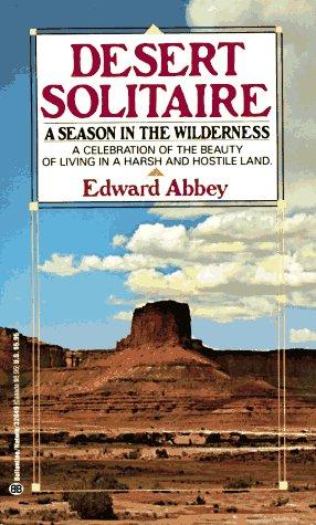
Edward Abbey's classic portrait of canyon country, solitude, and wilderness, influential to the identity and mythology of the Colorado Plateau.
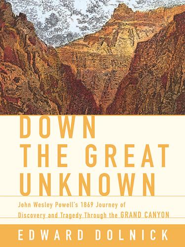
The dramatic story of John Wesley Powell's first expedition through the Grand Canyon and the birth of river exploration in the American West.

A foundational scientific text on river geomorphology, covering sediment transport, channel form, fluvial dynamics, and the physical processes that shape river systems.

A geological exploration of Utah’s major river systems explaining how tectonics, sedimentation, and erosion shaped the canyon landscapes of the Colorado Plateau and surrounding regions.
A river-running memoir by Roy Webb capturing the spirit, humor, and culture of Western river expeditions and the people who chase moving water through canyon country.
The story of Norman Nevills and the birth of commercial river running in the Colorado River basin.
Brad Dimock's exhaustive biography of Bert Loper — gold prospector, early Colorado River boatman, and one of the great stubborn characters of Western river history — who died in Grand Canyon at 79, alone in his boat in a rapid, on the river he refused to leave. The definitive account of the Colorado River's pioneer running era.
A foundational book on Western water development, dams, irrigation politics, and the long struggle over the Colorado River and the arid American West.

An accessible introduction to the rock layers, canyon formation, and landscapes of the Colorado Plateau and canyon country.

Craig Childs traces the routes of the ancient Anasazi across the Colorado Plateau, uncovering evidence of a lost civilization's migrations through canyon country.
A guide to understanding the subtle clues in water movement—from puddles and rivers to oceans—teaching readers how currents, waves, surface textures, and patterns reveal information about wind, depth, obstacles, and landscape.
A rigorous, university-level introduction to physical hydrology covering the full water cycle — precipitation, evapotranspiration, infiltration, groundwater, runoff generation, and streamflow — with quantitative methods throughout. The scientific foundation for understanding how rivers work at the watershed scale, from snowpack in the Rockies to baseflow in canyon rivers.

A rigorous graduate-level treatment of river hydraulics and sediment transport, covering flow resistance, bedforms, channel stability, and the physical mechanics that govern river behavior.
A comprehensive guidebook to whitewater rivers in Utah and neighboring regions, covering river access, rapids, flow considerations, trip logistics, and historical context for river runners.

A key geological reference for understanding the uplift, stratigraphy, tectonics, and erosional history of the Colorado Plateau.
A classic guide to the Colorado River through Grand Canyon with geology, ecology, and river running notes.

Three deeply reported narratives about humanity's attempts to stop rivers, lava, and debris flows — and what the land does in return. A masterwork of geological journalism that asks whether nature can ever truly be controlled.
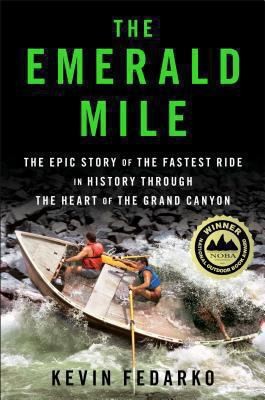
The thrilling story of the dory daredevils who set a speed record through the Grand Canyon at the height of the legendary flood of 1983 — and of the river that made it possible.
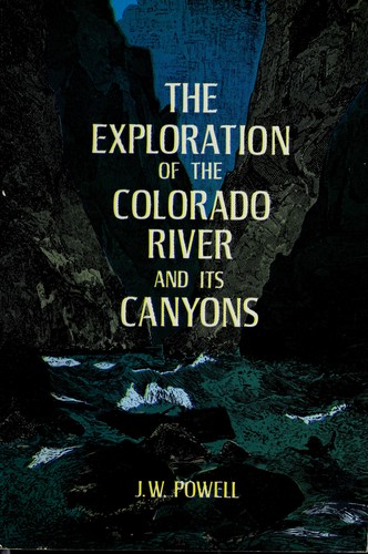
Powell's original account of the first scientific expedition through the Grand Canyon, documenting the geology, natural history, and challenges of navigating the unknown Colorado River.

A clear geological explanation of the formation of the Grand Canyon and the deep-time processes that shaped the Colorado River.

The story of the final free-flowing run of Glen Canyon before Lake Powell filled the canyon, capturing a vanished landscape and the culture it held.

A gang of desert outlaws wage a reckless, irreverent war against the machines carving up the American Southwest.
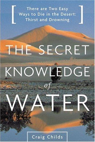
Craig Childs explores the hidden water sources and desert hydrology of the American Southwest, revealing how water shapes and sustains life in the most arid landscapes on Earth.
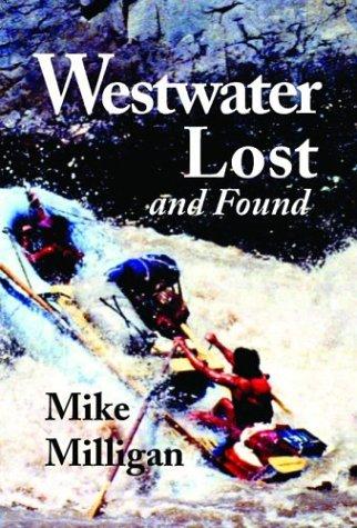
A story centered on the legendary Westwater Canyon stretch of the Colorado River, blending river-running culture, history, and storytelling from one of the most iconic whitewater sections in the Southwest.
Evidence behind the claims on this page — agency rules, maps, gauges, books, and field notes.